TopoQuest Logo
Do you find TopoQuest useful?
Help keep TopoQuest running and adding new maps/features by donating!
Bitcoin:  19c7KJd3qBynnjoSw5npx9KScwjBe4ifkT
Litecoin:  LXs6TkuXGGXo1vDsWCkWVdjQX94eUKd6ui
Home View Maps Find Maps Find Places Resources & Links


Wellton, Arizona Topographic Map

USGS Map Title: Wellton, AZ
USGS Map MRC: 32114F2
DRG (GeoTIFF) Download: o32114f2.tif


Neighboring USGS Topographic Map Quads:


  Dome, AZ  
32114G3
 

  Red Bluff Mountain West, AZ  
32114G2
 

  Red Bluff Mountain East, AZ  
32114G1
 

  Ligurta, AZ  
32114F3
 

  Wellton, AZ  
32114F2
 

  Wellton Mesa, AZ  
32114F1
 

  Fortuna Mine, AZ  
32114E3
 

  Wellton Hills, AZ  
32114E2
 

  Wellton SE, AZ  
32114E1


Map MRC Location:

N33°
W115°
N33°
W114°
H8 H7 H6 H5 H4 H3 H2 H1
G8 G7 G6 G5 G4 G3 G2 G1
F8 F7 F6 F5 F4 F3 F2 F1
E8 E7 E6 E5 E4 E3 E2 E1
D8 D7 D6 D5 D4 D3 D2 D1
C8 C7 C6 C5 C4 C3 C2 C1
B8 B7 B6 B5 B4 B3 B2 B1
A8 A7 A6 A5 A4 A3 A2 A1
N32°
W115°
N32°
W114°

Wellton, AZ USGS 1:24K Topographic Map Preview:
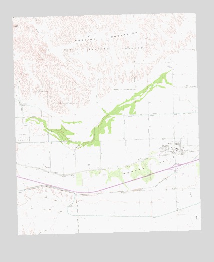
Wellton, AZ USGS Topographic Map
Click on map above to begin viewing in our Map Viewer.

This topographic map contains these locations and features:
Feature Name Type Latitude Longitude GNIS ID View Map
AdondeLocaleN32.6612°W114.1924°23875View Map
Butterfield Golf CourseLocaleN32.6770°W114.1301°2623001View Map
Butterfield ParkParkN32.6767°W114.1360°23496View Map
Coyote WashStreamN32.6881°W114.1377°3522View Map
Coyote Wash ChannelCanalN32.6920°W114.1613°3526View Map
Dome LateralCanalN32.6998°W114.2463°4010View Map
Grace Fellowship ChurchChurchN32.6706°W114.1434°2623444View Map
Mohawk ValleyValleyN32.6862°W114.1941°8185View Map
Morgan WashStreamN32.7048°W114.2488°422View Map
Muggins MountainsRangeN32.7450°W114.2033°8404View Map
The Links at Coyote WashLocaleN32.6522°W114.1447°2623002View Map
Town of WelltonCivilN32.6400°W114.2140°2413467View Map
WelltonPopulated PlaceN32.6728°W114.1469°13463View Map
Wellton 4.2 LateralCanalN32.6739°W114.1674°23614View Map
Wellton Assembly of GodChurchN32.6733°W114.1365°2623351View Map
Wellton Community Presbyterian ChurchChurchN32.6720°W114.1386°2623352View Map
Wellton Elementary SchoolSchoolN32.6723°W114.1413°23616View Map
Wellton Fire DepartmentBuildingN32.6742°W114.1417°2657535View Map
Wellton LibraryBuildingN32.6720°W114.1446°2623599View Map
Wellton Mohawk Main ChannelCanalN32.6784°W114.2397°13467View Map
Wellton Post OfficePost OfficeN32.6728°W114.1484°2622663View Map
Wellton Town HallBuildingN32.6729°W114.1480°2623626View Map
Wellton UnderpassCrossingN32.6617°W114.1430°23618View Map
Yuma County Sheriff's Office District 5BuildingN32.6748°W114.1343°2751682View Map

Note: Coordinates in the location and feature list above are referenced to NAD83 datum.


Copyright (C) 2008-2024 Ryan Niemi / Sunset Dynamics ... All Rights Reserved