TopoQuest Logo
Do you find TopoQuest useful?
Help keep TopoQuest running and adding new maps/features by donating!
Bitcoin:  19c7KJd3qBynnjoSw5npx9KScwjBe4ifkT
Litecoin:  LXs6TkuXGGXo1vDsWCkWVdjQX94eUKd6ui
Home View Maps Find Maps Find Places Resources & Links


West Fargo South, North Dakota Topographic Map

USGS Map Title: West Fargo South, ND
USGS Map MRC: 46096G8
DRG (GeoTIFF) Download: o46096g8.tif


Neighboring USGS Topographic Map Quads:


  Mapleton, ND  
46097H1
 

  West Fargo North, ND  
46096H8
 

  Fargo North, ND  
46096H7
 

  Casselton SE, ND  
46097G1
 

  West Fargo South, ND  
46096G8
 

  Fargo South, ND  
46096G7
 

  Kindred, ND  
46097F1
 

  Norman, ND  
46096F8
 

  Hickson, ND  
46096F7


Map MRC Location:

N47°
W97°
N47°
W96°
H8 H7 H6 H5 H4 H3 H2 H1
G8 G7 G6 G5 G4 G3 G2 G1
F8 F7 F6 F5 F4 F3 F2 F1
E8 E7 E6 E5 E4 E3 E2 E1
D8 D7 D6 D5 D4 D3 D2 D1
C8 C7 C6 C5 C4 C3 C2 C1
B8 B7 B6 B5 B4 B3 B2 B1
A8 A7 A6 A5 A4 A3 A2 A1
N46°
W97°
N46°
W96°

West Fargo South, ND USGS 1:24K Topographic Map Preview:
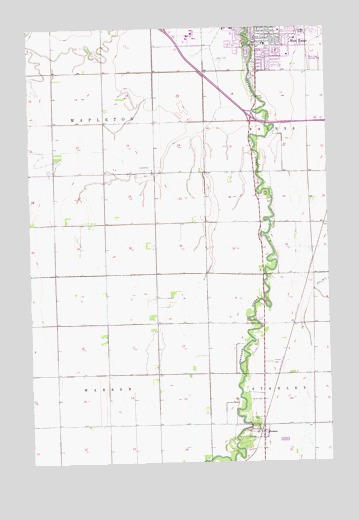
West Fargo South, ND USGS Topographic Map
Click on map above to begin viewing in our Map Viewer.

This topographic map contains these locations and features:
Feature Name Type Latitude Longitude GNIS ID View Map
Aurora Elementary SchoolSchoolN46.8288°W96.9161°2748364View Map
Brink CemeteryCemeteryN46.7680°W96.9040°1028133View Map
Cheney Middle SchoolSchoolN46.8539°W96.8848°2748373View Map
City of HoraceCivilN46.7558°W96.9074°1036095View Map
City of West FargoCivilN46.8566°W96.9048°1036321View Map
Clayton A Lodoen Kindergarten CenterSchoolN46.8740°W96.8942°2748365View Map
Eastwood Elementary SchoolSchoolN46.8670°W96.8913°2748366View Map
Faith Lutheran Church ColumbariumCemeteryN46.8745°W96.8988°2782365View Map
Freedom Elementary SchoolSchoolN46.8408°W96.8857°2748367View Map
HoracePopulated PlaceN46.7589°W96.9037°1029530View Map
Horace CemeteryCemeteryN46.7786°W96.8995°1029531View Map
Horace City HallBuildingN46.7567°W96.9019°2744690View Map
Horace Elementary SchoolSchoolN46.7638°W96.9050°2748368View Map
Horace Fire DepartmentBuildingN46.7584°W96.9041°2637647View Map
Horace Post OfficePost OfficeN46.7623°W96.9045°2742256View Map
KFNW-AM (Fargo)TowerN46.8019°W96.8831°1033422View Map
KFNW-AM (West Fargo)TowerN46.8016°W96.8829°1033423View Map
KFNW-FM (Fargo)TowerN46.8019°W96.8831°1033055View Map
L E Berger Elementary SchoolSchoolN46.8717°W96.8877°2748369View Map
Osgood Kindergarten CenterSchoolN46.8132°W96.8805°2748370View Map
Red River Valley SpeedwayLocaleN46.8712°W96.9299°2749304View Map
Saint John CemeteryCemeteryN46.7751°W96.9460°2782489View Map
Sheyenne 9th Grade CenterSchoolN46.8203°W96.8846°2748375View Map
Sheyenne Crossings Care CenterBuildingN46.8618°W96.9030°2748879View Map
Sheyenne River Diversion DamDamN46.8116°W96.8854°1033243View Map
South Elementary SchoolSchoolN46.8702°W96.9009°2748371View Map
South West FargoPopulated PlaceN46.8736°W96.9004°1035865View Map
Township of BarnesCivilN46.8639°W96.9232°1036359View Map
Township of MapletonCivilN46.8458°W96.9897°1036361View Map
Township of WarrenCivilN46.7605°W96.9906°1036360View Map
West FargoPopulated PlaceN46.8750°W96.9004°1032733View Map
West Fargo Airport (historical)AirportN46.8655°W96.8793°1033596View Map
West Fargo City HallBuildingN46.8722°W96.8859°2745334View Map
West Fargo High SchoolSchoolN46.8675°W96.8810°2748376View Map
West Fargo Police DepartmentBuildingN46.8723°W96.8851°2734382View Map
West Fargo Public LibraryBuildingN46.8747°W96.8955°2745730View Map
Westside Elementary SchoolSchoolN46.8684°W96.9150°2748372View Map

Note: Coordinates in the location and feature list above are referenced to NAD83 datum.


Copyright (C) 2008-2025 Ryan Niemi / Sunset Dynamics ... All Rights Reserved