TopoQuest Logo
Do you find TopoQuest useful?
Help keep TopoQuest running and adding new maps/features by donating!
Bitcoin:  19c7KJd3qBynnjoSw5npx9KScwjBe4ifkT
Litecoin:  LXs6TkuXGGXo1vDsWCkWVdjQX94eUKd6ui
Home View Maps Find Maps Find Places Resources & Links


West Milford, West Virginia Topographic Map

USGS Map Title: West Milford, WV
USGS Map MRC: 39080B4
DRG (GeoTIFF) Download: o39080b4.tif


Neighboring USGS Topographic Map Quads:


  Salem, WV  
39080C5
 

  Wolf Summit, WV  
39080C4
 

  Clarksburg, WV  
39080C3
 

  Big Isaac, WV  
39080B5
 

  West Milford, WV  
39080B4
 

  Mount Clare, WV  
39080B3
 

  Camden, WV  
39080A5
 

  Weston, WV  
39080A4
 

  Berlin, WV  
39080A3


Map MRC Location:

N40°
W81°
N40°
W80°
H8 H7 H6 H5 H4 H3 H2 H1
G8 G7 G6 G5 G4 G3 G2 G1
F8 F7 F6 F5 F4 F3 F2 F1
E8 E7 E6 E5 E4 E3 E2 E1
D8 D7 D6 D5 D4 D3 D2 D1
C8 C7 C6 C5 C4 C3 C2 C1
B8 B7 B6 B5 B4 B3 B2 B1
A8 A7 A6 A5 A4 A3 A2 A1
N39°
W81°
N39°
W80°

West Milford, WV USGS 1:24K Topographic Map Preview:
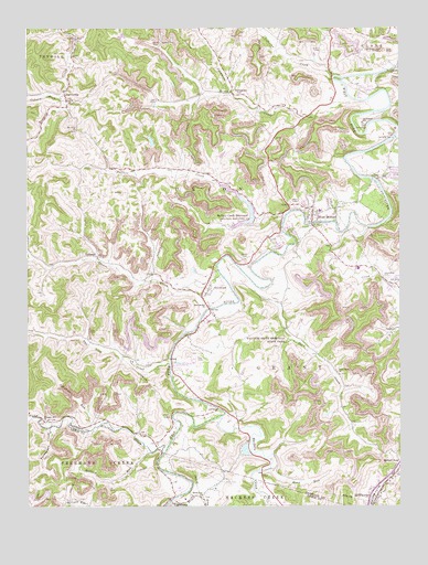
West Milford, WV USGS Topographic Map
Click on map above to begin viewing in our Map Viewer.

This topographic map contains these locations and features:
Feature Name Type Latitude Longitude GNIS ID View Map
Allen FordCrossingN39.2215°W80.3762°1553708View Map
Ayres School (historical)SchoolN39.2434°W80.4359°1956575View Map
Bethel CemeteryCemeteryN39.1904°W80.4259°1535685View Map
Broad RunStreamN39.1251°W80.4523°1536371View Map
Broad Run CemeteryCemeteryN39.1273°W80.4398°1728521View Map
Broad Run ChurchChurchN39.1273°W80.4415°1536373View Map
Browns RunStreamN39.1456°W80.4773°1536445View Map
Buffalo CreekStreamN39.2012°W80.4134°1536623View Map
Buffalo Creek ReservoirReservoirN39.1986°W80.4293°1536640View Map
Buffalo School (historical)SchoolN39.2131°W80.4640°1956578View Map
Clarksburg Water Works System DamDamN39.1998°W80.4237°1558889View Map
Coburn ForkStreamN39.2320°W80.4890°1537487View Map
Coburn School (historical)SchoolN39.2493°W80.4195°1956580View Map
Coburns CreekStreamN39.2373°W80.3968°1537490View Map
Cottrill School (historical)SchoolN39.1651°W80.4318°1956581View Map
Duck CreekStreamN39.1820°W80.4229°1538396View Map
Duck Creek CemeteryCemeteryN39.1595°W80.3948°1718443View Map
Duck Creek ChurchChurchN39.1593°W80.3951°1538398View Map
Duck Creek School (historical)SchoolN39.1537°W80.3954°1956582View Map
Good Hope Census Designated PlaceCensusN39.1838°W80.4408°2586816View Map
GoodhopePopulated PlaceN39.1815°W80.4393°1554579View Map
Grant Valley Trailer CourtPopulated PlaceN39.1848°W80.3781°1718456View Map
Hackers CreekStreamN39.1481°W80.4345°1539819View Map
Hall School (historical)SchoolN39.1951°W80.4993°1956584View Map
Hide A Way Golf CourseLocaleN39.2229°W80.3815°2634124View Map
Highland DamDamN39.2212°W80.3769°1540262View Map
Hollick RunStreamN39.1387°W80.4545°1540388View Map
Independent Order of Oddfellows CemeteryCemeteryN39.2042°W80.4115°1718463View Map
Isaacs CreekStreamN39.1751°W80.4406°1540729View Map
Isaacs Creek Baptist ChurchChurchN39.1898°W80.4762°1718465View Map
JarvisvillePopulated PlaceN39.2334°W80.4873°1540835View Map
Kincheloe CreekStreamN39.1387°W80.4548°1541203View Map
Koblegard School (historical)SchoolN39.2254°W80.3870°1541284View Map
LightburnPopulated PlaceN39.1259°W80.4512°1554952View Map
Lost CreekStreamN39.1979°W80.3854°1542463View Map
McWhorterPopulated PlaceN39.1273°W80.3829°1555092View Map
McWhorter United Methodist ChurchChurchN39.1281°W80.3815°1718483View Map
Milford RoadLocaleN39.1373°W80.3756°1543277View Map
Mount Olive CemeteryCemeteryN39.2231°W80.4834°1718491View Map
Mount Olive ChurchChurchN39.2234°W80.4834°1543718View Map
Mutton Town School (historical)SchoolN39.2209°W80.3751°1956587View Map
New Bethel CemeteryCemeteryN39.1773°W80.4390°1718494View Map
New Bethel United Methodist ChurchChurchN39.1770°W80.4398°1544110View Map
Pleasant Hill ChurchChurchN39.1476°W80.4943°1545000View Map
Post CemeteryCemeteryN39.1631°W80.4412°1545175View Map
Post School (historical)SchoolN39.2298°W80.4570°1956588View Map
Pressley Ridge SchoolSchoolN39.2251°W80.3876°2088320View Map
Road School (historical)SchoolN39.1445°W80.4520°1956589View Map
Sheets Mill CemeteryCemeteryN39.1845°W80.3801°1546658View Map
Sheets Mill School (historical)SchoolN39.1826°W80.3762°1956590View Map
Sheets MillsPopulated PlaceN39.1823°W80.3779°1718520View Map
South Harrison High SchoolSchoolN39.1871°W80.3885°2088355View Map
South Harrison Middle SchoolSchoolN39.1868°W80.3872°2088356View Map
Southwest DistrictCivilN39.2394°W80.4837°1928367View Map
Sycamore CemeteryCemeteryN39.2331°W80.4295°1718522View Map
Sycamore CemeteryCemeteryN39.2331°W80.4320°1547821View Map
Sycamore CreekStreamN39.2354°W80.3940°1547831View Map
Sycamore Dale School (historical)SchoolN39.2270°W80.4065°1956591View Map
Sycamore Methodist ChurchChurchN39.2334°W80.4312°1718524View Map
TichenalPopulated PlaceN39.1901°W80.4765°1548086View Map
Town of West MilfordCivilN39.2044°W80.4034°2391479View Map
Turkeypen CreekStreamN39.1456°W80.4926°1548372View Map
Two Lick CreekStreamN39.1623°W80.4520°1548408View Map
Two Lick School (historical)SchoolN39.1690°W80.4795°1956592View Map
Vens RunStreamN39.1351°W80.4184°1548642View Map
Watters Smith Memorial State ParkParkN39.1695°W80.4112°1548838View Map
West MilfordPopulated PlaceN39.2009°W80.4043°1555949View Map
West Milford Community Volunteer Fire DepartmentBuildingN39.2037°W80.3963°2578010View Map
West Milford Elementary SchoolSchoolN39.2022°W80.4018°1718528View Map
West Milford Police DepartmentBuildingN39.2040°W80.3965°2727954View Map
West Milford Post OfficePost OfficeN39.2003°W80.4039°1718529View Map
WPDX-AM (Clarksburg)TowerN39.2445°W80.3845°1559701View Map
WPDX-FM (Clarksburg)TowerN39.2445°W80.3845°1559778View Map

Note: Coordinates in the location and feature list above are referenced to NAD83 datum.


Copyright (C) 2008-2024 Ryan Niemi / Sunset Dynamics ... All Rights Reserved