TopoQuest Logo
Do you find TopoQuest useful?
Help keep TopoQuest running and adding new maps/features by donating!
Bitcoin:  19c7KJd3qBynnjoSw5npx9KScwjBe4ifkT
Litecoin:  LXs6TkuXGGXo1vDsWCkWVdjQX94eUKd6ui
Home View Maps Find Maps Find Places Resources & Links


Westhoff, Texas Topographic Map

USGS Map Title: Westhoff, TX
USGS Map MRC: 29097B4
DRG (GeoTIFF) Download: o29097b4.tif


Neighboring USGS Topographic Map Quads:


  Pilgrim, TX  
29097C5
 

  Cheapside, TX  
29097C4
 

  Hochheim, TX  
29097C3
 

  Sample, TX  
29097B5
 

  Westhoff, TX  
29097B4
 

  Concrete, TX  
29097B3
 

  New Davy, TX  
29097A5
 

  Blackwell Lake, TX  
29097A4
 

  Cuero, TX  
29097A3


Map MRC Location:

N30°
W98°
N30°
W97°
H8 H7 H6 H5 H4 H3 H2 H1
G8 G7 G6 G5 G4 G3 G2 G1
F8 F7 F6 F5 F4 F3 F2 F1
E8 E7 E6 E5 E4 E3 E2 E1
D8 D7 D6 D5 D4 D3 D2 D1
C8 C7 C6 C5 C4 C3 C2 C1
B8 B7 B6 B5 B4 B3 B2 B1
A8 A7 A6 A5 A4 A3 A2 A1
N29°
W98°
N29°
W97°

Westhoff, TX USGS 1:24K Topographic Map Preview:
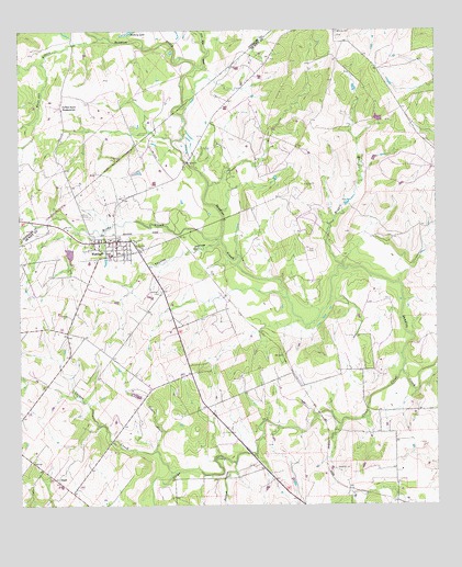
Westhoff, TX USGS Topographic Map
Click on map above to begin viewing in our Map Viewer.

This topographic map contains these locations and features:
Feature Name Type Latitude Longitude GNIS ID View Map
Barnhart LakeReservoirN29.1952°W97.4853°1864935View Map
Barnhart Lake DamDamN29.1952°W97.4853°1864934View Map
Bellview CemeteryCemeteryN29.2500°W97.4047°1377513View Map
Birds CreekStreamN29.1952°W97.4400°1377517View Map
Blackjack CreekStreamN29.1366°W97.4361°1377518View Map
Boggie CreekStreamN29.1872°W97.4025°1377520View Map
Clear CreekStreamN29.1605°W97.3855°1377534View Map
Cooper CreekStreamN29.1339°W97.4536°1377538View Map
DuBose Ranch HeadquartersLocaleN29.2308°W97.4878°1356385View Map
Five Mile CreekStreamN29.2405°W97.4469°1372151View Map
Little Cooper CreekStreamN29.1397°W97.4600°1377581View Map
Lord CemeteryCemeteryN29.1922°W97.4136°1377585View Map
Saint Aloysius CemeteryCemeteryN29.1927°W97.4633°1377620View Map
Thomas HollowValleyN29.1942°W97.4400°1377646View Map
WesthoffPopulated PlaceN29.1950°W97.4711°1377660View Map
Westhoff CemeteryCemeteryN29.1814°W97.4578°1377661View Map
Westhoff Fire DepartmentBuildingN29.1950°W97.4729°2552595View Map
Westhoff Post OfficePost OfficeN29.1944°W97.4715°2732153View Map
White Oak BranchStreamN29.2483°W97.4755°1371389View Map

Note: Coordinates in the location and feature list above are referenced to NAD83 datum.


Copyright (C) 2008-2025 Ryan Niemi / Sunset Dynamics ... All Rights Reserved