TopoQuest Logo
Do you find TopoQuest useful?
Help keep TopoQuest running and adding new maps/features by donating!
Bitcoin:  19c7KJd3qBynnjoSw5npx9KScwjBe4ifkT
Litecoin:  LXs6TkuXGGXo1vDsWCkWVdjQX94eUKd6ui
Home View Maps Find Maps Find Places Resources & Links


Westphalia East, Missouri Topographic Map

USGS Map Title: Westphalia East, MO
USGS Map MRC: 38091D8
DRG (GeoTIFF) Download: o38091d8.tif


Neighboring USGS Topographic Map Quads:


  Osage City, MO  
38092E1
 

  Loose Creek, MO  
38091E8
 

  Luystown, MO  
38091E7
 

  Westphalia West, MO  
38092D1
 

  Westphalia East, MO  
38091D8
 

  Linn, MO  
38091D7
 

  Argyle, MO  
38092C1
 

  Freeburg, MO  
38091C8
 

  Summerfield, MO  
38091C7


Map MRC Location:

N39°
W92°
N39°
W91°
H8 H7 H6 H5 H4 H3 H2 H1
G8 G7 G6 G5 G4 G3 G2 G1
F8 F7 F6 F5 F4 F3 F2 F1
E8 E7 E6 E5 E4 E3 E2 E1
D8 D7 D6 D5 D4 D3 D2 D1
C8 C7 C6 C5 C4 C3 C2 C1
B8 B7 B6 B5 B4 B3 B2 B1
A8 A7 A6 A5 A4 A3 A2 A1
N38°
W92°
N38°
W91°

Westphalia East, MO USGS 1:24K Topographic Map Preview:
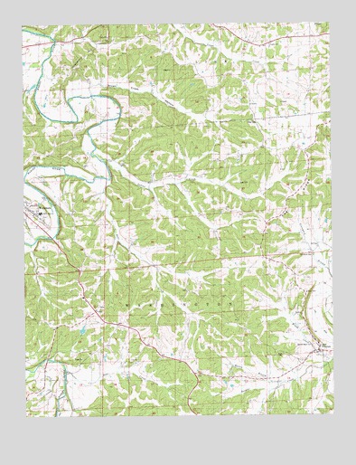
Westphalia East, MO USGS Topographic Map
Click on map above to begin viewing in our Map Viewer.

This topographic map contains these locations and features:
Feature Name Type Latitude Longitude GNIS ID View Map
Anvil Rock ArchArchN38.3939°W91.9922°2680496View Map
Bear CreekStreamN38.4506°W91.9663°713788View Map
Bexten BranchStreamN38.3850°W91.8966°738017View Map
Boy Scout CampLocaleN38.3942°W91.9941°714593View Map
Brush Creek HollowValleyN38.4789°W91.9713°714870View Map
Buchler CreekStreamN38.3928°W91.8754°738018View Map
Buckendorf School (historical)SchoolN38.4953°W91.8902°743821View Map
Church of the Sacred HeartChurchN38.3931°W91.8821°743697View Map
Deer CreekStreamN38.3896°W91.9835°738016View Map
Descher School (historical)SchoolN38.4545°W91.9446°716850View Map
Fatima High SchoolSchoolN38.4398°W91.9935°741911View Map
Freeburg Volunteer Fire Department Station 2BuildingN38.3963°W91.8811°2620815View Map
Grapevine HillSummitN38.4889°W91.9752°738015View Map
Indian CreekStreamN38.4567°W91.9690°720113View Map
Lake DitchCanalN38.4131°W91.8807°720751View Map
Luecke LakeReservoirN38.4023°W91.9768°763924View Map
Luecke Lake DamDamN38.4017°W91.9768°763923View Map
McDaniel SchoolSchoolN38.4500°W91.8832°722086View Map
Pea RidgeRidgeN38.4448°W91.8905°724121View Map
Rich FountainPopulated PlaceN38.3959°W91.8799°725251View Map
Sacred Heart CemeteryCemeteryN38.3975°W91.8829°741912View Map
Township of WashingtonCivilN38.3805°W91.9365°767122View Map
Van Buren CemeteryCemeteryN38.4261°W91.8832°728110View Map
WestphaliaPopulated PlaceN38.4420°W91.9993°729411View Map
Westphalia Catholic CemeteryCemeteryN38.4387°W91.9917°2777537View Map
Westphalia Post OfficePost OfficeN38.4401°W91.9966°2779466View Map
Winkelman School (historical)SchoolN38.3939°W91.9768°729002View Map

Note: Coordinates in the location and feature list above are referenced to NAD83 datum.


Copyright (C) 2008-2025 Ryan Niemi / Sunset Dynamics ... All Rights Reserved