TopoQuest Logo
Do you find TopoQuest useful?
Help keep TopoQuest running and adding new maps/features by donating!
Bitcoin:  19c7KJd3qBynnjoSw5npx9KScwjBe4ifkT
Litecoin:  LXs6TkuXGGXo1vDsWCkWVdjQX94eUKd6ui
Home View Maps Find Maps Find Places Resources & Links


Wharton, Ohio Topographic Map

USGS Map Title: Wharton, OH
USGS Map MRC: 40083G4
DRG (GeoTIFF) Download: o40083g4.tif


Neighboring USGS Topographic Map Quads:


  Mount Blanchard, OH  
40083H5
 

  Carey, OH  
40083H4
 

  McCutchenville, OH  
40083H3
 

  Forest, OH  
40083G5
 

  Wharton, OH  
40083G4
 

  Upper Sandusky, OH  
40083G3
 

  Kenton, OH  
40083F5
 

  Marseilles, OH  
40083F4
 

  Meeker, OH  
40083F3


Map MRC Location:

N41°
W84°
N41°
W83°
H8 H7 H6 H5 H4 H3 H2 H1
G8 G7 G6 G5 G4 G3 G2 G1
F8 F7 F6 F5 F4 F3 F2 F1
E8 E7 E6 E5 E4 E3 E2 E1
D8 D7 D6 D5 D4 D3 D2 D1
C8 C7 C6 C5 C4 C3 C2 C1
B8 B7 B6 B5 B4 B3 B2 B1
A8 A7 A6 A5 A4 A3 A2 A1
N40°
W84°
N40°
W83°

Wharton, OH USGS 1:24K Topographic Map Preview:
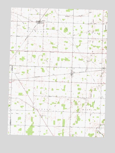
Wharton, OH USGS Topographic Map
Click on map above to begin viewing in our Map Viewer.

This topographic map contains these locations and features:
Feature Name Type Latitude Longitude GNIS ID View Map
Armstrong CemeteryCemeteryN40.8317°W83.4480°1037483View Map
Baughman CemeteryCemeteryN40.8720°W83.3989°1037686View Map
Bethany ChurchChurchN40.8184°W83.3799°1037892View Map
Big Oak ChurchChurchN40.8323°W83.4766°1038010View Map
Big Oak School (historical)SchoolN40.8323°W83.4777°1055351View Map
Blake DitchCanalN40.8528°W83.4021°1038100View Map
Callahan CemeteryCemeteryN40.8106°W83.4927°1038622View Map
Inman CemeteryCemeteryN40.8611°W83.3969°1041981View Map
Jackson Center CemeteryCemeteryN40.7695°W83.4574°1042026View Map
Jackson Center School (historical)SchoolN40.7776°W83.4677°1055353View Map
KirbyPopulated PlaceN40.8131°W83.4185°1064947View Map
Kirby Post OfficePost OfficeN40.8126°W83.4180°1958825View Map
Krock CemeteryCemeteryN40.8228°W83.3806°1042346View Map
Mann CemeteryCemeteryN40.8442°W83.3994°1042922View Map
Murrey CemeteryCemeteryN40.8659°W83.4196°1730717View Map
New Zion ChurchChurchN40.8470°W83.4921°1043852View Map
North Jackson School (historical)SchoolN40.8031°W83.4755°1055352View Map
Olive Branch School (historical)SchoolN40.7878°W83.3994°1055349View Map
Perkins RunStreamN40.8367°W83.3755°1044381View Map
Potato Creek Swamp (historical)SwampN40.8570°W83.4805°1060694View Map
Rowland CemeteryCemeteryN40.7878°W83.3999°1045234View Map
Saint Marys Catholic ChurchChurchN40.8151°W83.4196°1071996View Map
Saint Marys CemeteryCemeteryN40.8167°W83.4166°1700972View Map
Schoenberger CemeteryCemeteryN40.8252°W83.3994°1046010View Map
Shiloh ChurchChurchN40.7887°W83.4474°1046216View Map
Spoon CemeteryCemeteryN40.8575°W83.4913°1046535View Map
Township of JacksonCivilN40.7684°W83.4604°1087206View Map
Township of RichlandCivilN40.8613°W83.4672°1087210View Map
Village of KirbyCivilN40.8135°W83.4194°2398358View Map
Village of WhartonCivilN40.8613°W83.4648°2400159View Map
WhartonPopulated PlaceN40.8614°W83.4616°1061770View Map
Wharton - Richland Township Fire DepartmentBuildingN40.8606°W83.4649°2550432View Map
Wharton CemeteryCemeteryN40.8581°W83.4569°1700974View Map
Wharton Church of GodChurchN40.8606°W83.4627°1073230View Map
Wharton Middle SchoolSchoolN40.8601°W83.4635°1055350View Map
Wharton United Methodist ChurchChurchN40.8617°W83.4602°1071997View Map

Note: Coordinates in the location and feature list above are referenced to NAD83 datum.


Copyright (C) 2008-2025 Ryan Niemi / Sunset Dynamics ... All Rights Reserved