TopoQuest Logo
Do you find TopoQuest useful?
Help keep TopoQuest running and adding new maps/features by donating!
Bitcoin:  19c7KJd3qBynnjoSw5npx9KScwjBe4ifkT
Litecoin:  LXs6TkuXGGXo1vDsWCkWVdjQX94eUKd6ui
Home View Maps Find Maps Find Places Resources & Links


Wheatland, Indiana Topographic Map

USGS Map Title: Wheatland, IN
USGS Map MRC: 38087F3
DRG (GeoTIFF) Download: o38087f3.tif


Neighboring USGS Topographic Map Quads:


  Oaktown, IN  
38087G4
 

  Bicknell, IN  
38087G3
 

  Plainville, IN  
38087G2
 

  Fritchton, IN  
38087F4
 

  Wheatland, IN  
38087F3
 

  Washington, IN  
38087F2
 

  Iona, IN  
38087E4
 

  Monroe City, IN  
38087E3
 

  Sandy Hook, IN  
38087E2


Map MRC Location:

N39°
W88°
N39°
W87°
H8 H7 H6 H5 H4 H3 H2 H1
G8 G7 G6 G5 G4 G3 G2 G1
F8 F7 F6 F5 F4 F3 F2 F1
E8 E7 E6 E5 E4 E3 E2 E1
D8 D7 D6 D5 D4 D3 D2 D1
C8 C7 C6 C5 C4 C3 C2 C1
B8 B7 B6 B5 B4 B3 B2 B1
A8 A7 A6 A5 A4 A3 A2 A1
N38°
W88°
N38°
W87°

Wheatland, IN USGS 1:24K Topographic Map Preview:
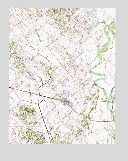
Wheatland, IN USGS Topographic Map
Click on map above to begin viewing in our Map Viewer.

This topographic map contains these locations and features:
Feature Name Type Latitude Longitude GNIS ID View Map
Asbury ChapelChurchN38.7470°W87.3258°430296View Map
Bennington LeveeLeveeN38.7214°W87.2525°430822View Map
Bens CreekStreamN38.6909°W87.2775°430824View Map
Bicknell Memorial CemeteryCemeteryN38.7474°W87.3069°440505View Map
Flat CreekStreamN38.7109°W87.3408°434559View Map
Ghost Hollow CreekStreamN38.6823°W87.2742°435052View Map
Godahavit AirportAirportN38.6513°W87.2828°2676967View Map
Hyatt IslandIslandN38.6706°W87.2533°436667View Map
Indian CreekStreamN38.7106°W87.3406°449501View Map
Indian CreekStreamN38.7348°W87.2614°436744View Map
Indian Creek SettlementPopulated PlaceN38.7292°W87.3456°436760View Map
Kessinger DitchCanalN38.6359°W87.3295°437270View Map
Mine PondLakeN38.6661°W87.2821°439261View Map
Montours Pond (historical)LakeN38.6345°W87.3306°448364View Map
Nicholson PondReservoirN38.6703°W87.3169°452470View Map
Nimnicht CreekStreamN38.6648°W87.2592°440177View Map
Opossum BranchStreamN38.6656°W87.3347°440665View Map
RagsdalePopulated PlaceN38.7459°W87.3250°441730View Map
Ragsdale Census Designated PlaceCensusN38.7467°W87.3241°2583467View Map
Reel CreekStreamN38.6359°W87.3295°441862View Map
Roberson DitchCanalN38.6950°W87.3267°442145View Map
Steen DitchCanalN38.6575°W87.3200°444111View Map
Steen Township Volunteer Fire DepartmentBuildingN38.6625°W87.3043°2626261View Map
Storks FerryLocaleN38.6603°W87.2772°448374View Map
Toms HillSummitN38.6670°W87.2503°444812View Map
Town of WheatlandCivilN38.6632°W87.3063°2397739View Map
Township of SteenCivilN38.6718°W87.2992°453872View Map
Weaver PondSwampN38.6660°W87.2654°445605View Map
WheatlandPopulated PlaceN38.6637°W87.3095°445878View Map

Note: Coordinates in the location and feature list above are referenced to NAD83 datum.


Copyright (C) 2008-2025 Ryan Niemi / Sunset Dynamics ... All Rights Reserved