TopoQuest Logo
Do you find TopoQuest useful?
Help keep TopoQuest running and adding new maps/features by donating!
Bitcoin:  19c7KJd3qBynnjoSw5npx9KScwjBe4ifkT
Litecoin:  LXs6TkuXGGXo1vDsWCkWVdjQX94eUKd6ui
Home View Maps Find Maps Find Places Resources & Links


Whetstone, South Carolina Topographic Map

USGS Map Title: Whetstone, SC
USGS Map MRC: 34083G2
DRG (GeoTIFF) Download: o34083g2.tif


Neighboring USGS Topographic Map Quads:


  Rabun Bald, GA  
34083H3
 

  Satolah, GA  
34083H2
 

  Tamassee, SC  
34083H1
 

  Rainy Mountain, GA  
34083G3
 

  Whetstone, SC  
34083G2
 

  Walhalla, SC  
34083G1
 

  Tugaloo Lake, GA  
34083F3
 

  Holly Springs, SC  
34083F2
 

  Westminster, SC  
34083F1


Map MRC Location:

N35°
W84°
N35°
W83°
H8 H7 H6 H5 H4 H3 H2 H1
G8 G7 G6 G5 G4 G3 G2 G1
F8 F7 F6 F5 F4 F3 F2 F1
E8 E7 E6 E5 E4 E3 E2 E1
D8 D7 D6 D5 D4 D3 D2 D1
C8 C7 C6 C5 C4 C3 C2 C1
B8 B7 B6 B5 B4 B3 B2 B1
A8 A7 A6 A5 A4 A3 A2 A1
N34°
W84°
N34°
W83°

Whetstone, SC USGS 1:24K Topographic Map Preview:
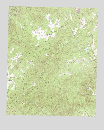
Whetstone, SC USGS Topographic Map
Click on map above to begin viewing in our Map Viewer.

This topographic map contains these locations and features:
Feature Name Type Latitude Longitude GNIS ID View Map
Andrew Pickens Ranger StationBuildingN34.8098°W83.1277°1230535View Map
Baker BranchStreamN34.7773°W83.1729°1220297View Map
Belmont Baptist ChurchChurchN34.8143°W83.1496°1246734View Map
Belmont CemeteryCemeteryN34.8145°W83.1493°1244790View Map
Bethlehem School (historical)SchoolN34.8629°W83.1502°1242919View Map
Blackwell BridgeBridgeN34.8331°W83.1752°1220786View Map
Bone Camp CreekStreamN34.8165°W83.1888°1220886View Map
Brasstown Baptist ChurchChurchN34.7537°W83.2404°1246968View Map
Brasstown CemeteryCemeteryN34.7537°W83.2399°1244793View Map
Buzzard Roost MountainSummitN34.7662°W83.1374°1221179View Map
Cassidy BridgeBridgeN34.7873°W83.2104°1221385View Map
Cassidy Bridge CampgroundLocaleN34.7859°W83.2102°1230536View Map
Cedar CreekStreamN34.7579°W83.1971°1221433View Map
Cedar Creek Rifle RangeLocaleN34.7831°W83.1565°1251835View Map
Chambers BranchStreamN34.8148°W83.1832°1221495View Map
Chattooga SchoolSchoolN34.8429°W83.1977°1221525View Map
Chauga River Scenic AreaParkN34.7687°W83.2257°1251833View Map
Collins CemeteryCemeteryN34.7634°W83.1602°1221687View Map
Coppermine BranchStreamN34.8256°W83.1796°1221754View Map
Crooked CreekStreamN34.7654°W83.2104°1221835View Map
Crystal LakeReservoirN34.8168°W83.1382°1238284View Map
Crystal LakeReservoirN34.8282°W83.1390°1221862View Map
Crystal Lake Dam D-1645DamN34.8270°W83.1432°1238283View Map
Dicks CreekStreamN34.8673°W83.2460°358286View Map
Doran CreekStreamN34.7629°W83.2229°1222066View Map
Double BranchStreamN34.7809°W83.2190°1222072View Map
Double Springs Baptist ChurchChurchN34.8526°W83.1727°1247551View Map
Double Springs ChurchChurchN34.8537°W83.1715°1222076View Map
East Village CreekStreamN34.8484°W83.1546°1247600View Map
Flint CreekStreamN34.7576°W83.1810°1222457View Map
Grapevine BranchStreamN34.8298°W83.1882°1222823View Map
Harts BranchStreamN34.8359°W83.2288°1223073View Map
Hell Hole CreekStreamN34.8109°W83.1965°1223115View Map
Hickory Flat BranchStreamN34.8004°W83.1990°1223131View Map
Hurricane MountainSummitN34.7751°W83.1368°1231412View Map
Jerry CreekStreamN34.8365°W83.1543°1229853View Map
John MountainSummitN34.8337°W83.2363°1231432View Map
Lake JemikeReservoirN34.7836°W83.1345°1223531View Map
Lake Jemike Number One Dam D-1648DamN34.7831°W83.1343°1238299View Map
Lake Jemike Number Two Dam D-1649DamN34.7801°W83.1349°1238998View Map
Lake LeroyReservoirN34.8746°W83.1502°1251832View Map
Lake Leroy Dam D-1639DamN34.8698°W83.1510°1238271View Map
Land BridgeBridgeN34.8331°W83.1579°1223801View Map
Laurel CreekStreamN34.7634°W83.2377°1223826View Map
Limestone CreekStreamN34.8251°W83.1815°1223932View Map
Long BranchStreamN34.8143°W83.2057°1224139View Map
Long Creek Academy (historical)SchoolN34.7898°W83.2463°1224167View Map
Long Creek DivisionCivilN34.7596°W83.2338°1938336View Map
Long Creek Lookout TowerTowerN34.8051°W83.2379°1242437View Map
Long Creek School (historical)SchoolN34.8148°W83.1499°1243044View Map
Long MountainSummitN34.8120°W83.2324°1224175View Map
Mill CreekStreamN34.7923°W83.2085°1224540View Map
Miller Field BranchStreamN34.8315°W83.1585°1224568View Map
Mongold GapGapN34.8704°W83.1885°1230032View Map
Monte Vista Baptist ChurchChurchN34.8429°W83.1329°1246714View Map
Monte Vista CemeteryCemeteryN34.8431°W83.1326°1244805View Map
Moss MountainSummitN34.8281°W83.2010°1224671View Map
Mountain Grove Baptist ChurchChurchN34.7951°W83.2232°1249741View Map
Mountain Grove CemeteryCemeteryN34.7951°W83.2232°1244807View Map
Mountain Grove School (historical)SchoolN34.7951°W83.2271°1243063View Map
Mountain RestLocaleN34.8693°W83.1532°1224859View Map
Mountain Rest Baptist ChurchChurchN34.8137°W83.1299°1249743View Map
Mountain Rest SchoolSchoolN34.8431°W83.1343°1249744View Map
Oconee County Rural Fire Department Mountain RestBuildingN34.8426°W83.1357°2578651View Map
Old Field MountainSummitN34.8298°W83.2238°1225180View Map
Orchard BranchStreamN34.8051°W83.1649°1225244View Map
Orrs Mill CreekStreamN34.8715°W83.1354°1225248View Map
Otter CreekStreamN34.7865°W83.1352°1225256View Map
Poor MountainSummitN34.7637°W83.1468°1225608View Map
Poplar Springs School (historical)SchoolN34.8187°W83.2354°1243105View Map
Rhoda BranchStreamN34.7940°W83.2063°1225851View Map
Rich MountainSummitN34.7529°W83.1610°1231721View Map
Rich Mountain School (historical)SchoolN34.7673°W83.1582°1243122View Map
Rock CreekStreamN34.8581°W83.2485°329457View Map
Rocky GapGapN34.8693°W83.2063°1225981View Map
Round MountainSummitN34.8051°W83.2379°1231751View Map
Round Mountain Church (historical)ChurchN34.7895°W83.2488°1243131View Map
Round Mountain School (historical)SchoolN34.7926°W83.2404°1243132View Map
Sand BranchStreamN34.7665°W83.2340°1226320View Map
Sandy FordCrossingN34.8606°W83.2468°332972View Map
Sawyer BranchStreamN34.8040°W83.1760°1226428View Map
Shingle Mill BranchStreamN34.8106°W83.1963°1226582View Map
South Carolina Noname 37030 D-1644 DamDamN34.8501°W83.1732°1238323View Map
Spider Valley CreekStreamN34.7670°W83.2327°1226791View Map
Spy Rock CreekStreamN34.7548°W83.1968°1226854View Map
Stumphouse Mountain TunnelTunnelN34.8165°W83.1299°1251064View Map
Swaford CreekStreamN34.8559°W83.2307°1226984View Map
Taylor CreekStreamN34.8509°W83.1510°1251125View Map
Tunnel HillSummitN34.8176°W83.1318°1243190View Map
Tyler BranchStreamN34.8501°W83.2190°1227271View Map
Village CreekStreamN34.8484°W83.1546°1227345View Map
West Village CreekStreamN34.8623°W83.1618°1227500View Map
WhetstonePopulated PlaceN34.8412°W83.1910°1227998View Map
Whetstone CreekStreamN34.8593°W83.2468°1251403View Map
Whetstone MountainSummitN34.8631°W83.2049°1227520View Map
Woodall BranchStreamN34.7968°W83.2088°1227696View Map
Yellow BranchStreamN34.7865°W83.1335°1227727View Map
Yellow Branch CampgroundLocaleN34.8059°W83.1282°1230534View Map

Note: Coordinates in the location and feature list above are referenced to NAD83 datum.


Copyright (C) 2008-2024 Ryan Niemi / Sunset Dynamics ... All Rights Reserved