TopoQuest Logo
Do you find TopoQuest useful?
Help keep TopoQuest running and adding new maps/features by donating!
Bitcoin:  19c7KJd3qBynnjoSw5npx9KScwjBe4ifkT
Litecoin:  LXs6TkuXGGXo1vDsWCkWVdjQX94eUKd6ui
Home View Maps Find Maps Find Places Resources & Links


White, South Dakota Topographic Map

USGS Map Title: White, SD
USGS Map MRC: 44096D6
DRG (GeoTIFF) Download: o44096d6.tif


Neighboring USGS Topographic Map Quads:


  Estelline SE, SD  
44096E7
 

  Toronto, SD  
44096E6
 

  Astoria, SD  
44096E5
 

  Brookings NE, SD  
44096D7
 

  White, SD  
44096D6
 

  White NE, SD  
44096D5
 

  Brookings, SD  
44096C7
 

  Aurora, SD  
44096C6
 

  White SE, SD  
44096C5


Map MRC Location:

N45°
W97°
N45°
W96°
H8 H7 H6 H5 H4 H3 H2 H1
G8 G7 G6 G5 G4 G3 G2 G1
F8 F7 F6 F5 F4 F3 F2 F1
E8 E7 E6 E5 E4 E3 E2 E1
D8 D7 D6 D5 D4 D3 D2 D1
C8 C7 C6 C5 C4 C3 C2 C1
B8 B7 B6 B5 B4 B3 B2 B1
A8 A7 A6 A5 A4 A3 A2 A1
N44°
W97°
N44°
W96°

White, SD USGS 1:24K Topographic Map Preview:
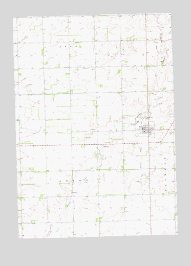
White, SD USGS Topographic Map
Click on map above to begin viewing in our Map Viewer.

This topographic map contains these locations and features:
Feature Name Type Latitude Longitude GNIS ID View Map
Afton District Number 12 SchoolSchoolN44.4125°W96.7470°1260279View Map
Afton District Number 13 SchoolSchoolN44.4122°W96.7476°1260280View Map
Afton District Number 14 SchoolSchoolN44.3830°W96.6978°1260281View Map
Afton District Number 15 SchoolSchoolN44.4202°W96.6745°1260282View Map
Argo District Number 26 SchoolSchoolN44.4711°W96.7276°1260275View Map
Argo District Number 27 SchoolSchoolN44.4858°W96.6767°1260276View Map
City of WhiteCivilN44.4359°W96.6460°1267651View Map
Deubrook Community LibraryBuildingN44.4337°W96.6493°2723794View Map
Deubrook High SchoolSchoolN44.4337°W96.6493°2728580View Map
Deubrook Junior High SchoolSchoolN44.4337°W96.6493°2728581View Map
Fair View CemeteryCemeteryN44.4336°W96.6284°1265211View Map
McKnight Community CenterBuildingN44.4350°W96.6502°2728110View Map
Pioneer ChurchChurchN44.4586°W96.7264°1257067View Map
Pioneer Lutheran CemeteryCemeteryN44.4592°W96.7263°2773571View Map
Saint Pauls CemeteryCemeteryN44.4702°W96.6970°1257721View Map
Saint Pauls ChurchChurchN44.4711°W96.7076°1257725View Map
Township of AftonCivilN44.4123°W96.7074°1267977View Map
Township of ArgoCivilN44.4999°W96.7062°1267984View Map
WhitePopulated PlaceN44.4347°W96.6498°1258947View Map
White Ambulance ServiceBuildingN44.4353°W96.6487°2658961View Map
White City HallBuildingN44.4350°W96.6500°2725395View Map
White Post OfficePost OfficeN44.4346°W96.6506°2712583View Map
White Volunteer Fire DepartmentBuildingN44.4354°W96.6488°2581011View Map

Note: Coordinates in the location and feature list above are referenced to NAD83 datum.


Copyright (C) 2008-2025 Ryan Niemi / Sunset Dynamics ... All Rights Reserved