TopoQuest Logo
Do you find TopoQuest useful?
Help keep TopoQuest running and adding new maps/features by donating!
Bitcoin:  19c7KJd3qBynnjoSw5npx9KScwjBe4ifkT
Litecoin:  LXs6TkuXGGXo1vDsWCkWVdjQX94eUKd6ui
Home View Maps Find Maps Find Places Resources & Links


Rio Grande Village, Texas Topographic Map

USGS Map Title: Rio Grande Village, TX
USGS Map MRC: 29102B8
DRG (GeoTIFF) Download: o29102b8.tif


Neighboring USGS Topographic Map Quads:


  Roys Peak, TX  
29103C1
 

  Ernst Valley, TX  
29102C8


  San Vicente, TX  
29103B1
 

  Rio Grande Village, TX  
29102B8


  Solis, TX  
29103A1


Map MRC Location:

N30°
W103°
N30°
W102°
H8 H7 H6 H5 H4 H3 H2 H1
G8 G7 G6 G5 G4 G3 G2 G1
F8 F7 F6 F5 F4 F3 F2 F1
E8 E7 E6 E5 E4 E3 E2 E1
D8 D7 D6 D5 D4 D3 D2 D1
C8 C7 C6 C5 C4 C3 C2 C1
B8 B7 B6 B5 B4 B3 B2 B1
A8 A7 A6 A5 A4 A3 A2 A1
N29°
W103°
N29°
W102°

Rio Grande Village, TX USGS 1:24K Topographic Map Preview:
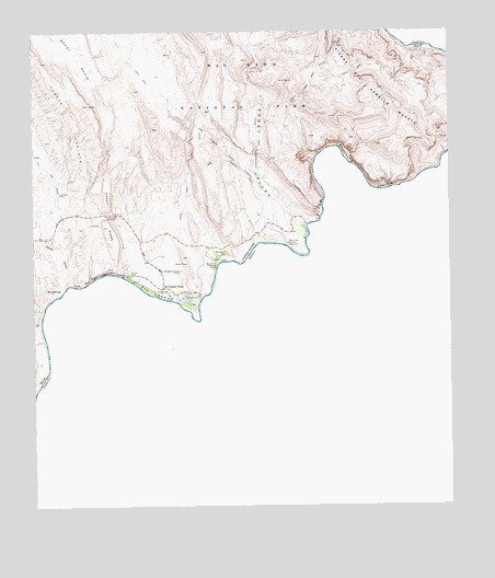
Rio Grande Village, TX USGS Topographic Map
Click on map above to begin viewing in our Map Viewer.

This topographic map contains these locations and features:
Feature Name Type Latitude Longitude GNIS ID View Map
Boquillas CanyonValleyN29.2111°W102.8861°1385426View Map
Boquillas Canyon OverlookLocaleN29.1941°W102.9235°1385420View Map
Boquillas Canyon TrailTrailN29.2002°W102.9185°2032943View Map
Boquillas CrossingPopulated PlaceN29.1888°W102.9454°1385421View Map
Boquillas Warm SpringsSpringN29.1919°W102.9754°1998629View Map
Daniels Farm HouseBuildingN29.1858°W102.9721°2031328View Map
Dead Mans CurveGapN29.2021°W102.9774°1385435View Map
Ernst ValleyValleyN29.1949°W102.9231°1385429View Map
Gambusia SpringSpringN29.1822°W102.9524°1998635View Map
Hot SpringsPopulated PlaceN29.1821°W102.9921°1385422View Map
Hot SpringsSpringN29.1810°W102.9921°1998639View Map
Hot Springs CanyonValleyN29.1862°W102.9739°1385430View Map
Marufa Vega TrailTrailN29.2283°W102.9241°1385431View Map
Ore Terminal Aerial TramwayLocaleN29.2188°W102.9435°1385423View Map
Ore Terminal TrailTrailN29.2160°W102.9427°1385424View Map
Rio Grande OverlookLocaleN29.2016°W102.9752°1385425View Map
Rio Grande VillagePopulated PlaceN29.1833°W102.9621°2033923View Map
Rio Grande VillageLocaleN29.1827°W102.9613°1385419View Map
Rio Grande Village Nature TrailTrailN29.1774°W102.9521°2033198View Map
Tornillo CreekStreamN29.1774°W102.9971°1385433View Map

Note: Coordinates in the location and feature list above are referenced to NAD83 datum.


Copyright (C) 2008-2025 Ryan Niemi / Sunset Dynamics ... All Rights Reserved