TopoQuest Logo
Do you find TopoQuest useful?
Help keep TopoQuest running and adding new maps/features by donating!
Bitcoin:  19c7KJd3qBynnjoSw5npx9KScwjBe4ifkT
Litecoin:  LXs6TkuXGGXo1vDsWCkWVdjQX94eUKd6ui
Home View Maps Find Maps Find Places Resources & Links


White Oak Creek, South Carolina Topographic Map

USGS Map Title: White Oak Creek, SC
USGS Map MRC: 34080D6
DRG (GeoTIFF) Download: o34080d6.tif


Neighboring USGS Topographic Map Quads:


  Lancaster SE, SC  
34080E7
 

  Heath Springs, SC  
34080E6
 

  Kershaw, SC  
34080E5
 

  Liberty Hill, SC  
34080D7
 

  White Oak Creek, SC  
34080D6
 

  Westville, SC  
34080D5
 

  Longtown, SC  
34080C7
 

  Rabon Crossroads, SC  
34080C6
 

  Camden North, SC  
34080C5


Map MRC Location:

N35°
W81°
N35°
W80°
H8 H7 H6 H5 H4 H3 H2 H1
G8 G7 G6 G5 G4 G3 G2 G1
F8 F7 F6 F5 F4 F3 F2 F1
E8 E7 E6 E5 E4 E3 E2 E1
D8 D7 D6 D5 D4 D3 D2 D1
C8 C7 C6 C5 C4 C3 C2 C1
B8 B7 B6 B5 B4 B3 B2 B1
A8 A7 A6 A5 A4 A3 A2 A1
N34°
W81°
N34°
W80°

White Oak Creek, SC USGS 1:24K Topographic Map Preview:
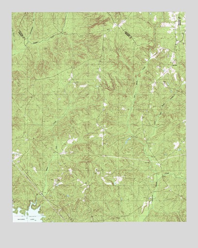
White Oak Creek, SC USGS Topographic Map
Click on map above to begin viewing in our Map Viewer.

This topographic map contains these locations and features:
Feature Name Type Latitude Longitude GNIS ID View Map
Beaver Creek CemeteryCemeteryN34.4757°W80.7329°1235008View Map
Beaver Creek Meeting House (historical)ChurchN34.4763°W80.7329°1235009View Map
Bethel ChurchChurchN34.4254°W80.7392°1220567View Map
Clermont Plantation (historical)LocaleN34.4054°W80.6420°1235062View Map
Dry BranchStreamN34.4004°W80.6451°1222107View Map
Ebenezer ChurchChurchN34.4663°W80.6862°1235076View Map
Ebenezer SchoolSchoolN34.4677°W80.6854°1222228View Map
Ebenezer School (historical)SchoolN34.4199°W80.6840°1235078View Map
Flat RockPopulated PlaceN34.4704°W80.6340°1247765View Map
Flat Rock ChurchChurchN34.4413°W80.6515°1247769View Map
Flat Rock CreekStreamN34.4007°W80.6459°1244834View Map
Flat Rock School (historical)SchoolN34.4635°W80.6384°1247772View Map
Fort HillSummitN34.4074°W80.6476°1231293View Map
Grannys Quarter (historical)Populated PlaceN34.3960°W80.6373°1251774View Map
Kershaw County Fire Station Baron DeKalbBuildingN34.3919°W80.6971°2578416View Map
Kirkland ChurchChurchN34.3888°W80.6990°1235122View Map
Kirkland SchoolSchoolN34.3876°W80.6979°1223750View Map
Kirkland SchoolSchoolN34.4063°W80.6890°1235123View Map
Little Barfield MillpondReservoirN34.4552°W80.6548°1239448View Map
Little Beaver CreekStreamN34.4749°W80.7473°1223953View Map
Little Flat Rock CreekStreamN34.4152°W80.6526°1246398View Map
Macedonia ChurchChurchN34.3938°W80.6359°1246505View Map
McDowell Plantation (historical)LocaleN34.4001°W80.6845°1235145View Map
Mount Calvary ChurchChurchN34.4843°W80.6823°1224692View Map
Red HillPopulated PlaceN34.4246°W80.7387°1235190View Map
Red Hill Plantation (historical)LocaleN34.4457°W80.7387°1235191View Map
Red Hill School (historical)SchoolN34.4243°W80.7387°1235192View Map
Red Hill School (historical)SchoolN34.4474°W80.7373°1235193View Map
Rock Spring ChurchChurchN34.4038°W80.7070°1225947View Map
Saint Johns CemeteryCemeteryN34.4190°W80.7226°1253364View Map
Saint Johns ChurchChurchN34.4190°W80.7223°1250556View Map
Showerbath BranchStreamN34.4840°W80.7234°1226599View Map
Smyrles CemeteryCemeteryN34.3826°W80.6898°1226709View Map
Smyrles Plantation (historical)LocaleN34.3815°W80.6929°1235210View Map
Squire Jims Plantation (historical)LocaleN34.4349°W80.6340°1235218View Map
Thorn HillSummitN34.4967°W80.6469°2085446View Map
Thornhill School (historical)SchoolN34.4960°W80.6648°1252632View Map
Tom Jones FordCrossingN34.4415°W80.6642°1235231View Map
Westville DivisionCivilN34.4421°W80.7129°1938465View Map
White Oak CemeteryCemeteryN34.3888°W80.7237°1253365View Map
White Oak ChurchChurchN34.3888°W80.7231°1235248View Map
White Oak CreekStreamN34.3846°W80.7362°1227565View Map
White Oak Plantation (historical)LocaleN34.4071°W80.7192°1235249View Map
Whiteoak ChurchChurchN34.3832°W80.7245°1251429View Map

Note: Coordinates in the location and feature list above are referenced to NAD83 datum.


Copyright (C) 2008-2025 Ryan Niemi / Sunset Dynamics ... All Rights Reserved