TopoQuest Logo
Do you find TopoQuest useful?
Help keep TopoQuest running and adding new maps/features by donating!
Bitcoin:  19c7KJd3qBynnjoSw5npx9KScwjBe4ifkT
Litecoin:  LXs6TkuXGGXo1vDsWCkWVdjQX94eUKd6ui
Home View Maps Find Maps Find Places Resources & Links


Whitewater West, Montana Topographic Map

USGS Map Title: Whitewater West, MT
USGS Map MRC: 48107G6
DRG (GeoTIFF) Download: o48107g6.tif


Neighboring USGS Topographic Map Quads:


  Morgan, MT  
48107H7
 

  Gustin Coulee, MT  
48107H6
 

  Pea Lake, MT  
48107H5
 

  Loring, MT  
48107G7
 

  Whitewater West, MT  
48107G6
 

  Whitewater East, MT  
48107G5
 

  Austin Coulee, MT  
48107F7
 

  Austin Lake, MT  
48107F6
 

  Tattnall, MT  
48107F5


Map MRC Location:

N49°
W108°
N49°
W107°
H8 H7 H6 H5 H4 H3 H2 H1
G8 G7 G6 G5 G4 G3 G2 G1
F8 F7 F6 F5 F4 F3 F2 F1
E8 E7 E6 E5 E4 E3 E2 E1
D8 D7 D6 D5 D4 D3 D2 D1
C8 C7 C6 C5 C4 C3 C2 C1
B8 B7 B6 B5 B4 B3 B2 B1
A8 A7 A6 A5 A4 A3 A2 A1
N48°
W108°
N48°
W107°

Whitewater West, MT USGS 1:24K Topographic Map Preview:
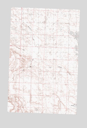
Whitewater West, MT USGS Topographic Map
Click on map above to begin viewing in our Map Viewer.

This topographic map contains these locations and features:
Feature Name Type Latitude Longitude GNIS ID View Map
35N31E26D___01 WellWellN48.7614°W107.6326°1636410View Map
Austin Number 2 DamDamN48.7683°W107.7040°797658View Map
Dibble CreekStreamN48.8175°W107.6979°800138View Map
Dibble SpringSpringN48.8051°W107.7139°800137View Map
Lone Tree CouleeValleyN48.8203°W107.7018°800139View Map
Ordean (historical)LocaleN48.8025°W107.7093°1722033View Map
Phillips County Volunteer Fire Company Whitewater StationBuildingN48.7598°W107.6285°2546749View Map
Saint Johns Catholic ChurchChurchN48.7595°W107.6276°1721806View Map
WhitewaterPopulated PlaceN48.7595°W107.6276°778429View Map
Whitewater (historical)LocaleN48.7595°W107.6276°1722111View Map
Whitewater Census Designated PlaceCensusN48.7635°W107.6302°2583867View Map
Whitewater DivisionCivilN48.7893°W107.6805°1940743View Map
Whitewater Lutheran ChurchChurchN48.7595°W107.6276°1721807View Map
Whitewater Post OfficePost OfficeN48.7598°W107.6277°1722110View Map
Whitewater Public SchoolsSchoolN48.7620°W107.6301°1722008View Map
Ynot (historical)Populated PlaceN48.8367°W107.6762°1722108View Map
Ynot Post Office (historical)Post OfficeN48.8367°W107.6762°1722109View Map

Note: Coordinates in the location and feature list above are referenced to NAD83 datum.


Copyright (C) 2008-2025 Ryan Niemi / Sunset Dynamics ... All Rights Reserved