TopoQuest Logo
Do you find TopoQuest useful?
Help keep TopoQuest running and adding new maps/features by donating!
Bitcoin:  19c7KJd3qBynnjoSw5npx9KScwjBe4ifkT
Litecoin:  LXs6TkuXGGXo1vDsWCkWVdjQX94eUKd6ui
Home View Maps Find Maps Find Places Resources & Links


Wibaux, Montana Topographic Map

USGS Map Title: Wibaux, MT
USGS Map MRC: 46104H2
DRG (GeoTIFF) Download: o46104h2.tif


Neighboring USGS Topographic Map Quads:


  Cluster Buttes SE, MT  
47104A3
 

  Odland Dam SW, MT  
47104A2
 

  Odland Dam, ND  
47104A1
 

  Freeman Creek, MT  
46104H3
 

  Wibaux, MT  
46104H2
 

  Beach West, ND  
46104H1
 

  Hodges SE, MT  
46104G3
 

  Red Top Butte, MT  
46104G2
 

  Duck Creek, MT  
46104G1


Map MRC Location:

N47°
W105°
N47°
W104°
H8 H7 H6 H5 H4 H3 H2 H1
G8 G7 G6 G5 G4 G3 G2 G1
F8 F7 F6 F5 F4 F3 F2 F1
E8 E7 E6 E5 E4 E3 E2 E1
D8 D7 D6 D5 D4 D3 D2 D1
C8 C7 C6 C5 C4 C3 C2 C1
B8 B7 B6 B5 B4 B3 B2 B1
A8 A7 A6 A5 A4 A3 A2 A1
N46°
W105°
N46°
W104°

Wibaux, MT USGS 1:24K Topographic Map Preview:
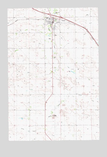
Wibaux, MT USGS Topographic Map
Click on map above to begin viewing in our Map Viewer.

This topographic map contains these locations and features:
Feature Name Type Latitude Longitude GNIS ID View Map
04N36E24DAAA01 WellWellN46.9922°W104.1772°819992View Map
13N59E01BAAA01 WellWellN46.9167°W104.1908°819361View Map
13N59E10DAAA01 WellWellN46.8958°W104.2224°819231View Map
13N59E13BCBB01 WellWellN46.8847°W104.1991°819094View Map
13N60E06CBBB01 WellWellN46.9111°W104.1755°819332View Map
13N60E07CB__01 WellWellN46.8958°W104.1727°819230View Map
14N59E10CDA_01 WellWellN46.9786°W104.2327°819893View Map
14N59E11DADB01 WellWellN46.9814°W104.2433°819922View Map
14N59E12CBD_01 WellWellN46.9803°W104.1966°819903View Map
14N59E15ABBB01 WellWellN46.9750°W104.2283°819859View Map
14N59E23AADA01 WellWellN46.9625°W104.2019°819737View Map
14N59E34DD__01 WellWellN46.9197°W104.2233°819375View Map
14N59E35DDD_01 WellWellN46.9236°W104.2005°819406View Map
14N60E07BDA_01 WellWellN46.9861°W104.1683°819947View Map
14N60E20CCC_01 WellWellN46.9481°W104.1552°819569View Map
Assembly of God Calvary TempleChurchN46.9878°W104.1935°1696518View Map
Baird ButteSummitN46.8983°W104.1874°799180View Map
Brophy CreekStreamN46.9208°W104.1677°799219View Map
Brophy School (historical)SchoolN46.9042°W104.1588°1696571View Map
Carol ParkParkN46.9889°W104.1988°1696612View Map
Christian Fundamental ChurchChurchN46.9886°W104.1874°1696516View Map
Duck CreekStreamN46.8762°W104.1619°770863View Map
Eiden School (historical)SchoolN46.9700°W104.2294°1696586View Map
Erickson School (historical)SchoolN46.9403°W104.1574°1696584View Map
Gateway MuseumBuildingN46.9836°W104.1855°1696521View Map
Interchange 241CrossingN46.9967°W104.1908°1696599View Map
Interchange 242CrossingN46.9911°W104.1783°1696600View Map
Knight DamDamN46.9383°W104.1605°796260View Map
Ley School (historical)SchoolN46.8756°W104.2422°1696576View Map
Lynn School (historical)SchoolN46.9050°W104.2005°1696574View Map
Maus Trailer CourtPopulated PlaceN46.9883°W104.1863°1696528View Map
Parker School (historical)SchoolN46.9395°W104.2005°1696585View Map
Pierre Wibaux County MuseumBuildingN46.9867°W104.1869°1696520View Map
Pierre Wibaux Historical MarkerParkN46.9881°W104.1869°1696530View Map
Pierre Wibaux MonumentParkN46.9881°W104.1983°1696519View Map
Saint Johns Evangelical Lutheran Church (historical)ChurchN46.9889°W104.1885°1696513View Map
Saint Peters Catholic ChurchChurchN46.9870°W104.1916°1696514View Map
Spring CreekStreamN46.8875°W104.1905°799181View Map
Spring Creek School (historical)SchoolN46.8897°W104.2008°1696575View Map
Town of WibauxCivilN46.9866°W104.1900°2413483View Map
Trinity Lutheran ChurchChurchN46.9895°W104.1885°1696517View Map
United Methodist ChurchChurchN46.9850°W104.1885°1696515View Map
Valley Motel and Trailer CourtLocaleN46.9820°W104.1905°1696529View Map
WibauxLocaleN46.9875°W104.1866°1696608View Map
WibauxPopulated PlaceN46.9850°W104.1883°778445View Map
Wibaux City ParkParkN46.9881°W104.1866°1696611View Map
Wibaux ClinicHospitalN46.9867°W104.1880°1696524View Map
Wibaux Cooperative Elevator (historical)LocaleN46.9875°W104.1866°1696607View Map
Wibaux CountyCivilN46.9653°W104.2492°1696629View Map
Wibaux County Ambulance ServiceBuildingN46.9866°W104.1899°2637919View Map
Wibaux County CemeteryCemeteryN46.9847°W104.2005°1696526View Map
Wibaux County CourthouseBuildingN46.9858°W104.1885°1696615View Map
Wibaux County FairgroundsLocaleN46.9745°W104.1866°1696616View Map
Wibaux County Nursing HomeHospitalN46.9800°W104.1880°1696523View Map
Wibaux County Sheriff's OfficeBuildingN46.9859°W104.1884°1696614View Map
Wibaux County Volunteer Fire DepartmentBuildingN46.9866°W104.1898°1696613View Map
Wibaux Elementary SchoolSchoolN46.9896°W104.1924°1696546View Map
Wibaux High SchoolSchoolN46.9904°W104.1960°1696547View Map
Wibaux Post OfficePost OfficeN46.9857°W104.1885°1696619View Map
Wibaux Public LibraryBuildingN46.9864°W104.1880°1696522View Map
Wibaux Visitor Information CenterBuildingN46.9870°W104.1863°1696618View Map
YatesPopulated PlaceN46.9511°W104.1305°802243View Map
Yates CreekStreamN46.9875°W104.1844°799182View Map

Note: Coordinates in the location and feature list above are referenced to NAD83 datum.


Copyright (C) 2008-2024 Ryan Niemi / Sunset Dynamics ... All Rights Reserved