TopoQuest Logo
Do you find TopoQuest useful?
Help keep TopoQuest running and adding new maps/features by donating!
Bitcoin:  19c7KJd3qBynnjoSw5npx9KScwjBe4ifkT
Litecoin:  LXs6TkuXGGXo1vDsWCkWVdjQX94eUKd6ui
Home View Maps Find Maps Find Places Resources & Links


Willard, Washington Topographic Map

USGS Map Title: Willard, WA
USGS Map MRC: 45121G6
DRG (GeoTIFF) Download: o45121g6.tif


Neighboring USGS Topographic Map Quads:


  Gifford Peak, WA  
45121H7
 

  Little Huckleberry Mountain, WA  
45121H6
 

  Guler Mountain, WA  
45121H5
 

  Big Huckleberry Mountain, WA  
45121G7
 

  Willard, WA  
45121G6
 

  Northwestern Lake, WA  
45121G5
 

  Carson, WA  
45121F7
 

  Mount Defiance, OR  
45121F6
 

  Hood River, OR  
45121F5


Map MRC Location:

N46°
W122°
N46°
W121°
H8 H7 H6 H5 H4 H3 H2 H1
G8 G7 G6 G5 G4 G3 G2 G1
F8 F7 F6 F5 F4 F3 F2 F1
E8 E7 E6 E5 E4 E3 E2 E1
D8 D7 D6 D5 D4 D3 D2 D1
C8 C7 C6 C5 C4 C3 C2 C1
B8 B7 B6 B5 B4 B3 B2 B1
A8 A7 A6 A5 A4 A3 A2 A1
N45°
W122°
N45°
W121°

Willard, WA USGS 1:24K Topographic Map Preview:
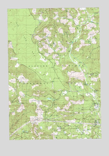
Willard, WA USGS Topographic Map
Click on map above to begin viewing in our Map Viewer.

This topographic map contains these locations and features:
Feature Name Type Latitude Longitude GNIS ID View Map
Berry CreekStreamN45.8537°W121.6520°1516442View Map
Big Cedars County ParkParkN45.8007°W121.6426°1516474View Map
Cabbage CreekStreamN45.8268°W121.6659°1517182View Map
Carson-Underwood DivisionCivilN45.7664°W121.7331°1939677View Map
Goat PointSummitN45.7932°W121.6901°1520056View Map
Goat Point TrailTrailN45.7951°W121.7345°1520057View Map
Hauk ButteSummitN45.7779°W121.6795°1520604View Map
Homes CreekStreamN45.8612°W121.6406°1520878View Map
Lapham CreekStreamN45.7618°W121.6287°1521899View Map
Larson LakesLakeN45.7583°W121.7325°1521915View Map
Lava CreekStreamN45.7815°W121.6279°1521946View Map
Little Wind River CampLocaleN45.7743°W121.7040°1522329View Map
Lost CreekStreamN45.7923°W121.6712°1522458View Map
Lusk CreekStreamN45.8607°W121.6437°1522583View Map
Mill APopulated PlaceN45.7568°W121.6504°1523144View Map
Mill A SchoolSchoolN45.7504°W121.6520°1523146View Map
Mill A Volunteer Fire DepartmentBuildingN45.7577°W121.6486°2643951View Map
Moss CreekStreamN45.7985°W121.6390°1523408View Map
Moss Creek CampgroundLocaleN45.7971°W121.6392°1523409View Map
Nestor Peak TrailTrailN45.8140°W121.6281°1523627View Map
North Fork Berry CreekStreamN45.8623°W121.6617°1533063View Map
Pine CreekStreamN45.7779°W121.6287°1528705View Map
Shingle MountainSummitN45.8140°W121.6651°1525688View Map
South Fork Berry CreekStreamN45.8623°W121.6615°1528446View Map
Triangle PassGapN45.7682°W121.7345°1528706View Map
WillardPopulated PlaceN45.7810°W121.6309°1528164View Map
Willard National Fish HatcheryParkN45.7651°W121.6326°1533273View Map
Willard Work CenterLocaleN45.7837°W121.6323°1531793View Map
Wilson CreekStreamN45.8085°W121.6462°1528202View Map
Zone II Engineering StationLocaleN45.7654°W121.6320°1529307View Map

Note: Coordinates in the location and feature list above are referenced to NAD83 datum.


Copyright (C) 2008-2024 Ryan Niemi / Sunset Dynamics ... All Rights Reserved