TopoQuest Logo
Do you find TopoQuest useful?
Help keep TopoQuest running and adding new maps/features by donating!
Bitcoin:  19c7KJd3qBynnjoSw5npx9KScwjBe4ifkT
Litecoin:  LXs6TkuXGGXo1vDsWCkWVdjQX94eUKd6ui
Home View Maps Find Maps Find Places Resources & Links


Williams, Iowa Topographic Map

USGS Map Title: Williams, IA
USGS Map MRC: 42093D5
DRG (GeoTIFF) Download: o42093d5.tif


Neighboring USGS Topographic Map Quads:


  Clarion SW, IA  
42093E6
 

  Sheldon Creek, IA  
42093E5
 

  Popejoy, IA  
42093E4
 

  Blairsburg, IA  
42093D6
 

  Williams, IA  
42093D5
 

  Buckeye West, IA  
42093D4
 

  Jewell, IA  
42093C6
 

  Ellsworth, IA  
42093C5
 

  Radcliffe, IA  
42093C4


Map MRC Location:

N43°
W94°
N43°
W93°
H8 H7 H6 H5 H4 H3 H2 H1
G8 G7 G6 G5 G4 G3 G2 G1
F8 F7 F6 F5 F4 F3 F2 F1
E8 E7 E6 E5 E4 E3 E2 E1
D8 D7 D6 D5 D4 D3 D2 D1
C8 C7 C6 C5 C4 C3 C2 C1
B8 B7 B6 B5 B4 B3 B2 B1
A8 A7 A6 A5 A4 A3 A2 A1
N42°
W94°
N42°
W93°

Williams, IA USGS 1:24K Topographic Map Preview:
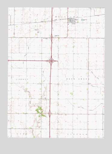
Williams, IA USGS Topographic Map
Click on map above to begin viewing in our Map Viewer.

This topographic map contains these locations and features:
Feature Name Type Latitude Longitude GNIS ID View Map
City of WilliamsCivilN42.4892°W93.5411°2397317View Map
Coyote Bend AreaParkN42.4514°W93.6030°1996867View Map
Ditch Number 64CanalN42.4541°W93.5674°465739View Map
Ellis United Methodist ChurchChurchN42.4878°W93.5458°1996935View Map
Interchange 139CrossingN42.3986°W93.5708°1996981View Map
Interchange 142CrossingN42.4489°W93.5691°1996980View Map
Interchange 144CrossingN42.4878°W93.5688°1996979View Map
Rose Grove CemeteryCemeteryN42.4264°W93.5822°1997011View Map
Rose Grove ChurchChurchN42.4266°W93.5819°460787View Map
Rose Grove Post Office (historical)Post OfficeN42.3980°W93.5780°466678View Map
Saint Mary's Catholic ChurchChurchN42.4853°W93.5438°1996936View Map
Saint Marys CemeteryCemeteryN42.4783°W93.5883°461174View Map
Saint Paul's Lutheran ChurchChurchN42.4880°W93.5391°1996937View Map
Township of Rose GroveCivilN42.4273°W93.5222°468641View Map
WilliamsLocaleN42.4894°W93.5447°1996938View Map
WilliamsPopulated PlaceN42.4883°W93.5449°463052View Map
Williams CemeteryCemeteryN42.4780°W93.5866°463054View Map
Williams Fire DepartmentBuildingN42.4874°W93.5453°2577428View Map
Williams Municipal BuildingBuildingN42.4875°W93.5452°1996933View Map
Williams Post OfficePost OfficeN42.4876°W93.5444°1996925View Map
Williams Public LibraryBuildingN42.4872°W93.5447°1996934View Map

Note: Coordinates in the location and feature list above are referenced to NAD83 datum.


Copyright (C) 2008-2024 Ryan Niemi / Sunset Dynamics ... All Rights Reserved