TopoQuest Logo
Do you find TopoQuest useful?
Help keep TopoQuest running and adding new maps/features by donating!
Bitcoin:  19c7KJd3qBynnjoSw5npx9KScwjBe4ifkT
Litecoin:  LXs6TkuXGGXo1vDsWCkWVdjQX94eUKd6ui
Home View Maps Find Maps Find Places Resources & Links


Willie, Georgia Topographic Map

USGS Map Title: Willie, GA
USGS Map MRC: 32081A6
DRG (GeoTIFF) Download: o32081a6.tif


Neighboring USGS Topographic Map Quads:


  Daisy, GA  
32081B7
 

  Groveland, GA  
32081B6
 

  Lanier, GA  
32081B5
 

  Glissons Millpond, GA  
32081A7
 

  Willie, GA  
32081A6
 

  Letford, GA  
32081A5
 

  Glennville NE, GA  
31081H7
 

  Taylors Creek, GA  
31081H6
 

  Trinity, GA  
31081H5


Map MRC Location:

N33°
W82°
N33°
W81°
H8 H7 H6 H5 H4 H3 H2 H1
G8 G7 G6 G5 G4 G3 G2 G1
F8 F7 F6 F5 F4 F3 F2 F1
E8 E7 E6 E5 E4 E3 E2 E1
D8 D7 D6 D5 D4 D3 D2 D1
C8 C7 C6 C5 C4 C3 C2 C1
B8 B7 B6 B5 B4 B3 B2 B1
A8 A7 A6 A5 A4 A3 A2 A1
N32°
W82°
N32°
W81°

Willie, GA USGS 1:24K Topographic Map Preview:
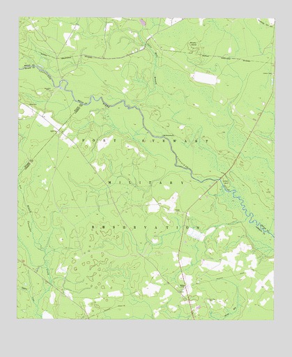
Willie, GA USGS Topographic Map
Click on map above to begin viewing in our Map Viewer.

This topographic map contains these locations and features:
Feature Name Type Latitude Longitude GNIS ID View Map
Brushy IslandIslandN32.1144°W81.6643°311926View Map
Clifton BluffCliffN32.0574°W81.6484°312746View Map
Dukes (historical)Populated PlaceN32.0013°W81.7132°357066View Map
Edwards RocksBarN32.0841°W81.6890°350509View Map
Elarbee CemeteryCemeteryN32.0449°W81.6704°313885View Map
Floyd LandingLocaleN32.0424°W81.6409°357075View Map
Jerusalem CemeteryCemeteryN32.0944°W81.7343°316088View Map
Long BranchStreamN32.0313°W81.7390°317326View Map
Moody CemeteryCemeteryN32.0888°W81.7446°318414View Map
Moodys BridgeBridgeN32.0991°W81.7287°350522View Map
Mule Pen LandingLocaleN32.0919°W81.7148°350523View Map
Oak Grove School (historical)SchoolN32.0896°W81.6465°350525View Map
Otter Hole BranchStreamN32.0874°W81.6904°320118View Map
Salem CemeteryCemeteryN32.0774°W81.7304°322329View Map
Salem School (historical)SchoolN32.0783°W81.7307°345951View Map
Short Road School (historical)SchoolN32.0396°W81.7240°357127View Map
Simmons PointCliffN32.0766°W81.6790°323008View Map
Strum Bay (historical)Populated PlaceN32.0210°W81.6359°357129View Map
Strum Bay CemeteryCemeteryN32.0080°W81.6562°323698View Map
Taylors CreekStreamN32.0055°W81.7401°323960View Map
WilliePopulated PlaceN32.0141°W81.6673°333436View Map

Note: Coordinates in the location and feature list above are referenced to NAD83 datum.


Copyright (C) 2008-2024 Ryan Niemi / Sunset Dynamics ... All Rights Reserved