TopoQuest Logo
Do you find TopoQuest useful?
Help keep TopoQuest running and adding new maps/features by donating!
Bitcoin:  19c7KJd3qBynnjoSw5npx9KScwjBe4ifkT
Litecoin:  LXs6TkuXGGXo1vDsWCkWVdjQX94eUKd6ui
Home View Maps Find Maps Find Places Resources & Links


Willis Buttes, Montana Topographic Map

USGS Map Title: Willis Buttes, MT
USGS Map MRC: 47106G1
DRG (GeoTIFF) Download: o47106g1.tif


Neighboring USGS Topographic Map Quads:


  McRae Springs, MT  
47106H2
 

  Pasture Creek, MT  
47106H1
 

  Turtle Creek, MT  
47105H8
 

  Sand Arroyo, MT  
47106G2
 

  Willis Buttes, MT  
47106G1
 

  Shade Creek, MT  
47105G8
 

  Bug Creek, MT  
47106F2
 

  Crow Springs, MT  
47106F1
 

  Figure Eight Creek, MT  
47105F8


Map MRC Location:

N48°
W107°
N48°
W106°
H8 H7 H6 H5 H4 H3 H2 H1
G8 G7 G6 G5 G4 G3 G2 G1
F8 F7 F6 F5 F4 F3 F2 F1
E8 E7 E6 E5 E4 E3 E2 E1
D8 D7 D6 D5 D4 D3 D2 D1
C8 C7 C6 C5 C4 C3 C2 C1
B8 B7 B6 B5 B4 B3 B2 B1
A8 A7 A6 A5 A4 A3 A2 A1
N47°
W107°
N47°
W106°

Willis Buttes, MT USGS 1:24K Topographic Map Preview:
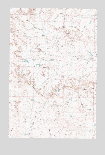
Willis Buttes, MT USGS Topographic Map
Click on map above to begin viewing in our Map Viewer.

This topographic map contains these locations and features:
Feature Name Type Latitude Longitude GNIS ID View Map
24N44E12DAAA01 WellWellN47.8547°W106.0050°825102View Map
24N44E20CABD01 WellWellN47.8247°W106.1045°825032View Map
24N44E21AACB01 WellWellN47.8308°W106.0734°825051View Map
Alecs SpringsSpringN47.8380°W106.0367°768163View Map
Bald ButteSummitN47.8625°W106.1014°768468View Map
Big ButteSummitN47.8545°W106.0584°768755View Map
Bonin DivideRidgeN47.7620°W106.1172°769101View Map
Corner ButteSummitN47.8178°W106.0689°770093View Map
Deer PassGapN47.7972°W106.0195°770590View Map
Game ReservoirReservoirN47.8237°W106.1006°771694View Map
Game Reservoir DamDamN47.8233°W106.0989°797583View Map
Goose Island ReservoirReservoirN47.8250°W106.0675°771866View Map
Hell GateGapN47.8020°W106.0531°772328View Map
Hell Gate ReservoirReservoirN47.7959°W106.0544°772329View Map
Hell Gate Reservoir DamDamN47.7967°W106.0539°797337View Map
Horsford SpringSpringN47.8391°W106.0525°772572View Map
Illmont School (historical)SchoolN47.8461°W106.0572°772671View Map
Jack CreekStreamN47.8225°W106.0550°772758View Map
Jays ReservoirReservoirN47.8342°W106.0949°772800View Map
Lions PassGapN47.7858°W106.0695°773382View Map
Lytle HillSummitN47.8572°W106.0497°773778View Map
Margaret Hays Number 1 DamDamN47.8300°W106.0089°798105View Map
Moore SpringSpringN47.8681°W106.1225°774367View Map
North DamDamN47.8489°W106.0759°774696View Map
North Prong Shade CreekStreamN47.8281°W106.0195°774849View Map
Pattonhill Post Office (historical)Post OfficeN47.8625°W106.0486°1716183View Map
Rocky ButteSummitN47.8178°W106.0731°775880View Map
Rooney SpringSpringN47.8468°W106.0259°775927View Map
Shady Lane DamDamN47.7633°W106.0022°798234View Map
Teds ReservoirReservoirN47.8204°W106.0837°777442View Map
Teds Reservoir DamDamN47.8200°W106.0839°797594View Map
Teton ButteSummitN47.8514°W106.0881°777478View Map
Twitchell PassGapN47.8503°W106.0450°777863View Map
US Number 1 DamDamN47.8133°W106.1072°797289View Map
Vanderhoof HillSummitN47.8092°W106.0495°778003View Map
Walton Reservoir DamDamN47.7867°W106.0356°797288View Map
Willis ButtesSummitN47.8367°W106.0856°778525View Map

Note: Coordinates in the location and feature list above are referenced to NAD83 datum.


Copyright (C) 2008-2024 Ryan Niemi / Sunset Dynamics ... All Rights Reserved