TopoQuest Logo
Do you find TopoQuest useful?
Help keep TopoQuest running and adding new maps/features by donating!
Bitcoin:  19c7KJd3qBynnjoSw5npx9KScwjBe4ifkT
Litecoin:  LXs6TkuXGGXo1vDsWCkWVdjQX94eUKd6ui
Home View Maps Find Maps Find Places Resources & Links


Williston East, North Dakota Topographic Map

USGS Map Title: Williston East, ND
USGS Map MRC: 48103B5
DRG (GeoTIFF) Download: o48103b5.tif


Neighboring USGS Topographic Map Quads:


  Otter Tail Creek, ND  
48103C6
 

  Blacktail Lake SE, ND  
48103C5
 

  Spring Brook, ND  
48103C4
 

  Williston West, ND  
48103B6
 

  Williston East, ND  
48103B5
 

  Stockyard Creek, ND  
48103B4
 

  Williston SW, ND  
48103A6
 

  Williston SE, ND  
48103A5
 

  Lake Jessie, ND  
48103A4


Map MRC Location:

N49°
W104°
N49°
W103°
H8 H7 H6 H5 H4 H3 H2 H1
G8 G7 G6 G5 G4 G3 G2 G1
F8 F7 F6 F5 F4 F3 F2 F1
E8 E7 E6 E5 E4 E3 E2 E1
D8 D7 D6 D5 D4 D3 D2 D1
C8 C7 C6 C5 C4 C3 C2 C1
B8 B7 B6 B5 B4 B3 B2 B1
A8 A7 A6 A5 A4 A3 A2 A1
N48°
W104°
N48°
W103°

Williston East, ND USGS 1:24K Topographic Map Preview:
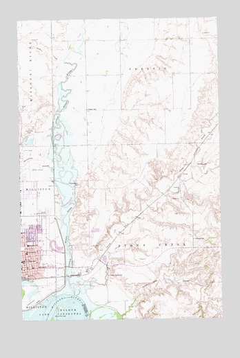
Williston East, ND USGS Topographic Map
Click on map above to begin viewing in our Map Viewer.

This topographic map contains these locations and features:
Feature Name Type Latitude Longitude GNIS ID View Map
Abramson HallBuildingN48.1562°W103.6134°2747360View Map
Art Wood BuildingSchoolN48.1583°W103.6115°2747356View Map
AvocaPopulated PlaceN48.1850°W103.5241°1033832View Map
Camp CreekStreamN48.2334°W103.5963°1028255View Map
Chinaman CouleeValleyN48.1870°W103.6044°1028360View Map
Crazy Man CouleeValleyN48.1267°W103.5627°1028530View Map
Crighton BuildingSchoolN48.1595°W103.6113°2747357View Map
Dickson HallBuildingN48.1572°W103.6113°2747359View Map
East Lawn ParkParkN48.1484°W103.6127°1028780View Map
Frontier HallBuildingN48.1575°W103.6132°2747363View Map
Frontier MuseumBuildingN48.2033°W103.6247°2749337View Map
Harmon ParkParkN48.1553°W103.6241°1029321View Map
Hillside Memory GardensCemeteryN48.1700°W103.6077°1029465View Map
Lake Park Drive-InLocaleN48.1961°W103.6236°2633325View Map
Little Muddy RiverStreamN48.1353°W103.5921°1027634View Map
Manger HallBuildingN48.1562°W103.6130°2747361View Map
McVay Elementary SchoolSchoolN48.1488°W103.6145°2748397View Map
Nelson HallBuildingN48.1563°W103.6125°2747362View Map
North Dakota Highway Patrol Northwest Region - Williston OfficeBuildingN48.1466°W103.6184°2734446View Map
Palmer SchoolSchoolN48.2125°W103.5824°1030624View Map
Penman SchoolSchoolN48.1581°W103.5174°1030672View Map
Powerhouse SchoolSchoolN48.1814°W103.5883°1030792View Map
Rabon FieldParkN48.1603°W103.6138°2747358View Map
Rickard Elementary SchoolSchoolN48.1566°W103.6211°1030906View Map
Stevens HallSchoolN48.1589°W103.6138°2747336View Map
Stockyard CreekStreamN48.1881°W103.5160°1032327View Map
Stony CreekStreamN48.1411°W103.5813°1032341View Map
Stony Creek Elementary SchoolSchoolN48.1434°W103.5705°1032343View Map
Thomas Witt Leach Health Science and Sports ComplexSchoolN48.1584°W103.6128°2747337View Map
Township of PherrinCivilN48.2413°W103.5390°1036989View Map
Twin Lakes ParkParkN48.2022°W103.6213°1032581View Map
Unorganized Territory of Pherrin (historical)CensusN48.2412°W103.5394°2393305View Map
Western Star Career and Technology CenterSchoolN48.1589°W103.6099°2747364View Map
Williams County CourthouseBuildingN48.1470°W103.6186°2743624View Map
Williams County Sheriff's OfficeBuildingN48.1472°W103.6181°2734340View Map
WillistonPopulated PlaceN48.1470°W103.6180°1032815View Map
Williston Basin SpeedwayLocaleN48.1931°W103.6113°2749339View Map
Williston City HallBuildingN48.1464°W103.6205°2745336View Map
Williston LandfillLocaleN48.1656°W103.5753°2681441View Map
Williston Police DepartmentBuildingN48.1472°W103.6177°2734414View Map
Williston Post OfficePost OfficeN48.1462°W103.6191°2743241View Map
Williston State CollegeSchoolN48.1589°W103.6138°2745409View Map
Williston State College LibraryBuildingN48.1588°W103.6138°2745732View Map
Wright Field Airport (historical)AirportN48.1876°W103.6238°1033600View Map

Note: Coordinates in the location and feature list above are referenced to NAD83 datum.


Copyright (C) 2008-2025 Ryan Niemi / Sunset Dynamics ... All Rights Reserved