TopoQuest Logo
Do you find TopoQuest useful?
Help keep TopoQuest running and adding new maps/features by donating!
Bitcoin:  19c7KJd3qBynnjoSw5npx9KScwjBe4ifkT
Litecoin:  LXs6TkuXGGXo1vDsWCkWVdjQX94eUKd6ui
Home View Maps Find Maps Find Places Resources & Links


Willow Creek Butte, Utah Topographic Map

USGS Map Title: Willow Creek Butte, UT
USGS Map MRC: 40109H1
DRG (GeoTIFF) Download: o40109h1.tif


Neighboring USGS Topographic Map Quads:


  Richards Gap, WY  
41109A2
 

  Red Creek Ranch, WY  
41109A1
 

  Four J Rim, WY  
41108A8
 

  Clay Basin, UT  
40109H2
 

  Willow Creek Butte, UT  
40109H1
 

  Beaver Basin, CO  
40108H8
 

  Warren Draw, UT  
40109G2
 

  Swallow Canyon, UT  
40109G1
 

  Lodore School, CO  
40108G8


Map MRC Location:

N41°
W110°
N41°
W109°
H8 H7 H6 H5 H4 H3 H2 H1
G8 G7 G6 G5 G4 G3 G2 G1
F8 F7 F6 F5 F4 F3 F2 F1
E8 E7 E6 E5 E4 E3 E2 E1
D8 D7 D6 D5 D4 D3 D2 D1
C8 C7 C6 C5 C4 C3 C2 C1
B8 B7 B6 B5 B4 B3 B2 B1
A8 A7 A6 A5 A4 A3 A2 A1
N40°
W110°
N40°
W109°

Willow Creek Butte, UT USGS 1:24K Topographic Map Preview:
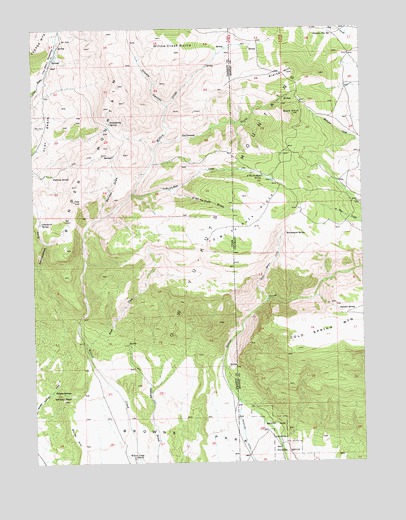
Willow Creek Butte, UT USGS Topographic Map
Click on map above to begin viewing in our Map Viewer.

This topographic map contains these locations and features:
Feature Name Type Latitude Longitude GNIS ID View Map
Bender DrawValleyN40.9463°W109.1004°1425425View Map
Bender MountainSummitN40.9833°W109.0932°1425426View Map
Birch CreekStreamN40.8972°W109.0943°1425598View Map
Buck KnollSummitN40.9747°W109.0262°169649View Map
Chokecherry SpringSpringN40.9730°W109.0960°1426615View Map
Clay Basin MeadowsFlatN40.9913°W109.1201°1426679View Map
Cottonwood DrawValleyN40.9311°W109.1232°1426922View Map
Cottonwood SpringSpringN40.9442°W109.1227°1426948View Map
Crumb CanyonValleyN40.9775°W109.0746°1427129View Map
Fighting SpringSpringN40.9577°W109.1179°1427928View Map
Galloway CreekStreamN40.9669°W109.0779°1428130View Map
Galloway CreekStreamN40.9668°W109.0778°169651View Map
Honeymoon SpringSpringN40.9411°W109.0296°169648View Map
Kleins HillSummitN40.9869°W109.0262°169650View Map
Little Beaver CreekStreamN40.9208°W109.0373°169647View Map
O-Wi-Yu-Kuts CreekStreamN40.9525°W109.0879°1430894View Map
O-Wi-Yu-Kuts CreekStreamN40.9526°W109.0879°169643View Map
O-Wi-Yu-Kuts DrawValleyN40.9537°W109.0735°169642View Map
O-Wi-Yu-Kuts FlatsFlatN40.9427°W109.0443°1430896View Map
O-Wi-Yu-Kuts FlatsFlatN40.9441°W109.0446°169640View Map
O-Wi-Yu-Kuts MountainsRangeN40.9519°W109.0523°169641View Map
O-Wi-Yu-Kuts SpringSpringN40.9571°W109.0383°169644View Map
Slippery Jim SpringSpringN40.9986°W109.0127°169645View Map
Summit SpringSpringN40.9186°W109.0095°169646View Map
Whisky PeakSummitN40.8933°W109.1148°1434154View Map
Whisky SpringsSpringN40.8950°W109.1137°1434156View Map
White HillSummitN40.8841°W109.1123°1434162View Map
Willow Creek ButteSummitN40.9933°W109.0715°1434322View Map
Willow Creek RanchLocaleN40.8766°W109.0887°1434323View Map

Note: Coordinates in the location and feature list above are referenced to NAD83 datum.


Copyright (C) 2008-2024 Ryan Niemi / Sunset Dynamics ... All Rights Reserved