TopoQuest Logo
Do you find TopoQuest useful?
Help keep TopoQuest running and adding new maps/features by donating!
Bitcoin:  19c7KJd3qBynnjoSw5npx9KScwjBe4ifkT
Litecoin:  LXs6TkuXGGXo1vDsWCkWVdjQX94eUKd6ui
Home View Maps Find Maps Find Places Resources & Links


Willow Island, Nebraska Topographic Map

USGS Map Title: Willow Island, NE
USGS Map MRC: 40100H1
DRG (GeoTIFF) Download: o40100h1.tif


Neighboring USGS Topographic Map Quads:


  Odencranze Table South, NE  
41100A2
 

  Roten Valley South, NE  
41100A1
 

  Oconto SW, NE  
41099A8
 

  Gothenburg, NE  
40100H2
 

  Willow Island, NE  
40100H1
 

  Cozad NW, NE  
40099H8
 

  Gothenburg SW, NE  
40100G2
 

  Gothenburg SE, NE  
40100G1
 

  Cozad, NE  
40099G8


Map MRC Location:

N41°
W101°
N41°
W100°
H8 H7 H6 H5 H4 H3 H2 H1
G8 G7 G6 G5 G4 G3 G2 G1
F8 F7 F6 F5 F4 F3 F2 F1
E8 E7 E6 E5 E4 E3 E2 E1
D8 D7 D6 D5 D4 D3 D2 D1
C8 C7 C6 C5 C4 C3 C2 C1
B8 B7 B6 B5 B4 B3 B2 B1
A8 A7 A6 A5 A4 A3 A2 A1
N40°
W101°
N40°
W100°

Willow Island, NE USGS 1:24K Topographic Map Preview:
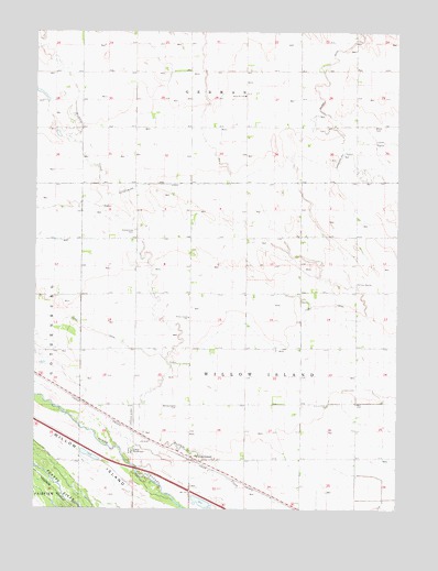
Willow Island, NE USGS Topographic Map
Click on map above to begin viewing in our Map Viewer.

This topographic map contains these locations and features:
Feature Name Type Latitude Longitude GNIS ID View Map
Camp RockhavenLocaleN40.8897°W100.0915°827908View Map
Center Star SchoolSchoolN40.9342°W100.0140°828043View Map
Cozad CanalCanalN40.9250°W100.0323°828432View Map
Fiese AirstripAirportN40.8969°W100.0911°837569View Map
Gothenburg CanalCanalN40.9600°W100.0707°829596View Map
Gothenburg Election PrecinctCivilN40.9198°W100.1171°1928909View Map
Grand View CemeteryCemeteryN40.9475°W100.0912°829630View Map
Lucerne Valley SchoolSchoolN40.9022°W100.0240°830951View Map
School Number 81RSchoolN40.9833°W100.0535°837123View Map
Township of GermanCivilN40.9917°W100.0504°1874884View Map
Township of Willow IslandCivilN40.9167°W100.0421°1875079View Map
Willow IslandIslandN40.8778°W100.0948°834775View Map
Willow IslandPopulated PlaceN40.8886°W100.0715°834776View Map
Willow IslandLocaleN40.8881°W100.0715°1874851View Map
Willow Island CemeteryCemeteryN40.9017°W100.0759°834777View Map
Willow Island Census Designated PlaceCensusN40.8900°W100.0707°2583906View Map
Willow Island Election Precinct (historical)CivilN40.9145°W100.0501°1929395View Map
Willow Island Post OfficePost OfficeN40.8886°W100.0715°1874852View Map
Willow Island SchoolSchoolN40.9253°W100.0723°834778View Map
Willow Island State Wildlife Management AreaParkN40.8764°W100.0698°1874922View Map

Note: Coordinates in the location and feature list above are referenced to NAD83 datum.


Copyright (C) 2008-2025 Ryan Niemi / Sunset Dynamics ... All Rights Reserved