TopoQuest Logo
Do you find TopoQuest useful?
Help keep TopoQuest running and adding new maps/features by donating!
Bitcoin:  19c7KJd3qBynnjoSw5npx9KScwjBe4ifkT
Litecoin:  LXs6TkuXGGXo1vDsWCkWVdjQX94eUKd6ui
Home View Maps Find Maps Find Places Resources & Links


Wilmot, Ohio Topographic Map

USGS Map Title: Wilmot, OH
USGS Map MRC: 40081F6
DRG (GeoTIFF) Download: o40081f6.tif


Neighboring USGS Topographic Map Quads:


  Orrville, OH  
40081G7
 

  Dalton, OH  
40081G6
 

  Massillon, OH  
40081G5
 

  Fredericksburg, OH  
40081F7
 

  Wilmot, OH  
40081F6
 

  Navarre, OH  
40081F5
 

  Berlin, OH  
40081E7
 

  Sugarcreek, OH  
40081E6
 

  Strasburg, OH  
40081E5


Map MRC Location:

N41°
W82°
N41°
W81°
H8 H7 H6 H5 H4 H3 H2 H1
G8 G7 G6 G5 G4 G3 G2 G1
F8 F7 F6 F5 F4 F3 F2 F1
E8 E7 E6 E5 E4 E3 E2 E1
D8 D7 D6 D5 D4 D3 D2 D1
C8 C7 C6 C5 C4 C3 C2 C1
B8 B7 B6 B5 B4 B3 B2 B1
A8 A7 A6 A5 A4 A3 A2 A1
N40°
W82°
N40°
W81°

Wilmot, OH USGS 1:24K Topographic Map Preview:
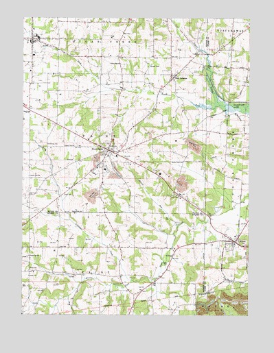
Wilmot, OH USGS Topographic Map
Click on map above to begin viewing in our Map Viewer.

This topographic map contains these locations and features:
Feature Name Type Latitude Longitude GNIS ID View Map
Beach Grove SchoolSchoolN40.7098°W81.7468°1037699View Map
Beidler CemeteryCemeteryN40.6473°W81.6698°1037816View Map
Beidler SchoolSchoolN40.6501°W81.6668°1060857View Map
Boone School (historical)SchoolN40.7412°W81.7065°1054778View Map
Calvary ChapelChurchN40.6751°W81.6635°1038641View Map
Cherry Ridge SchoolSchoolN40.7306°W81.6965°1039026View Map
Chestnut Ridge CemeteryCemeteryN40.6287°W81.6476°1963819View Map
Clar - Lain FarmLocaleN40.7153°W81.7408°2709665View Map
Cozy AcresPopulated PlaceN40.6583°W81.6369°2554306View Map
Crabapple CreekStreamN40.6392°W81.6887°1039433View Map
Eberly FarmsLocaleN40.7397°W81.7217°2709306View Map
Frogpond School (historical)SchoolN40.7120°W81.7465°1054779View Map
G and G FarmsLocaleN40.7136°W81.7497°2709664View Map
Gordin School (historical)SchoolN40.6828°W81.7462°1054780View Map
Goshen School (historical)SchoolN40.6917°W81.6293°1057611View Map
Green Lawn CemeteryCemeteryN40.6584°W81.6391°1730874View Map
Harmony FarmsLocaleN40.7358°W81.7431°2709662View Map
Hershberger CemeteryCemeteryN40.6759°W81.7460°1041504View Map
Hershberger CemeteryCemeteryN40.6970°W81.7365°1041505View Map
Keim CemeteryCemeteryN40.6558°W81.6818°1042196View Map
KidronPopulated PlaceN40.7409°W81.7449°1064931View Map
Kidron Census Designated PlaceCensusN40.7440°W81.7467°2584364View Map
Kidron Volunteer Fire DepartmentBuildingN40.7416°W81.7447°2549372View Map
Longenecker ChurchChurchN40.6381°W81.6943°1042765View Map
Longnecker CemeteryCemeteryN40.6384°W81.6948°1961598View Map
Lowes School (historical)SchoolN40.6531°W81.7074°1056061View Map
McFarren CemeteryCemeteryN40.7234°W81.6254°1730879View Map
McFarren School (historical)SchoolN40.7239°W81.6257°1057610View Map
Meadow Valley SchoolSchoolN40.6892°W81.6618°1043199View Map
Misers RunStreamN40.6639°W81.6612°1043410View Map
Mount EatonPopulated PlaceN40.6945°W81.7032°1065067View Map
Mount Eaton Elementary SchoolSchoolN40.6926°W81.7035°1054776View Map
Mount Eaton LandfillLocaleN40.6956°W81.6544°2677746View Map
Mount Eaton Lutheran CemeteryCemeteryN40.6926°W81.7004°1730928View Map
North Fork Sugar CreekStreamN40.7137°W81.6415°1043946View Map
Nussbaum FarmsLocaleN40.7211°W81.7144°2709302View Map
Old Wilmot CemeteryCemeteryN40.6567°W81.6304°1730882View Map
Paint Township Fire DepartmentBuildingN40.6935°W81.7008°2550300View Map
Parker CemeteryCemeteryN40.6445°W81.7454°1044303View Map
Peters School (historical)SchoolN40.6337°W81.7074°1069666View Map
Pleasant Hill SchoolSchoolN40.6498°W81.7457°1057929View Map
Pleasant View SchoolSchoolN40.6837°W81.7465°1044628View Map
Raygor FarmsLocaleN40.7347°W81.7019°2709308View Map
Reeds School (historical)SchoolN40.7128°W81.7065°1054777View Map
Rocky Dale School (historical)SchoolN40.6806°W81.6693°1054775View Map
Saint Pauls United Church of ChristChurchN40.6962°W81.7015°1730934View Map
School Number 1 (historical)SchoolN40.7481°W81.7454°1069503View Map
School Number 9 (historical)SchoolN40.7412°W81.7071°1069521View Map
Shillings School (historical)SchoolN40.7406°W81.6679°1054774View Map
Spring Brook SchoolSchoolN40.6684°W81.7168°1046547View Map
Sugar Creek Township CemeteryCemeteryN40.7295°W81.6687°1730936View Map
Sunny Slope Dairy FarmLocaleN40.7422°W81.7008°2634699View Map
Sunny Slope OrchardLocaleN40.7397°W81.6406°2544539View Map
Sunny View SchoolSchoolN40.6962°W81.7265°1046863View Map
Sunset LakeLakeN40.7298°W81.6800°1046870View Map
The Wilderness CenterParkN40.6834°W81.6435°1074935View Map
Township of PaintCivilN40.6319°W81.7100°1086334View Map
Township of PaintCivilN40.6973°W81.7075°1087158View Map
Village of Mount EatonCivilN40.6951°W81.7026°2399410View Map
Village of WilmotCivilN40.6559°W81.6344°2399706View Map
Weaver CemeteryCemeteryN40.6414°W81.7460°1047641View Map
West LebanonPopulated PlaceN40.7245°W81.6676°1049310View Map
West Lebanon Lutheran CemeteryCemeteryN40.7259°W81.6654°1730937View Map
Westlawn CemeteryCemeteryN40.6973°W81.7026°1730938View Map
WilmotPopulated PlaceN40.6559°W81.6321°1061793View Map
Wilmot Fire DepartmentBuildingN40.6552°W81.6325°2549275View Map
Wilmot Methodist ChurchChurchN40.6559°W81.6340°1057613View Map
Wilmot Post officePost OfficeN40.6556°W81.6318°2056342View Map
Wilmot United Brethren ChurchChurchN40.6567°W81.6321°1057612View Map
Yoder CemeteryCemeteryN40.6535°W81.7294°1048200View Map
Yoder CemeteryCemeteryN40.6754°W81.7266°1048201View Map

Note: Coordinates in the location and feature list above are referenced to NAD83 datum.


Copyright (C) 2008-2024 Ryan Niemi / Sunset Dynamics ... All Rights Reserved