TopoQuest Logo
Do you find TopoQuest useful?
Help keep TopoQuest running and adding new maps/features by donating!
Bitcoin:  19c7KJd3qBynnjoSw5npx9KScwjBe4ifkT
Litecoin:  LXs6TkuXGGXo1vDsWCkWVdjQX94eUKd6ui
Home View Maps Find Maps Find Places Resources & Links


Winfield South, Iowa Topographic Map

USGS Map Title: Winfield South, IA
USGS Map MRC: 41091A4
DRG (GeoTIFF) Download: o41091a4.tif


Neighboring USGS Topographic Map Quads:


  Crawfordsville, IA  
41091B5
 

  Winfield North, IA  
41091B4
 

  Cairo, IA  
41091B3
 

  Swedesburg, IA  
41091A5
 

  Winfield South, IA  
41091A4
 

  Morning Sun, IA  
41091A3
 

  Mount Pleasant, IA  
40091H5
 

  New London, IA  
40091H4
 

  Pleasant Grove, IA  
40091H3


Map MRC Location:

N42°
W92°
N42°
W91°
H8 H7 H6 H5 H4 H3 H2 H1
G8 G7 G6 G5 G4 G3 G2 G1
F8 F7 F6 F5 F4 F3 F2 F1
E8 E7 E6 E5 E4 E3 E2 E1
D8 D7 D6 D5 D4 D3 D2 D1
C8 C7 C6 C5 C4 C3 C2 C1
B8 B7 B6 B5 B4 B3 B2 B1
A8 A7 A6 A5 A4 A3 A2 A1
N41°
W92°
N41°
W91°

Winfield South, IA USGS 1:24K Topographic Map Preview:
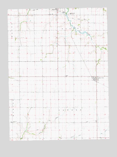
Winfield South, IA USGS Topographic Map
Click on map above to begin viewing in our Map Viewer.

This topographic map contains these locations and features:
Feature Name Type Latitude Longitude GNIS ID View Map
City of Mount Union (historical)CivilN41.0576°W91.3908°2395127View Map
Cotton Grove Post Office (historical)Post OfficeN41.0159°W91.4388°466536View Map
Farmers Co-op Grain ElevatorLocaleN41.0578°W91.3904°1981533View Map
Mount UnionPopulated PlaceN41.0578°W91.3904°459342View Map
Mount Union (historical)LocaleN41.0564°W91.3932°1981529View Map
Mount Union Benefited Fire DepartmentBuildingN41.0568°W91.3926°2577174View Map
Mount Union Census Designated PlaceCensusN41.0576°W91.3908°2790739View Map
Mount Union Post OfficePost OfficeN41.0578°W91.3904°1981531View Map
Pleasant Lawn SchoolSchoolN41.0173°W91.4954°1825017View Map
Prairie Ag Cooperative ElevatorLocaleN41.0578°W91.3904°1981532View Map
Sheridan CemeteryCemeteryN41.0606°W91.4293°1825014View Map
Tallman CemeteryCemeteryN41.0972°W91.4974°1981534View Map
Township of CanaanCivilN41.0311°W91.4288°467526View Map
Township of ScottCivilN41.1183°W91.4283°468671View Map
Trinity CemeteryCemeteryN41.0175°W91.3896°1825016View Map
United Methodist ChurchChurchN41.0578°W91.3904°1981530View Map
Wesley ChapelChurchN41.0175°W91.4960°1825018View Map
WinfieldPopulated PlaceN41.1231°W91.4413°463130View Map
Winfield and Scott CemeteryCemeteryN41.1192°W91.4238°1825015View Map

Note: Coordinates in the location and feature list above are referenced to NAD83 datum.


Copyright (C) 2008-2024 Ryan Niemi / Sunset Dynamics ... All Rights Reserved