TopoQuest Logo
Do you find TopoQuest useful?
Help keep TopoQuest running and adding new maps/features by donating!
Bitcoin:  19c7KJd3qBynnjoSw5npx9KScwjBe4ifkT
Litecoin:  LXs6TkuXGGXo1vDsWCkWVdjQX94eUKd6ui
Home View Maps Find Maps Find Places Resources & Links


Winifred West, Montana Topographic Map

USGS Map Title: Winifred West, MT
USGS Map MRC: 47109E4
DRG (GeoTIFF) Download: o47109e4.tif


Neighboring USGS Topographic Map Quads:


  Council Island, MT  
47109F5
 

  Gallatin Rapids, MT  
47109F4
 

  Taffy Ridge, MT  
47109F3
 

  Anderson Bridge, MT  
47109E5
 

  Winifred West, MT  
47109E4
 

  Winifred East, MT  
47109E3
 

  Wild Bill Flat East, MT  
47109D5
 

  Hilger NW, MT  
47109D4
 

  Christina, MT  
47109D3


Map MRC Location:

N48°
W110°
N48°
W109°
H8 H7 H6 H5 H4 H3 H2 H1
G8 G7 G6 G5 G4 G3 G2 G1
F8 F7 F6 F5 F4 F3 F2 F1
E8 E7 E6 E5 E4 E3 E2 E1
D8 D7 D6 D5 D4 D3 D2 D1
C8 C7 C6 C5 C4 C3 C2 C1
B8 B7 B6 B5 B4 B3 B2 B1
A8 A7 A6 A5 A4 A3 A2 A1
N47°
W110°
N47°
W109°

Winifred West, MT USGS 1:24K Topographic Map Preview:
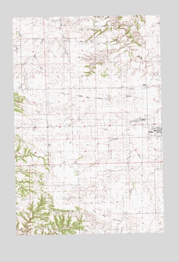
Winifred West, MT USGS Topographic Map
Click on map above to begin viewing in our Map Viewer.

This topographic map contains these locations and features:
Feature Name Type Latitude Longitude GNIS ID View Map
20N19E14ACDD01 WellWellN47.5011°W109.4243°823433View Map
American Lutheran ChurchChurchN47.5578°W109.3771°1722525View Map
Cracins Independent Elevator (historical)LocaleN47.5603°W109.3752°1722562View Map
Daddy-Long Legs Number 2 DamDamN47.5783°W109.4074°798625View Map
Donkey Ridge School (historical)SchoolN47.5116°W109.4252°1722727View Map
Flax Post Office (historical)Post OfficeN47.5986°W109.4938°1722856View Map
Flax School (historical)SchoolN47.5986°W109.4938°1722743View Map
Freeman Brothers Elevator (historical)LocaleN47.5603°W109.3752°1722561View Map
Harvest States Cooperatives ElevatorLocaleN47.5603°W109.3752°1722560View Map
Holy Family Catholic ChurchChurchN47.5578°W109.3771°1722524View Map
North Winifred DamDamN47.5633°W109.3957°795067View Map
Old McDonalds Pig DamDamN47.6100°W109.4991°798626View Map
Reeves DamDamN47.5533°W109.4124°795148View Map
Rumble Creek (historical)Populated PlaceN47.5622°W109.4994°1722907View Map
Sig Larson CouleeValleyN47.5755°W109.3763°805801View Map
Stafford Post Office (historical)Post OfficeN47.5180°W109.4091°1722946View Map
Stafford ReservoirReservoirN47.5647°W109.3972°805802View Map
Town of WinifredCivilN47.5621°W109.3773°2413498View Map
United Methodist ChurchChurchN47.5578°W109.3771°1722523View Map
Winifred AirportAirportN47.5553°W109.3865°806552View Map
Winifred AmbulanceBuildingN47.5599°W109.3771°2637920View Map
Winifred Post OfficePost OfficeN47.5597°W109.3771°1722955View Map
Winifred Public SchoolsSchoolN47.5586°W109.3816°1722587View Map
Winifred Rural Fire DepartmentBuildingN47.5597°W109.3770°2546707View Map
Winnifred Community Bible ChurchChurchN47.5578°W109.3771°1722522View Map
Yaaps CornerLocaleN47.5836°W109.3880°805803View Map
Yecha-Kucera School (historical)SchoolN47.6130°W109.4318°1722742View Map

Note: Coordinates in the location and feature list above are referenced to NAD83 datum.


Copyright (C) 2008-2025 Ryan Niemi / Sunset Dynamics ... All Rights Reserved