TopoQuest Logo
Do you find TopoQuest useful?
Help keep TopoQuest running and adding new maps/features by donating!
Bitcoin:  19c7KJd3qBynnjoSw5npx9KScwjBe4ifkT
Litecoin:  LXs6TkuXGGXo1vDsWCkWVdjQX94eUKd6ui
Home View Maps Find Maps Find Places Resources & Links


Winslow Creek, Montana Topographic Map

USGS Map Title: Winslow Creek, MT
USGS Map MRC: 44111E8
DRG (GeoTIFF) Download: o44111e8.tif


Neighboring USGS Topographic Map Quads:


  Antelope Peak, MT  
44112F1
 

  Metzel Creek, MT  
44111F8
 

  Lower Red Rock Lake, MT  
44111F7
 

  Big Table Mountain, ID  
44112E1
 

  Winslow Creek, MT  
44111E8
 

  Slide Mountain, MT  
44111E7
 

  Lookout Point, ID  
44112D1
 

  Kilgore, ID  
44111D8
 

  Antelope Valley, ID  
44111D7


Map MRC Location:

N45°
W112°
N45°
W111°
H8 H7 H6 H5 H4 H3 H2 H1
G8 G7 G6 G5 G4 G3 G2 G1
F8 F7 F6 F5 F4 F3 F2 F1
E8 E7 E6 E5 E4 E3 E2 E1
D8 D7 D6 D5 D4 D3 D2 D1
C8 C7 C6 C5 C4 C3 C2 C1
B8 B7 B6 B5 B4 B3 B2 B1
A8 A7 A6 A5 A4 A3 A2 A1
N44°
W112°
N44°
W111°

Winslow Creek, MT USGS 1:24K Topographic Map Preview:
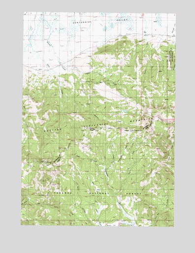
Winslow Creek, MT USGS Topographic Map
Click on map above to begin viewing in our Map Viewer.

This topographic map contains these locations and features:
Feature Name Type Latitude Longitude GNIS ID View Map
14S03W13DBCB01 WellWellN44.6130°W111.9122°807128View Map
14S03W21DDCC01 WellWellN44.5941°W111.9683°807113View Map
14S03W22CABD01 WellWellN44.5996°W111.9569°807118View Map
14S03W23BBD_01 SpringSpringN44.6057°W111.9408°807126View Map
Bear Trap CreekStreamN44.5080°W111.9378°377196View Map
Burnt CanyonValleyN44.5119°W111.9780°378542View Map
Coal MineMineN44.5463°W111.9494°393826View Map
Coon CreekStreamN44.5371°W111.9347°379661View Map
Doyle School (historical)SchoolN44.6007°W111.9544°770740View Map
Lake CreekStreamN44.5352°W111.9330°384344View Map
Mule Meadows CreekStreamN44.5152°W111.9941°387387View Map
Salamander CreekStreamN44.5330°W111.9333°389848View Map
Seven L RanchLocaleN44.6152°W111.9016°776350View Map
Table Mountain TrailTrailN44.5077°W111.9958°391805View Map
Tipton CreekStreamN44.5982°W111.9728°777683View Map
Trail CreekStreamN44.5185°W111.9236°392269View Map

Note: Coordinates in the location and feature list above are referenced to NAD83 datum.


Copyright (C) 2008-2025 Ryan Niemi / Sunset Dynamics ... All Rights Reserved