TopoQuest Logo
Do you find TopoQuest useful?
Help keep TopoQuest running and adding new maps/features by donating!
Bitcoin:  19c7KJd3qBynnjoSw5npx9KScwjBe4ifkT
Litecoin:  LXs6TkuXGGXo1vDsWCkWVdjQX94eUKd6ui
Home View Maps Find Maps Find Places Resources & Links


Wolbach, Nebraska Topographic Map

USGS Map Title: Wolbach, NE
USGS Map MRC: 41098D4
DRG (GeoTIFF) Download: o41098d4.tif


Neighboring USGS Topographic Map Quads:


  Greeley, NE  
41098E5
 

  Spalding SW, NE  
41098E4
 

  Spalding SE, NE  
41098E3
 

  Scotia NE, NE  
41098D5
 

  Wolbach, NE  
41098D4
 

  Wolbach NE, NE  
41098D3
 

  Elba, NE  
41098C5
 

  Wolbach SW, NE  
41098C4
 

  Cushing, NE  
41098C3


Map MRC Location:

N42°
W99°
N42°
W98°
H8 H7 H6 H5 H4 H3 H2 H1
G8 G7 G6 G5 G4 G3 G2 G1
F8 F7 F6 F5 F4 F3 F2 F1
E8 E7 E6 E5 E4 E3 E2 E1
D8 D7 D6 D5 D4 D3 D2 D1
C8 C7 C6 C5 C4 C3 C2 C1
B8 B7 B6 B5 B4 B3 B2 B1
A8 A7 A6 A5 A4 A3 A2 A1
N41°
W99°
N41°
W98°

Wolbach, NE USGS 1:24K Topographic Map Preview:
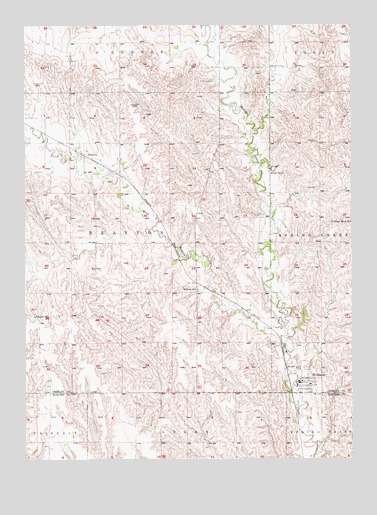
Wolbach, NE USGS Topographic Map
Click on map above to begin viewing in our Map Viewer.

This topographic map contains these locations and features:
Feature Name Type Latitude Longitude GNIS ID View Map
BraytonPopulated PlaceN41.4633°W98.4776°835258View Map
Brayton Post Office (historical)Post OfficeN41.4633°W98.4776°1849828View Map
College Knob SchoolSchoolN41.4431°W98.3826°828263View Map
Dino Mini ParkParkN41.3972°W98.3951°1849844View Map
Farmers Union Co-op ElevatorLocaleN41.3970°W98.3942°1849885View Map
Midway SchoolSchoolN41.4239°W98.4340°831286View Map
Saint Josephs Catholic ChurchChurchN41.3964°W98.3895°1849841View Map
School Number 37SchoolN41.4578°W98.4065°836645View Map
Stone DamDamN41.3825°W98.3839°1768994View Map
Stone ReservoirReservoirN41.3837°W98.3836°1768995View Map
Summit CemeteryCemeteryN41.3875°W98.4956°833890View Map
Summit Post Office (historical)Post OfficeN41.4161°W98.4967°1849819View Map
Summit SchoolSchoolN41.4161°W98.4967°833893View Map
Township of BraytonCivilN41.4333°W98.4587°1849890View Map
Village of WolbachCivilN41.4013°W98.3940°2399726View Map
West Branch Spring CreekStreamN41.4139°W98.4009°834572View Map
WolbachPopulated PlaceN41.3970°W98.3942°834838View Map
Wolbach CemeteryCemeteryN41.4006°W98.3920°1849840View Map
Wolbach City ParkParkN41.3983°W98.3978°1849838View Map
Wolbach Election PrecinctCivilN41.4662°W98.3869°1954015View Map
Wolbach Lutheran ChurchChurchN41.3972°W98.3920°1849839View Map
Wolbach Methodist ChurchChurchN41.3975°W98.3951°1849842View Map
Wolbach Number 1 Election Precinct (historical)CivilN41.4425°W98.4617°1929399View Map
Wolbach Police DepartmentBuildingN41.3970°W98.3942°1849843View Map
Wolbach Post OfficePost OfficeN41.3972°W98.3958°1849886View Map
Wolbach Public LibraryBuildingN41.3972°W98.3940°1849845View Map
Wolbach Public SchoolsSchoolN41.3967°W98.3917°1849884View Map
Wolbach Volunteer Fire and RescueBuildingN41.3973°W98.3942°1849846View Map

Note: Coordinates in the location and feature list above are referenced to NAD83 datum.


Copyright (C) 2008-2025 Ryan Niemi / Sunset Dynamics ... All Rights Reserved