TopoQuest Logo
Do you find TopoQuest useful?
Help keep TopoQuest running and adding new maps/features by donating!
Bitcoin:  19c7KJd3qBynnjoSw5npx9KScwjBe4ifkT
Litecoin:  LXs6TkuXGGXo1vDsWCkWVdjQX94eUKd6ui
Home View Maps Find Maps Find Places Resources & Links


Wolf Hole Mountain East, Arizona Topographic Map

USGS Map Title: Wolf Hole Mountain East, AZ
USGS Map MRC: 36113G5
DRG (GeoTIFF) Download: o36113g5.tif


Neighboring USGS Topographic Map Quads:


  Purgatory Canyon, AZ  
36113H6
 

  Lizard Point, AZ  
36113H5
 

  Yellowhorse Flat, AZ  
36113H4
 

  Wolf Hole Mountain West, AZ  
36113G6
 

  Wolf Hole Mountain East, AZ  
36113G5
 

  Hole-n-Wall Canyon, AZ  
36113G4
 

  Mustang Knoll, AZ  
36113F6
 

  Sullivan Draw North, AZ  
36113F5
 

  Dutchman Draw, AZ  
36113F4


Map MRC Location:

N37°
W114°
N37°
W113°
H8 H7 H6 H5 H4 H3 H2 H1
G8 G7 G6 G5 G4 G3 G2 G1
F8 F7 F6 F5 F4 F3 F2 F1
E8 E7 E6 E5 E4 E3 E2 E1
D8 D7 D6 D5 D4 D3 D2 D1
C8 C7 C6 C5 C4 C3 C2 C1
B8 B7 B6 B5 B4 B3 B2 B1
A8 A7 A6 A5 A4 A3 A2 A1
N36°
W114°
N36°
W113°

Wolf Hole Mountain East, AZ USGS 1:24K Topographic Map Preview:
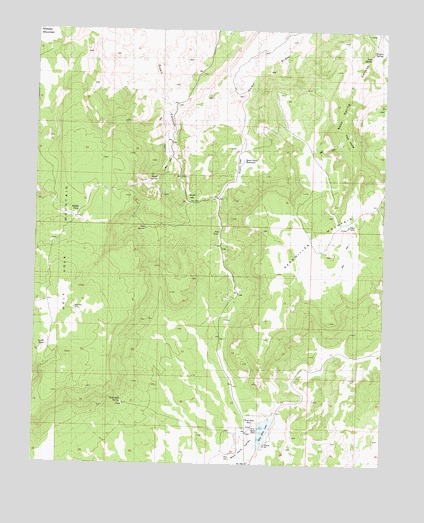
Wolf Hole Mountain East, AZ USGS Topographic Map
Click on map above to begin viewing in our Map Viewer.

This topographic map contains these locations and features:
Feature Name Type Latitude Longitude GNIS ID View Map
Canyon SpringSpringN36.8691°W113.5022°2445View Map
Middle TankReservoirN36.8231°W113.6101°8013View Map
Oak SpringSpringN36.8175°W113.5861°8884View Map
Quail Draw ReservoirReservoirN36.8375°W113.5514°9837View Map
Quail FlatFlatN36.8364°W113.5530°9838View Map
Quail HillSummitN36.8283°W113.5677°9839View Map
Quail SpringSpringN36.8320°W113.5822°9846View Map
Seegmiller MountainSummitN36.8216°W113.5205°11055View Map
Seep SpringSpringN36.8675°W113.5061°11061View Map
South TankReservoirN36.7840°W113.6213°11642View Map
The HoleBasinN36.8436°W113.5166°12330View Map
Tub PondLakeN36.8167°W113.5597°12796View Map
Wolf HoleLocaleN36.7628°W113.5494°13955View Map
Wolf Hole LakeLakeN36.7596°W113.5429°13956View Map
Wolf Hole MountainSummitN36.7944°W113.6113°13957View Map
Wolf Hole SpringSpringN36.7683°W113.5933°13958View Map
Wolf Hole ValleyValleyN36.7589°W113.5447°13959View Map

Note: Coordinates in the location and feature list above are referenced to NAD83 datum.


Copyright (C) 2008-2025 Ryan Niemi / Sunset Dynamics ... All Rights Reserved