TopoQuest Logo
Do you find TopoQuest useful?
Help keep TopoQuest running and adding new maps/features by donating!
Bitcoin:  19c7KJd3qBynnjoSw5npx9KScwjBe4ifkT
Litecoin:  LXs6TkuXGGXo1vDsWCkWVdjQX94eUKd6ui
Home View Maps Find Maps Find Places Resources & Links


Wolf Prairie, Montana Topographic Map

USGS Map Title: Wolf Prairie, MT
USGS Map MRC: 48115C1
DRG (GeoTIFF) Download: o48115c1.tif


Neighboring USGS Topographic Map Quads:


  Cripple Horse Mountain, MT  
48115D2
 

  Warland Peak, MT  
48115D1
 

  Bowen Lake, MT  
48114D8
 

  Richards Mountain, MT  
48115C2
 

  Wolf Prairie, MT  
48115C1
 

  Horse Hill, MT  
48114C8
 

  Calx Mountain, MT  
48115B2
 

  Deer Creek, MT  
48115B1
 

  Lynch Lake, MT  
48114B8


Map MRC Location:

N49°
W116°
N49°
W115°
H8 H7 H6 H5 H4 H3 H2 H1
G8 G7 G6 G5 G4 G3 G2 G1
F8 F7 F6 F5 F4 F3 F2 F1
E8 E7 E6 E5 E4 E3 E2 E1
D8 D7 D6 D5 D4 D3 D2 D1
C8 C7 C6 C5 C4 C3 C2 C1
B8 B7 B6 B5 B4 B3 B2 B1
A8 A7 A6 A5 A4 A3 A2 A1
N48°
W116°
N48°
W115°

Wolf Prairie, MT USGS 1:24K Topographic Map Preview:
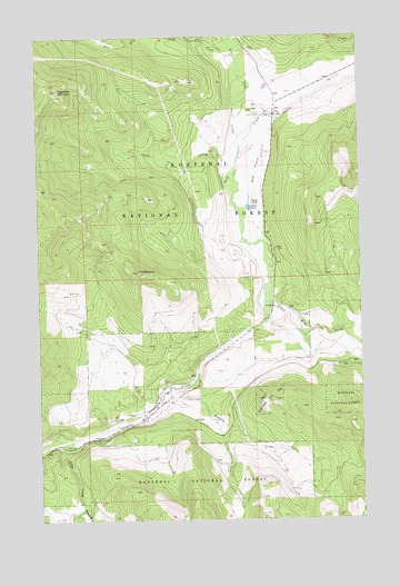
Wolf Prairie, MT USGS Topographic Map
Click on map above to begin viewing in our Map Viewer.

This topographic map contains these locations and features:
Feature Name Type Latitude Longitude GNIS ID View Map
Atlanta (historical)LocaleN48.2797°W115.0515°1782223View Map
Atlanta Post Office (historical)Post OfficeN48.2797°W115.0515°1782332View Map
Betts LakeLakeN48.3306°W115.0439°779741View Map
Calx CreekStreamN48.2713°W115.1210°780798View Map
Dry Fork CreekStreamN48.3483°W115.0454°782603View Map
Fairview Guard StationLocaleN48.3544°W115.0388°783270View Map
French RanchLocaleN48.3325°W115.0429°783743View Map
Kavalla CreekStreamN48.2822°W115.0785°785635View Map
Little Wolf CreekStreamN48.3061°W115.0382°786398View Map
Redemption HillSummitN48.3141°W115.0874°789498View Map
Strad Beck MineMineN48.3025°W115.0746°804107View Map
Sugarloaf MountainSummitN48.3613°W115.1177°791635View Map
Syrup CreekStreamN48.3383°W115.0538°791840View Map
Tamarack CreekStreamN48.2536°W115.1099°791878View Map
West Dry Fork CreekStreamN48.3647°W115.0474°792966View Map
Wolf PrairieFlatN48.3397°W115.0413°793463View Map
Wolf PrairieLocaleN48.3405°W115.0390°1782456View Map

Note: Coordinates in the location and feature list above are referenced to NAD83 datum.


Copyright (C) 2008-2025 Ryan Niemi / Sunset Dynamics ... All Rights Reserved