TopoQuest Logo
Do you find TopoQuest useful?
Help keep TopoQuest running and adding new maps/features by donating!
Bitcoin:  19c7KJd3qBynnjoSw5npx9KScwjBe4ifkT
Litecoin:  LXs6TkuXGGXo1vDsWCkWVdjQX94eUKd6ui
Home View Maps Find Maps Find Places Resources & Links


Wolfforth, Texas Topographic Map

USGS Map Title: Wolfforth, TX
USGS Map MRC: 33102E1
DRG (GeoTIFF) Download: o33102e1.tif


Neighboring USGS Topographic Map Quads:


  Wolfforth NW, TX  
33102F2
 

  Wolfforth NE, TX  
33102F1
 

  Shallowater, TX  
33101F8
 

  Smyer, TX  
33102E2
 

  Wolfforth, TX  
33102E1
 

  Lubbock West, TX  
33101E8
 

  Ropesville, TX  
33102D2
 

  Busterville, TX  
33102D1
 

  Slide, TX  
33101D8


Map MRC Location:

N34°
W103°
N34°
W102°
H8 H7 H6 H5 H4 H3 H2 H1
G8 G7 G6 G5 G4 G3 G2 G1
F8 F7 F6 F5 F4 F3 F2 F1
E8 E7 E6 E5 E4 E3 E2 E1
D8 D7 D6 D5 D4 D3 D2 D1
C8 C7 C6 C5 C4 C3 C2 C1
B8 B7 B6 B5 B4 B3 B2 B1
A8 A7 A6 A5 A4 A3 A2 A1
N33°
W103°
N33°
W102°

Wolfforth, TX USGS 1:24K Topographic Map Preview:
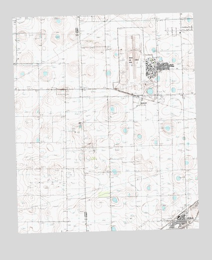
Wolfforth, TX USGS Topographic Map
Click on map above to begin viewing in our Map Viewer.

This topographic map contains these locations and features:
Feature Name Type Latitude Longitude GNIS ID View Map
Bradford SchoolSchoolN33.5545°W102.0435°1352809View Map
Casey Elementary SchoolSchoolN33.5037°W102.0135°2007849View Map
City of WolfforthCivilN33.5148°W102.0066°2412293View Map
Frenship Independent School District Police DepartmentBuildingN33.5030°W102.0120°2750587View Map
HurlwoodPopulated PlaceN33.5768°W102.0379°1359848View Map
Hurlwood Baptist ChurchChurchN33.5923°W102.0124°2022563View Map
Lubbock Army Air Field (historical)MilitaryN33.5933°W102.0375°2092789View Map
Lubbock Army Flying School (historical)SchoolN33.5933°W102.0372°2090477View Map
Lubbock Police AcademyBuildingN33.5941°W102.0333°2750488View Map
Reese Air Force Base (historical)MilitaryN33.5965°W102.0427°1387112View Map
Reese AirparkAirportN33.5976°W102.0334°2675900View Map
Reese Center Census Designated PlaceCensusN33.6001°W102.0409°2409158View Map
Reese Educational CenterSchoolN33.5926°W102.0135°2007793View Map
Reese VillagePopulated PlaceN33.5948°W102.0221°1366313View Map
West Carlisle Fire and Emergency Medical ServicesBuildingN33.5963°W102.0086°2552112View Map
WolfforthPopulated PlaceN33.5059°W102.0091°1371874View Map
Wolfforth CemeteryCemeteryN33.5055°W102.0256°2773409View Map
Wolfforth Municipal BuildingBuildingN33.5100°W102.0098°2754009View Map
Wolfforth Police DepartmentBuildingN33.5099°W102.0099°2750374View Map
Wolfforth Post OfficePost OfficeN33.5057°W102.0044°2731284View Map
Wolfforth Volunteer Fire and Emergency Medical ServiceBuildingN33.5065°W102.0118°2551882View Map

Note: Coordinates in the location and feature list above are referenced to NAD83 datum.


Copyright (C) 2008-2025 Ryan Niemi / Sunset Dynamics ... All Rights Reserved