TopoQuest Logo
Do you find TopoQuest useful?
Help keep TopoQuest running and adding new maps/features by donating!
Bitcoin:  19c7KJd3qBynnjoSw5npx9KScwjBe4ifkT
Litecoin:  LXs6TkuXGGXo1vDsWCkWVdjQX94eUKd6ui
Home View Maps Find Maps Find Places Resources & Links


Boulder East, Montana Topographic Map

USGS Map Title: Boulder East, MT
USGS Map MRC: 46112B1
DRG (GeoTIFF) Download: o46112b1.tif


Neighboring USGS Topographic Map Quads:


  Mount Thompson, MT  
46112C2
 

  Wickes, MT  
46112C1
 

  Elkhorn, MT  
46111C8
 

  Boulder West, MT  
46112B2
 

  Boulder East, MT  
46112B1
 

  Tacoma Park, MT  
46111B8
 

  Ratio Mountain, MT  
46112A2
 

  Wilson Park, MT  
46112A1
 

  Dunn Creek, MT  
46111A8


Map MRC Location:

N47°
W113°
N47°
W112°
H8 H7 H6 H5 H4 H3 H2 H1
G8 G7 G6 G5 G4 G3 G2 G1
F8 F7 F6 F5 F4 F3 F2 F1
E8 E7 E6 E5 E4 E3 E2 E1
D8 D7 D6 D5 D4 D3 D2 D1
C8 C7 C6 C5 C4 C3 C2 C1
B8 B7 B6 B5 B4 B3 B2 B1
A8 A7 A6 A5 A4 A3 A2 A1
N46°
W113°
N46°
W112°

Boulder East, MT USGS 1:24K Topographic Map Preview:
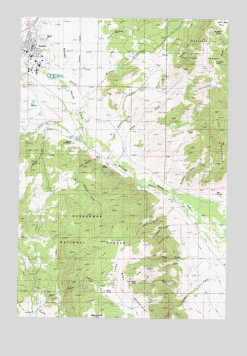
Boulder East, MT USGS Topographic Map
Click on map above to begin viewing in our Map Viewer.

This topographic map contains these locations and features:
Feature Name Type Latitude Longitude GNIS ID View Map
05N03W10CBAC01 SpringSpringN46.1989°W112.0957°814541View Map
05N03W18CDCD01 WellWellN46.1791°W112.0303°814439View Map
05N04W03AAAA01 WellWellN46.2210°W112.0800°814650View Map
05N04W10BCCB01 WellWellN46.2016°W112.0989°814563View Map
05N04W10CAB_01 SpringSpringN46.1980°W112.0944°814536View Map
05N04W10CACB01 SpringSpringN46.1980°W112.0944°814537View Map
05N04W10CACB02 SpringSpringN46.1980°W112.0944°814538View Map
05N04W10CACB03 SpringSpringN46.1980°W112.0944°814539View Map
05N04W10CACB04 SpringSpringN46.1988°W112.0940°814540View Map
05N04W16DCA_01 SpringSpringN46.1816°W112.1036°814456View Map
06N04W28DADD01 WellWellN46.2399°W112.1008°814738View Map
06N04W28DADD02 WellWellN46.2402°W112.1006°814740View Map
06N04W28DCAB01 WellWellN46.2388°W112.1072°814730View Map
06N04W32AABD01 WellWellN46.2349°W112.1242°814717View Map
06N04W33BAAD01 WellWellN46.2349°W112.1117°814716View Map
06N04W33BABD01 WellWellN46.2344°W112.1139°814713View Map
06N04W33CCBD01 WellWellN46.2235°W112.1197°814661View Map
06N04W33CCCC01 WellWellN46.2222°W112.1203°814654View Map
Beaver CreekStreamN46.2041°W112.1131°779604View Map
Black CanyonValleyN46.2333°W112.0453°806191View Map
Bonan HillSummitN46.2188°W112.0689°806190View Map
BoulderPopulated PlaceN46.2366°W112.1208°780250View Map
Boulder (historical)LocaleN46.2360°W112.1231°1762511View Map
Boulder AirportAirportN46.2108°W112.1048°806368View Map
Boulder AmbulanceBuildingN46.2380°W112.1209°2637856View Map
Boulder CemeteryCemeteryN46.2390°W112.1074°780253View Map
Boulder Chiropractic ClinicHospitalN46.2360°W112.1200°1762549View Map
Boulder Community LibraryBuildingN46.2349°W112.1197°1762606View Map
Boulder Elementary SchoolSchoolN46.2355°W112.1222°1762533View Map
Boulder Hot SpringsLocaleN46.1988°W112.0958°780269View Map
Boulder Medical ClinicHospitalN46.2341°W112.1197°1762587View Map
Boulder Police DepartmentBuildingN46.2360°W112.1208°2548937View Map
Boulder Post OfficePost OfficeN46.2356°W112.1192°1762500View Map
Boulder River BridgeBridgeN46.2110°W112.0914°1762608View Map
Boulder River Bridge Historical MarkerParkN46.2110°W112.0911°1813136View Map
Boulder River Schooland HospitalLocaleN46.2272°W112.1167°794189View Map
Boulder Volunteer Fire DepartmentBuildingN46.2380°W112.1210°1762537View Map
Browns GulchValleyN46.2069°W112.0647°780456View Map
Bull Mountain Rural Fire District Station 1BuildingN46.2302°W112.1225°2546521View Map
Burt SpringSpringN46.2030°W112.0248°806188View Map
Capital HillSummitN46.2408°W112.1131°806196View Map
Chinese DigginsMineN46.2047°W112.1239°800588View Map
City of BoulderCivilN46.2358°W112.1197°2411712View Map
Clarke RidgeRidgeN46.1455°W112.0494°806182View Map
Crazyman GulchValleyN46.1796°W112.0300°806185View Map
Dry GulchValleyN46.1483°W112.0272°806181View Map
Farnham CreekStreamN46.1933°W112.0722°783310View Map
First Baptist ChurchChurchN46.2416°W112.1231°1762548View Map
Gibson GulchValleyN46.1646°W112.0286°793878View Map
Goat CanyonValleyN46.1921°W112.0764°806186View Map
Hadley ParkFlatN46.1452°W112.0664°784438View Map
Half Moon ParkFlatN46.2483°W112.0053°806193View Map
Half Moon SpringsSpringN46.2438°W112.0072°806192View Map
Hot Springs (historical)LocaleN46.1988°W112.0958°1762509View Map
Interchange 164CrossingN46.2463°W112.1189°1762612View Map
Jefferson CountyCivilN46.1485°W112.0938°1720045View Map
Jefferson County CourthouseBuildingN46.2364°W112.1217°1762538View Map
Jefferson County Sheriff's OfficeBuildingN46.2361°W112.1207°1762536View Map
Jefferson High SchoolSchoolN46.2337°W112.1195°1762534View Map
Killian GulchValleyN46.1958°W112.0625°806189View Map
Larson RanchLocaleN46.2419°W112.0781°785974View Map
Little Boulder (historical)LocaleN46.1999°W112.0883°1762668View Map
Little Boulder RiverStreamN46.1977°W112.0858°786250View Map
Log GulchValleyN46.1499°W112.0050°793876View Map
Manganese SpringSpringN46.2321°W112.0083°786812View Map
McCarty CreekStreamN46.2166°W112.0889°786991View Map
McCauley RanchLocaleN46.1838°W112.0481°787001View Map
Montana State Training SchoolSchoolN46.2272°W112.1197°787576View Map
Murphy RanchLocaleN46.1713°W112.0044°787869View Map
Muskrat CreekStreamN46.1974°W112.0858°787882View Map
Pete SpringsSpringN46.1785°W112.0057°806184View Map
RCRV ParkLocaleN46.2438°W112.1203°1762599View Map
Rear GulchValleyN46.1735°W112.0322°793872View Map
Rocky Canyon CreekStreamN46.1366°W112.1031°789724View Map
Rocky SpringSpringN46.1361°W112.0727°806195View Map
Rosie Murphy SpringSpringN46.1399°W112.0542°806183View Map
Ryan GulchValleyN46.1499°W112.0050°786445View Map
Ryan MountainSummitN46.2038°W112.0058°806187View Map
Saint Catherine Catholic ChurchChurchN46.2333°W112.1153°1762545View Map
Schoolhouse SpringSpringN46.2439°W112.0698°806194View Map
Seventh Day Adventist ChurchChurchN46.2333°W112.1206°1762544View Map
Smelter (historical)LocaleN46.2124°W112.0911°1762647View Map
Sunset Trailer CourtPopulated PlaceN46.2347°W112.1244°1762598View Map
Taylor ReservoirReservoirN46.2148°W112.1179°791928View Map
Widemouth GulchValleyN46.1680°W112.0230°793268View Map

Note: Coordinates in the location and feature list above are referenced to NAD83 datum.


Copyright (C) 2008-2025 Ryan Niemi / Sunset Dynamics ... All Rights Reserved