TopoQuest Logo
Do you find TopoQuest useful?
Help keep TopoQuest running and adding new maps/features by donating!
Bitcoin:  19c7KJd3qBynnjoSw5npx9KScwjBe4ifkT
Litecoin:  LXs6TkuXGGXo1vDsWCkWVdjQX94eUKd6ui
Home View Maps Find Maps Find Places Resources & Links


Woodland, Maine Topographic Map

USGS Map Title: Woodland, ME
USGS Map MRC: 45067B4
DRG (GeoTIFF) Download: o45067b4.tif


Neighboring USGS Topographic Map Quads:


  Tomah Ridge, ME  
45067C5
 

  Kelleyland, ME  
45067C4


  Princeton, ME  
45067B5
 

  Woodland, ME  
45067B4
 

  Calais, ME  
45067B3
 

  Crawford Lake, ME  
45067A5
 

  Meddybemps Lake West, ME  
45067A4
 

  Meddybemps Lake East, ME  
45067A3


Map MRC Location:

N46°
W68°
N46°
W67°
H8 H7 H6 H5 H4 H3 H2 H1
G8 G7 G6 G5 G4 G3 G2 G1
F8 F7 F6 F5 F4 F3 F2 F1
E8 E7 E6 E5 E4 E3 E2 E1
D8 D7 D6 D5 D4 D3 D2 D1
C8 C7 C6 C5 C4 C3 C2 C1
B8 B7 B6 B5 B4 B3 B2 B1
A8 A7 A6 A5 A4 A3 A2 A1
N45°
W68°
N45°
W67°

Woodland, ME USGS 1:24K Topographic Map Preview:
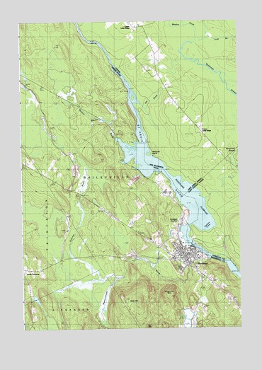
Woodland, ME USGS Topographic Map
Click on map above to begin viewing in our Map Viewer.

This topographic map contains these locations and features:
Feature Name Type Latitude Longitude GNIS ID View Map
Anderson BrookStreamN45.1470°W67.4439°561246View Map
Baileyville Police DepartmentBuildingN45.1575°W67.4109°2735850View Map
Baileyville Post OfficePost OfficeN45.1468°W67.3987°2768926View Map
Baileyville Volunteer Ambulance Service (historical)BuildingN45.1543°W67.4086°2666745View Map
Baileyville Volunteer Fire DepartmentBuildingN45.1543°W67.4086°2552992View Map
Chapman MountainSummitN45.1380°W67.4149°563850View Map
Downeast Emergency Medical ServicesBuildingN45.1601°W67.4104°2735792View Map
Georgia-Pacific Corporation HeliportAirportN45.1606°W67.4100°582252View Map
Robb HillSummitN45.1367°W67.4330°574284View Map
Saint Croix River ReservoirReservoirN45.1584°W67.4011°1773918View Map
Saint James ChurchChurchN45.1545°W67.4061°1909333View Map
Sprague Meadow BrookStreamN45.2023°W67.4439°576076View Map
Town of BaileyvilleCivilN45.1786°W67.4416°582337View Map
Wapsaconhagan BrookStreamN45.1542°W67.3919°581358View Map
WoodlandPopulated PlaceN45.1570°W67.4047°578669View Map
Woodland Baptist ChurchChurchN45.1537°W67.4131°1909409View Map
Woodland Census Designated PlaceCensusN45.1598°W67.4124°2377972View Map
Woodland DamDamN45.1596°W67.4027°1773917View Map
Woodland Elementary SchoolSchoolN45.1563°W67.4131°2738083View Map
Woodland FlowageReservoirN45.1667°W67.4039°578884View Map
Woodland JunctionPopulated PlaceN45.1704°W67.4067°579855View Map
Woodland Junior Senior High SchoolSchoolN45.1521°W67.4033°2738084View Map
Woodland Public LibraryBuildingN45.1582°W67.4083°2738372View Map

Note: Coordinates in the location and feature list above are referenced to NAD83 datum.


Copyright (C) 2008-2024 Ryan Niemi / Sunset Dynamics ... All Rights Reserved