TopoQuest Logo
Do you find TopoQuest useful?
Help keep TopoQuest running and adding new maps/features by donating!
Bitcoin:  19c7KJd3qBynnjoSw5npx9KScwjBe4ifkT
Litecoin:  LXs6TkuXGGXo1vDsWCkWVdjQX94eUKd6ui
Home View Maps Find Maps Find Places Resources & Links


Woodsboro, Maryland Topographic Map

USGS Map Title: Woodsboro, MD
USGS Map MRC: 39077E3
DRG (GeoTIFF) Download: o39077e3.tif


Neighboring USGS Topographic Map Quads:


  Blue Ridge Summit, PA  
39077F4
 

  Emmitsburg, MD  
39077F3
 

  Taneytown, MD  
39077F2
 

  Catoctin Furnace, MD  
39077E4
 

  Woodsboro, MD  
39077E3
 

  Union Bridge, MD  
39077E2
 

  Frederick, MD  
39077D4
 

  Walkersville, MD  
39077D3
 

  Libertytown, MD  
39077D2


Map MRC Location:

N40°
W78°
N40°
W77°
H8 H7 H6 H5 H4 H3 H2 H1
G8 G7 G6 G5 G4 G3 G2 G1
F8 F7 F6 F5 F4 F3 F2 F1
E8 E7 E6 E5 E4 E3 E2 E1
D8 D7 D6 D5 D4 D3 D2 D1
C8 C7 C6 C5 C4 C3 C2 C1
B8 B7 B6 B5 B4 B3 B2 B1
A8 A7 A6 A5 A4 A3 A2 A1
N39°
W78°
N39°
W77°

Woodsboro, MD USGS 1:24K Topographic Map Preview:
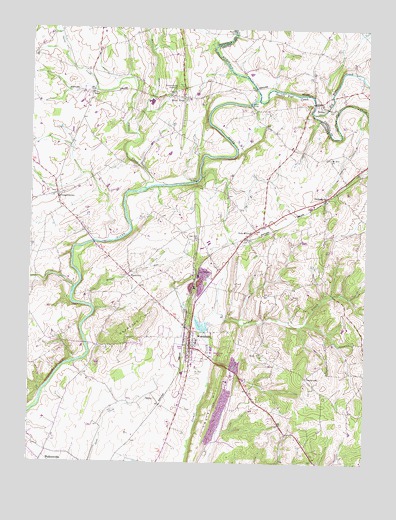
Woodsboro, MD USGS Topographic Map
Click on map above to begin viewing in our Map Viewer.

This topographic map contains these locations and features:
Feature Name Type Latitude Longitude GNIS ID View Map
Beaver BranchStreamN39.5945°W77.3358°583102View Map
Big Hunting CreekStreamN39.5501°W77.3583°585114View Map
Big Pipe CreekStreamN39.6012°W77.2703°583226View Map
Broad RunStreamN39.5451°W77.3519°583415View Map
CentervillePopulated PlaceN39.5245°W77.2716°589931View Map
Chestnut HillSummitN39.5395°W77.3342°589959View Map
Chestnut Hill BranchStreamN39.5170°W77.3397°1711389View Map
Cookerlys CreekStreamN39.5822°W77.3117°2770988View Map
Copper OaksPopulated PlaceN39.5362°W77.3042°1711482View Map
Creagers RanchStreamN39.5829°W77.3558°1711391View Map
CreagerstownPopulated PlaceN39.5773°W77.3650°590041View Map
Creagerstown ParkParkN39.5654°W77.3530°1711392View Map
Delaplane Mill (historical)LocaleN39.5993°W77.2680°1711503View Map
DetourPopulated PlaceN39.6040°W77.2680°590092View Map
Detour Methodist Protestant ChurchChurchN39.6026°W77.2667°1695540View Map
Detour Post OfficePost OfficeN39.6037°W77.2683°1695541View Map
Devon FarmsPopulated PlaceN39.5079°W77.3744°1711395View Map
District 11, WoodsboroCivilN39.5506°W77.3080°1929456View Map
District 4, CreagerstownCivilN39.5885°W77.3550°1929609View Map
Dorcas BranchStreamN39.5307°W77.3075°1711396View Map
Double Pipe CreekStreamN39.6045°W77.2894°584136View Map
Emmitsburg JunctionPopulated PlaceN39.6082°W77.3203°590161View Map
FairhavenPopulated PlaceN39.5398°W77.2566°1711399View Map
Franklin School (historical)SchoolN39.6209°W77.2800°1695544View Map
Glade CreekPopulated PlaceN39.5195°W77.3433°1711403View Map
Glade Haven FarmsLocaleN39.5228°W77.3511°2704515View Map
Glade Valley Golf CourseLocaleN39.5245°W77.3289°1711483View Map
Good HillPopulated PlaceN39.5601°W77.2908°1711484View Map
Grace Evangelical Lutheran ChurchChurchN39.5337°W77.3150°1711485View Map
Grooe Academy School (historical)SchoolN39.5895°W77.2789°1711509View Map
Harlan CemeteryCemeteryN39.5340°W77.3128°1711511View Map
Haughs CemeteryCemeteryN39.5884°W77.2641°1711513View Map
Haughs German Reformed Church (historical)ChurchN39.5882°W77.2650°1711514View Map
Haughs HidewayPopulated PlaceN39.5973°W77.2819°1711515View Map
HoffmanPopulated PlaceN39.5101°W77.2705°1711408View Map
Hunt Club AcresPopulated PlaceN39.5612°W77.3653°1711409View Map
KoblanPopulated PlaceN39.5643°W77.3608°1711413View Map
LadiesburgPopulated PlaceN39.5765°W77.2650°590619View Map
Ladiesburg Post OfficePost OfficeN39.5765°W77.2636°1711522View Map
Lamberts AcresPopulated PlaceN39.5473°W77.2747°1711415View Map
Laurel HillSummitN39.5254°W77.3028°585365View Map
Le GorePopulated PlaceN39.5543°W77.3122°590647View Map
Le Gore BranchStreamN39.5423°W77.3128°1711486View Map
Le Gore BridgeBridgeN39.5809°W77.3128°585386View Map
Le Gore QuarryMineN39.5544°W77.3103°1712337View Map
Liberty ForestPopulated PlaceN39.5095°W77.2664°1711421View Map
Little Pipe CreekStreamN39.6012°W77.2703°595058View Map
Lost and GainLocaleN39.5290°W77.3658°1711423View Map
LoysPopulated PlaceN39.6065°W77.3525°585633View Map
Loys Station Covered BridgeBridgeN39.6090°W77.3511°1711425View Map
Loys Station ParkParkN39.6090°W77.3514°1711426View Map
Mabels ManorPopulated PlaceN39.5079°W77.2800°1711427View Map
Martins Mill (historical)LocaleN39.5865°W77.3417°1711428View Map
Meyers FordCrossingN39.5501°W77.3578°1711429View Map
Meyers Mill (historical)LocaleN39.5504°W77.3580°1711430View Map
Midway PinesPopulated PlaceN39.5154°W77.2855°1711481View Map
Millers BridgeBridgeN39.6032°W77.2928°585889View Map
Monocacy CemeteryCemeteryN39.6062°W77.3178°1711527View Map
Monocacy Church of the BrethrenChurchN39.6062°W77.3183°1711528View Map
Monocacy MeadowsPopulated PlaceN39.5257°W77.3550°1711432View Map
Mort HillsPopulated PlaceN39.5270°W77.2566°1711433View Map
Mount Hope CemeteryCemeteryN39.5265°W77.3141°586003View Map
Mount Tabor CemeteryCemeteryN39.6048°W77.3175°1711530View Map
Mount Tabor United Church of ChristChurchN39.6045°W77.3180°1711531View Map
Mount Zion ChurchChurchN39.5879°W77.2633°586064View Map
Mumma FordCrossingN39.6240°W77.2989°590860View Map
New MidwayPopulated PlaceN39.5670°W77.2908°590874View Map
New Midway Elementary SchoolSchoolN39.5690°W77.2876°1711534View Map
New Midway Fire Company Number 9BuildingN39.5637°W77.2955°2085780View Map
New Midway Post OfficePost OfficeN39.5648°W77.2953°1711535View Map
New Midway Volunteer Fire Company Station 9BuildingN39.5637°W77.2955°2085782View Map
North Branch Israel CreekStreamN39.5437°W77.3053°1711487View Map
Oak Bluff Dairy FarmLocaleN39.5636°W77.3083°2704500View Map
Oak Hill CemeteryCemeteryN39.5643°W77.3130°1711536View Map
Oak Hill ChurchChurchN39.5643°W77.3125°586273View Map
Old Bridges CreekStreamN39.5289°W77.3589°2770989View Map
Old Mill Road BridgeBridgeN39.6020°W77.3386°1711440View Map
Owens CreekStreamN39.5790°W77.3322°586369View Map
PhylpresPopulated PlaceN39.6084°W77.3011°1711537View Map
Piney Hill EstatesPopulated PlaceN39.5043°W77.2808°1711441View Map
Quarry ViewPopulated PlaceN39.5579°W77.2978°1711538View Map
Renner BranchStreamN39.5409°W77.2969°1711488View Map
Resolution FarmLocaleN39.5393°W77.3580°1711443View Map
Rock Chapel EstatesPopulated PlaceN39.5007°W77.3555°1711444View Map
Rocky Glade FarmsLocaleN39.5342°W77.3169°2704508View Map
Rocky Hill BranchStreamN39.5273°W77.3000°1711445View Map
Rocky Hill ChurchChurchN39.5307°W77.2880°586906View Map
Rocky RidgePopulated PlaceN39.6051°W77.3175°591170View Map
Rocky Ridge EstatesPopulated PlaceN39.6076°W77.3025°1711540View Map
Rocky Ridge ParkParkN39.6087°W77.3200°1711541View Map
Rocky Ridge Post OfficePost OfficeN39.6061°W77.3192°1711542View Map
Rocky Ridge Volunteer Fire Company Station 13BuildingN39.6074°W77.3181°2085784View Map
Rosswood EstatesPopulated PlaceN39.5040°W77.2686°1711446View Map
Saint Johns CemeteryCemeteryN39.5354°W77.3133°1711543View Map
Saint Johns CemeteryCemeteryN39.5762°W77.3672°1711447View Map
Saint Johns Evangelical Lutheran ChurchChurchN39.5765°W77.3667°1711449View Map
Saint Johns Reformed ChurchChurchN39.5354°W77.3133°1711544View Map
Saint Johns Reformed ChurchChurchN39.5765°W77.3661°1711450View Map
Saint Peters Rocky Hill CemeteryCemeteryN39.5306°W77.2878°1711546View Map
Sexton FarmLocaleN39.6175°W77.3589°2704502View Map
Sharrer HeightsPopulated PlaceN39.5743°W77.2986°1711551View Map
SidmarPopulated PlaceN39.5534°W77.2630°1711456View Map
StoversPopulated PlaceN39.5201°W77.3169°1711489View Map
StullPopulated PlaceN39.5612°W77.2983°1711553View Map
Stulls FordCrossingN39.5787°W77.3314°591366View Map
Sunset AcresPopulated PlaceN39.5309°W77.2822°1711460View Map
SwigerPopulated PlaceN39.5504°W77.2769°1711461View Map
Town of WoodsboroCivilN39.5328°W77.3096°2391492View Map
Triple FarmLocaleN39.5570°W77.2691°1711472View Map
TroutvillePopulated PlaceN39.5534°W77.3372°591432View Map
Union Bethel CemeteryCemeteryN39.5776°W77.3658°1711473View Map
Union Bethel ChurchChurchN39.5773°W77.3658°1711474View Map
Vicmyer VistaPopulated PlaceN39.6051°W77.3150°1711554View Map
Wiley Mill (historical)LocaleN39.6120°W77.2539°1695604View Map
Wolfs DenPopulated PlaceN39.5734°W77.2636°1711555View Map
WoodsboroPopulated PlaceN39.5332°W77.3147°591604View Map
Woodsboro Elementary SchoolSchoolN39.5336°W77.3127°1711490View Map
Woodsboro Industrial ParkLocaleN39.5265°W77.3064°1711491View Map
Woodsboro Medical Center Primary CareHospitalN39.5382°W77.3141°1711492View Map
Woodsboro ParkParkN39.5312°W77.3039°1711479View Map
Woodsboro Post OfficePost OfficeN39.5291°W77.3144°1711493View Map
Woodsboro Volunteer Fire Company Station 16BuildingN39.5347°W77.3124°2085752View Map

Note: Coordinates in the location and feature list above are referenced to NAD83 datum.


Copyright (C) 2008-2025 Ryan Niemi / Sunset Dynamics ... All Rights Reserved