TopoQuest Logo
Do you find TopoQuest useful?
Help keep TopoQuest running and adding new maps/features by donating!
Bitcoin:  19c7KJd3qBynnjoSw5npx9KScwjBe4ifkT
Litecoin:  LXs6TkuXGGXo1vDsWCkWVdjQX94eUKd6ui
Home View Maps Find Maps Find Places Resources & Links


Wray, Colorado Topographic Map

USGS Map Title: Wray, CO
USGS Map MRC: 40102A2
DRG (GeoTIFF) Download: o40102a2.tif


Neighboring USGS Topographic Map Quads:


  Eckley NE, CO  
40102B3
 

  Wray NW, CO  
40102B2
 

  Wray NE, CO  
40102B1
 

  Robb, CO  
40102A3
 

  Wray, CO  
40102A2
 

  Laird, CO  
40102A1
 

  Vernon, CO  
39102H3
 

  Beecher Island NW, CO  
39102H2
 

  Willow Creek Ranch, CO  
39102H1


Map MRC Location:

N41°
W103°
N41°
W102°
H8 H7 H6 H5 H4 H3 H2 H1
G8 G7 G6 G5 G4 G3 G2 G1
F8 F7 F6 F5 F4 F3 F2 F1
E8 E7 E6 E5 E4 E3 E2 E1
D8 D7 D6 D5 D4 D3 D2 D1
C8 C7 C6 C5 C4 C3 C2 C1
B8 B7 B6 B5 B4 B3 B2 B1
A8 A7 A6 A5 A4 A3 A2 A1
N40°
W103°
N40°
W102°

Wray, CO USGS 1:24K Topographic Map Preview:
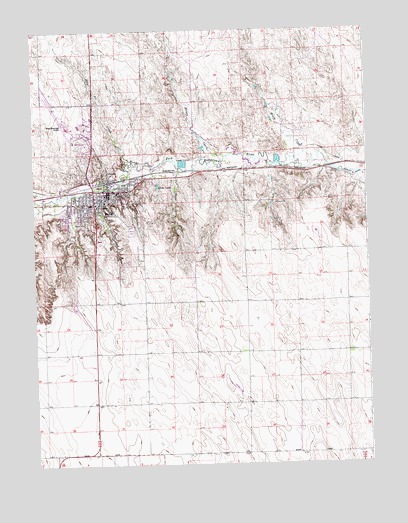
Wray, CO USGS Topographic Map
Click on map above to begin viewing in our Map Viewer.

This topographic map contains these locations and features:
Feature Name Type Latitude Longitude GNIS ID View Map
Bloom CreekStreamN40.0872°W102.1455°183037View Map
City of WrayCivilN40.0799°W102.2279°2412310View Map
Grandview CemeteryCemeteryN40.0672°W102.2135°183036View Map
Hayes CreekStreamN40.0886°W102.1774°183033View Map
Holy Joe CreekStreamN40.0903°W102.2141°183035View Map
KATR-FM (Wray)TowerN40.0822°W102.1907°204210View Map
KRDZ-AM (Wray)TowerN40.0822°W102.1907°204079View Map
Laird CanalCanalN40.0886°W102.1338°202924View Map
Olive CreekStreamN40.0847°W102.1932°183039View Map
Olive LakeReservoirN40.0802°W102.2035°183038View Map
Whomble AirportAirportN40.0191°W102.1727°2717092View Map
WrayPopulated PlaceN40.0758°W102.2232°183032View Map
Wray Community District HospitalHospitalN40.0763°W102.2349°2695613View Map
Wray EMSBuildingN40.0787°W102.2252°2666893View Map
Wray Fire and Rescue DepartmentBuildingN40.0802°W102.2223°2666854View Map
Wray Municipal AirportAirportN40.1020°W102.2411°204634View Map
Wray Police DepartmentBuildingN40.0777°W102.2257°2757282View Map
Wray Post OfficePost OfficeN40.0757°W102.2266°2735991View Map
Wray Watershed District Number 1 DamDamN40.0750°W102.2121°198902View Map
Wray Watershed District Number 3 DamDamN40.0750°W102.2205°198906View Map
Wray Watershed District Number 4 DamDamN40.0717°W102.2238°198908View Map
Wray Watershed District Number 5 DamDamN40.0683°W102.2305°198910View Map
Wray Watershed District Number 6 DamDamN40.0667°W102.2355°198912View Map
Wray Watershed District Reservoir Number 1ReservoirN40.0750°W102.2121°198903View Map
Wray Watershed District Reservoir Number 3ReservoirN40.0751°W102.2207°198907View Map
Wray Watershed District Reservoir Number 4ReservoirN40.0717°W102.2238°198909View Map
Wray Watershed District Reservoir Number 5ReservoirN40.0683°W102.2305°198911View Map
Wray Watershed District Reservoir Number 6ReservoirN40.0667°W102.2355°198913View Map
Yuma County Sheriff's OfficeBuildingN40.0784°W102.2203°2736080View Map

Note: Coordinates in the location and feature list above are referenced to NAD83 datum.


Copyright (C) 2008-2024 Ryan Niemi / Sunset Dynamics ... All Rights Reserved