TopoQuest Logo
Do you find TopoQuest useful?
Help keep TopoQuest running and adding new maps/features by donating!
Bitcoin:  19c7KJd3qBynnjoSw5npx9KScwjBe4ifkT
Litecoin:  LXs6TkuXGGXo1vDsWCkWVdjQX94eUKd6ui
Home View Maps Find Maps Find Places Resources & Links


Yandell Springs, Idaho Topographic Map

USGS Map Title: Yandell Springs, ID
USGS Map MRC: 43112A2
DRG (GeoTIFF) Download: o43112a2.tif


Neighboring USGS Topographic Map Quads:


  Blackfoot, ID  
43112B3
 

  Lincoln Creek, ID  
43112B2
 

  Higham Peak, ID  
43112B1
 

  Buckskin Basin, ID  
43112A3
 

  Yandell Springs, ID  
43112A2
 

  Lincoln Peak, ID  
43112A1
 

  Moonlight Mountain, ID  
42112H3
 

  South Putnam Mountain, ID  
42112H2
 

  Jeff Cabin Creek, ID  
42112H1


Map MRC Location:

N44°
W113°
N44°
W112°
H8 H7 H6 H5 H4 H3 H2 H1
G8 G7 G6 G5 G4 G3 G2 G1
F8 F7 F6 F5 F4 F3 F2 F1
E8 E7 E6 E5 E4 E3 E2 E1
D8 D7 D6 D5 D4 D3 D2 D1
C8 C7 C6 C5 C4 C3 C2 C1
B8 B7 B6 B5 B4 B3 B2 B1
A8 A7 A6 A5 A4 A3 A2 A1
N43°
W113°
N43°
W112°

Yandell Springs, ID USGS 1:24K Topographic Map Preview:
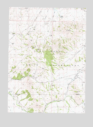
Yandell Springs, ID USGS Topographic Map
Click on map above to begin viewing in our Map Viewer.

This topographic map contains these locations and features:
Feature Name Type Latitude Longitude GNIS ID View Map
Buckskin SpringSpringN43.0944°W112.2433°371757View Map
Cow SpringSpringN43.0369°W112.1289°372198View Map
Cowboy SpringSpringN43.0934°W112.2202°372206View Map
Coyote SpringSpringN43.0758°W112.2038°372224View Map
Danielson BasinBasinN43.0435°W112.1477°372311View Map
Dare PeakSummitN43.0257°W112.1389°395286View Map
Dixey SpringSpringN43.0988°W112.2105°372422View Map
Dry Hollow WellWellN43.0796°W112.1266°372485View Map
Fort Hall DivisionCivilN43.1091°W112.2207°1936712View Map
Lone Pine SpringSpringN43.0325°W112.1795°373702View Map
Martin SpringSpringN43.0525°W112.1921°395676View Map
Rabbit HollowValleyN43.1230°W112.1855°374558View Map
Rawhide SpringSpringN43.0822°W112.2450°374598View Map
Sage Hen BasinBasinN43.1121°W112.1877°374841View Map
Sage Hen DrawValleyN43.1205°W112.1758°374842View Map
WestvacoLocaleN43.0444°W112.1402°401835View Map
White RockPillarN43.0855°W112.2150°399647View Map
White Rock SpringSpringN43.0776°W112.2109°375871View Map
Yandell MountainSummitN43.0982°W112.1552°376005View Map
Yandell SpringsSpringN43.1144°W112.1677°393734View Map

Note: Coordinates in the location and feature list above are referenced to NAD83 datum.


Copyright (C) 2008-2025 Ryan Niemi / Sunset Dynamics ... All Rights Reserved