TopoQuest Logo
Do you find TopoQuest useful?
Help keep TopoQuest running and adding new maps/features by donating!
Bitcoin:  19c7KJd3qBynnjoSw5npx9KScwjBe4ifkT
Litecoin:  LXs6TkuXGGXo1vDsWCkWVdjQX94eUKd6ui
Home View Maps Find Maps Find Places Resources & Links


Yellow Jacket, Colorado Topographic Map

USGS Map Title: Yellow Jacket, CO
USGS Map MRC: 37108E6
DRG (GeoTIFF) Download: o37108e6.tif


Neighboring USGS Topographic Map Quads:


  Cahone, CO  
37108F7
 

  Doe Canyon, CO  
37108F6
 

  Narraguinnep Mountain, CO  
37108F5
 

  Pleasant View, CO  
37108E7
 

  Yellow Jacket, CO  
37108E6
 

  Trimble Point, CO  
37108E5
 

  Woods Canyon, CO  
37108D7
 

  Arriola, CO  
37108D6
 

  Dolores West, CO  
37108D5


Map MRC Location:

N38°
W109°
N38°
W108°
H8 H7 H6 H5 H4 H3 H2 H1
G8 G7 G6 G5 G4 G3 G2 G1
F8 F7 F6 F5 F4 F3 F2 F1
E8 E7 E6 E5 E4 E3 E2 E1
D8 D7 D6 D5 D4 D3 D2 D1
C8 C7 C6 C5 C4 C3 C2 C1
B8 B7 B6 B5 B4 B3 B2 B1
A8 A7 A6 A5 A4 A3 A2 A1
N37°
W109°
N37°
W108°

Yellow Jacket, CO USGS 1:24K Topographic Map Preview:
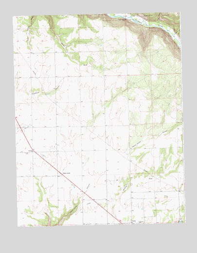
Yellow Jacket, CO USGS Topographic Map
Click on map above to begin viewing in our Map Viewer.

This topographic map contains these locations and features:
Feature Name Type Latitude Longitude GNIS ID View Map
Dolores River State Wildlife AreaParkN37.6222°W108.6798°201833View Map
Emmanuel ChurchChurchN37.5447°W108.7370°176858View Map
Fairview CemeteryCemeteryN37.5439°W108.7405°176859View Map
Ferris CanyonValleyN37.6182°W108.6420°176627View Map
Lewis - Arriola Fire Protection District LewisBuildingN37.5009°W108.6714°2667160View Map
Lewis Census Designated PlaceCensusN37.5017°W108.6601°2583259View Map
Lone DomeCliffN37.6211°W108.6662°176861View Map
Lone Dome Recreation AreaParkN37.6178°W108.6476°201838View Map
Pleasant View HeliportAirportN37.5997°W108.6345°204364View Map
Salter CanyonValleyN37.6120°W108.6291°176676View Map
Sunnyside CemeteryCemeteryN37.5014°W108.6601°176862View Map
U LateralCanalN37.5178°W108.6512°202416View Map
Yellow JacketPopulated PlaceN37.5344°W108.7173°176860View Map
Yellow Jacket Post OfficePost OfficeN37.5299°W108.7193°2759223View Map

Note: Coordinates in the location and feature list above are referenced to NAD83 datum.


Copyright (C) 2008-2025 Ryan Niemi / Sunset Dynamics ... All Rights Reserved