TopoQuest Logo
Do you find TopoQuest useful?
Help keep TopoQuest running and adding new maps/features by donating!
Bitcoin:  19c7KJd3qBynnjoSw5npx9KScwjBe4ifkT
Litecoin:  LXs6TkuXGGXo1vDsWCkWVdjQX94eUKd6ui
Home View Maps Find Maps Find Places Resources & Links


Yellowjacket Mountain, California Topographic Map

USGS Map Title: Yellowjacket Mountain, CA
USGS Map MRC: 41122A2
DRG (GeoTIFF) Download: o41122a2.tif


Neighboring USGS Topographic Map Quads:


  Dunsmuir, CA  
41122B3
 

  Girard Ridge, CA  
41122B2
 

  Lake McCloud, CA  
41122B1
 

  Tombstone Mountain, CA  
41122A3
 

  Yellowjacket Mountain, CA  
41122A2
 

  Shoeinhorse Mountain, CA  
41122A1
 

  Hanland Peak, CA  
40122H3
 

  Bollibokka Mountain, CA  
40122H2
 

  Goose Gap, CA  
40122H1


Map MRC Location:

N42°
W123°
N42°
W122°
H8 H7 H6 H5 H4 H3 H2 H1
G8 G7 G6 G5 G4 G3 G2 G1
F8 F7 F6 F5 F4 F3 F2 F1
E8 E7 E6 E5 E4 E3 E2 E1
D8 D7 D6 D5 D4 D3 D2 D1
C8 C7 C6 C5 C4 C3 C2 C1
B8 B7 B6 B5 B4 B3 B2 B1
A8 A7 A6 A5 A4 A3 A2 A1
N41°
W123°
N41°
W122°

Yellowjacket Mountain, CA USGS 1:24K Topographic Map Preview:
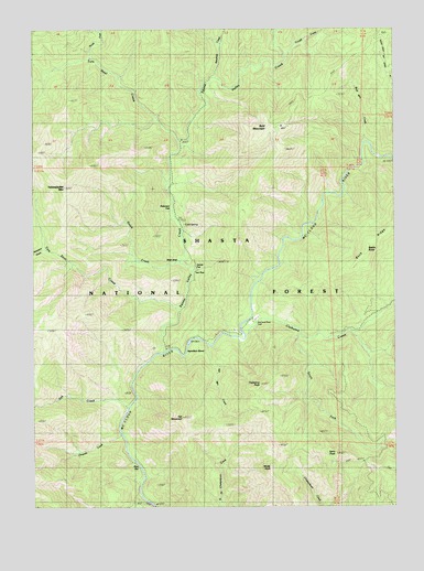
Yellowjacket Mountain, CA USGS Topographic Map
Click on map above to begin viewing in our Map Viewer.

This topographic map contains these locations and features:
Feature Name Type Latitude Longitude GNIS ID View Map
Bald MountainSummitN41.0999°W122.1661°218597View Map
Bald Mountain CreekStreamN41.0957°W122.1369°218601View Map
Beartrap CreekStreamN41.1127°W122.1886°218923View Map
Beetle ButteSummitN41.0668°W122.1367°1658023View Map
Chiquito CreekStreamN41.0188°W122.2211°233670View Map
Claiborne CreekStreamN41.0443°W122.1786°221136View Map
Claiborne PeakSummitN41.0340°W122.1669°221137View Map
Cold SpringSpringN41.0738°W122.1987°221333View Map
Dutch CreekStreamN41.0632°W122.1997°222760View Map
Garret FlatFlatN41.0674°W122.1947°224080View Map
Hamilton BendBendN41.0438°W122.1953°224832View Map
Hat MountainSummitN41.0229°W122.2008°225007View Map
Hat Mountain CreekStreamN41.0421°W122.1914°225008View Map
McCloud River ClubLocaleN41.0493°W122.1750°228302View Map
Mule ShoeFlatN41.0663°W122.1997°229313View Map
North Fork Tom Neal CreekStreamN41.1174°W122.2308°229726View Map
Oak CreekStreamN41.0260°W122.2189°229841View Map
Peterson FlatFlatN41.0782°W122.2033°1661847View Map
Pine FlatFlatN41.0110°W122.2158°230692View Map
Pine Flat Ranger Station (historical)LocaleN41.0118°W122.2169°1682388View Map
Satin PeakSummitN41.0138°W122.1481°232593View Map
Scorpion GulchValleyN41.0674°W122.2489°232709View Map
South Fork Claiborne CreekStreamN41.0449°W122.1594°234987View Map
Squaw Valley CreekStreamN41.0407°W122.2067°235327View Map
Tom Dow CreekStreamN41.0518°W122.2017°236428View Map
Tom Neal CreekStreamN41.0963°W122.2011°236436View Map
Trough CreekStreamN41.1171°W122.1644°236560View Map
Two PineFlatN41.0624°W122.1953°236729View Map
White RockPillarN41.0102°W122.1703°237663View Map
Yellowjacket MountainSummitN41.0838°W122.2406°238250View Map

Note: Coordinates in the location and feature list above are referenced to NAD83 datum.


Copyright (C) 2008-2025 Ryan Niemi / Sunset Dynamics ... All Rights Reserved