TopoQuest Logo
Do you find TopoQuest useful?
Help keep TopoQuest running and adding new maps/features by donating!
Bitcoin:  19c7KJd3qBynnjoSw5npx9KScwjBe4ifkT
Litecoin:  LXs6TkuXGGXo1vDsWCkWVdjQX94eUKd6ui
Home View Maps Find Maps Find Places Resources & Links


York Beach, Maine Topographic Map

USGS Map Title: York Beach, ME
USGS Map MRC: 43070B5
DRG (GeoTIFF) Download: o43070b5.tif


Neighboring USGS Topographic Map Quads:


  North Berwick, ME  
43070C6
 

  Wells, ME  
43070C5
 

  Kennebunkport, ME  
43070C4
 

  York Harbor, ME  
43070B6
 

  York Beach, ME  
43070B5


  Kittery, ME  
43070A6


Map MRC Location:

N44°
W71°
N44°
W70°
H8 H7 H6 H5 H4 H3 H2 H1
G8 G7 G6 G5 G4 G3 G2 G1
F8 F7 F6 F5 F4 F3 F2 F1
E8 E7 E6 E5 E4 E3 E2 E1
D8 D7 D6 D5 D4 D3 D2 D1
C8 C7 C6 C5 C4 C3 C2 C1
B8 B7 B6 B5 B4 B3 B2 B1
A8 A7 A6 A5 A4 A3 A2 A1
N43°
W71°
N43°
W70°

York Beach, ME USGS 1:24K Topographic Map Preview:
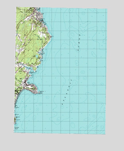
York Beach, ME USGS Topographic Map
Click on map above to begin viewing in our Map Viewer.

This topographic map contains these locations and features:
Feature Name Type Latitude Longitude GNIS ID View Map
Adams LotCemeteryN43.2395°W70.6089°2737073View Map
All Saints Catholic ChurchChurchN43.2462°W70.5992°1910735View Map
Allen LotCemeteryN43.1898°W70.6141°2737075View Map
Avery LotCemeteryN43.1901°W70.6141°2737078View Map
Bald HeadPopulated PlaceN43.2209°W70.5773°561497View Map
Bald Head CliffCliffN43.2209°W70.5762°561500View Map
Banks RockBarN43.1376°W70.6209°561564View Map
Barn PointCapeN43.1812°W70.6023°561616View Map
Birch KnollSummitN43.2373°W70.6053°562321View Map
Boon IslandIslandN43.1609°W70.5801°580220View Map
BraeburnPopulated PlaceN43.2248°W70.5806°562870View Map
Bragdon LotCemeteryN43.1970°W70.6228°2737104View Map
Briley BrookGutN43.1773°W70.6184°562973View Map
Briley PondLakeN43.1789°W70.6145°562974View Map
Brooks LotCemeteryN43.2319°W70.5935°2737109View Map
Cape Neddic Post OfficePost OfficeN43.1897°W70.6206°1910803View Map
Cape NeddickCapeN43.1698°W70.6034°563477View Map
Cape NeddickPopulated PlaceN43.1937°W70.6209°563478View Map
Cape Neddick Baptist ChurchChurchN43.1940°W70.6176°1910799View Map
Cape Neddick BeachBeachN43.1873°W70.5962°1910800View Map
Cape Neddick CampgroundLocaleN43.1868°W70.6048°1910801View Map
Cape Neddick Census Designated PlaceCensusN43.1709°W70.6212°2377897View Map
Cape Neddick HarborBayN43.1848°W70.6014°563479View Map
Cape Neddick LightBuildingN43.1651°W70.5909°563480View Map
Cape Neddick NubbleIslandN43.1659°W70.5903°563481View Map
Cape Neddick ParkParkN43.1918°W70.6056°1910802View Map
Cape Neddick RiverStreamN43.1834°W70.5987°563482View Map
Caswell Barton LotCemeteryN43.1873°W70.6070°2737125View Map
Clark BridgeBridgeN43.1928°W70.6147°564018View Map
Clark Road CemeteryCemeteryN43.1915°W70.6169°2737138View Map
Clay HillSummitN43.2293°W70.6231°1910822View Map
ConcordvillePopulated PlaceN43.1704°W70.5962°564281View Map
Cow Beach PointCapeN43.1404°W70.6214°564404View Map
Currier CemeteryCemeteryN43.1941°W70.6140°2736404View Map
Dixons CampgroundLocaleN43.2204°W70.6114°1910839View Map
Donnell Bridges LotCemeteryN43.1707°W70.6230°2736422View Map
Dover BluffCliffN43.1676°W70.6053°565249View Map
East PointCapeN43.1340°W70.6231°565660View Map
Flaggs Trailer ParkPopulated PlaceN43.1595°W70.6242°1910884View Map
Freeman LotCemeteryN43.1818°W70.6086°2736872View Map
Freeman LotCemeteryN43.1969°W70.6227°2736873View Map
Freeman LotCemeteryN43.2135°W70.6225°2736874View Map
Freeman LotCemeteryN43.1874°W70.6093°2736875View Map
Goodwin LotCemeteryN43.2065°W70.6198°2736893View Map
Gulf HillSummitN43.2222°W70.6101°567375View Map
High PasturePopulated PlaceN43.2304°W70.5851°568024View Map
Hutchins LotCemeteryN43.1932°W70.6239°2736475View Map
Israels HeadCapeN43.2440°W70.5887°568713View Map
Jacks CoveBayN43.2331°W70.5851°568726View Map
Josias RiverStreamN43.2354°W70.5887°569006View Map
Lake CarolynLakeN43.2014°W70.5951°563582View Map
Little BeachBeachN43.2445°W70.5903°1910995View Map
Littlefield CemeteryCemeteryN43.2238°W70.5848°2736514View Map
Littlefield LotCemeteryN43.2362°W70.6101°2736517View Map
Littlefield LotCemeteryN43.2312°W70.5954°2736518View Map
Locust Grove CemeteryCemeteryN43.2434°W70.5958°2736519View Map
Long BeachBeachN43.1604°W70.6209°570171View Map
Long BeachPopulated PlaceN43.1673°W70.6223°570172View Map
Lord LotCemeteryN43.1715°W70.6061°2736521View Map
Lord LotCemeteryN43.1933°W70.6103°2736522View Map
Matthews CemeteryCemeteryN43.1900°W70.6110°2736531View Map
Mayo FallsFallsN43.2373°W70.5089°1911018View Map
Muddy BrookStreamN43.2256°W70.6223°571959View Map
Norton LotCemeteryN43.1870°W70.6096°2737158View Map
Norton LotCemeteryN43.1900°W70.6144°2737159View Map
Norton LotCemeteryN43.1942°W70.6153°2737160View Map
Norton LotCemeteryN43.1942°W70.6121°2737161View Map
Nubble PointCapeN43.1656°W70.5928°1911063View Map
Oarweed CoveBayN43.2384°W70.5887°572657View Map
Ocean View VillagePopulated PlaceN43.1787°W70.6078°1911066View Map
OgunquitPopulated PlaceN43.2490°W70.5992°572671View Map
Ogunquit Art Association GalleryBuildingN43.2420°W70.5970°1911068View Map
Ogunquit Baptist ChurchChurchN43.2445°W70.5962°1911069View Map
Ogunquit Country ClubLocaleN43.2243°W70.5876°581589View Map
Ogunquit Fire - Rescue DepartmentBuildingN43.2471°W70.5983°2552762View Map
Ogunquit Information BureauBuildingN43.2440°W70.6009°1911070View Map
Ogunquit Memorial LibraryBuildingN43.2439°W70.5967°1911071View Map
Ogunquit Museum of American ArtBuildingN43.2337°W70.5898°1911072View Map
Ogunquit PlayhouseBuildingN43.2406°W70.6012°1911073View Map
Ogunquit Police DepartmentBuildingN43.2468°W70.5986°2735862View Map
Ogunquit Post OfficePost OfficeN43.2473°W70.6001°1911074View Map
Ogunquit RiverStreamN43.2459°W70.5914°572673View Map
Ogunquit United Methodist ChurchChurchN43.2479°W70.5973°1911075View Map
Ogunquit Village SchoolSchoolN43.2462°W70.5984°1911076View Map
Parsons LotCemeteryN43.2089°W70.5928°2737176View Map
Perkins CoveBayN43.2348°W70.5867°573203View Map
Perkins LotCemeteryN43.2317°W70.5868°2737187View Map
Perkins LotCemeteryN43.2345°W70.5993°2737189View Map
Perkins LotCemeteryN43.2324°W70.5986°2737190View Map
Perkins LotCemeteryN43.2146°W70.6076°2737191View Map
Perkins LotCemeteryN43.2190°W70.6130°2737192View Map
Perkins White LotCemeteryN43.2315°W70.5866°2737193View Map
Phillips CoveBayN43.2037°W70.5878°573266View Map
Phillips LotCemeteryN43.2079°W70.5923°2737195View Map
Phillips PondLakeN43.2044°W70.5920°573270View Map
Pine HillPopulated PlaceN43.2315°W70.5973°573367View Map
Pine HillSummitN43.2349°W70.5988°573368View Map
Pint CoveBayN43.1909°W70.5939°573438View Map
Pond RocksBarN43.2056°W70.5845°573614View Map
Prebble BrookStreamN43.1654°W70.6164°1911107View Map
Prebbles PointCapeN43.1498°W70.6220°573768View Map
Ramsdell LotCemeteryN43.2371°W70.6108°2737215View Map
River Road CemeteryCemeteryN43.1936°W70.6176°2737226View Map
Roaring Rock PointCapeN43.1426°W70.6234°574282View Map
Rush SwampSwampN43.2187°W70.5917°574599View Map
Rush Swamp BrookStreamN43.2084°W70.5876°574600View Map
S Judson Dunaway CenterBuildingN43.2470°W70.5981°1911122View Map
Saint Peters By-The-Sea ChurchChurchN43.2181°W70.5837°1911146View Map
Short SandsBeachN43.1743°W70.6076°575440View Map
Simpson HillSummitN43.1864°W70.6150°575482View Map
Simpson LotCemeteryN43.1850°W70.6109°2737257View Map
Simpson LotCemeteryN43.1901°W70.6143°2737258View Map
Sohier ParkParkN43.1698°W70.5939°1911180View Map
Staple PondReservoirN43.2308°W70.5932°1911202View Map
Staples LotCemeteryN43.2304°W70.5920°2737278View Map
Staples PondLakeN43.2349°W70.5931°576259View Map
Talpey LotCemeteryN43.1874°W70.6072°2737288View Map
Talpey LotCemeteryN43.1911°W70.6221°2737289View Map
The BasinBasinN43.2368°W70.5912°576747View Map
The Blacksmith Mall Shopping CenterLocaleN43.2493°W70.5995°1911208View Map
Town of OgunquitCivilN43.2434°W70.5668°582646View Map
Town of YorkCivilN43.1582°W70.5853°582832View Map
Union Congregational ChurchChurchN43.1729°W70.6114°1911224View Map
Waddell PondLakeN43.1990°W70.5912°577751View Map
Wadleighs HeadCapeN43.1968°W70.5889°577769View Map
Walnut HillPopulated PlaceN43.2373°W70.5945°577813View Map
Wander HillSummitN43.2048°W70.6126°577819View Map
Wayside Trailer ParkPopulated PlaceN43.1762°W70.6217°1911242View Map
Weare LotCemeteryN43.1936°W70.6081°2736571View Map
Weare LotCemeteryN43.2146°W70.6076°2736572View Map
Weare LotCemeteryN43.2276°W70.6016°2736573View Map
Weare LotCemeteryN43.1929°W70.6039°2736574View Map
Weare LotCemeteryN43.2070°W70.6181°2736575View Map
Weare LotCemeteryN43.2131°W70.6081°2736576View Map
Weare PointCapeN43.1862°W70.5976°577913View Map
Webber Merrow CemeteryCemeteryN43.1973°W70.6227°2736578View Map
Welch LotCemeteryN43.2171°W70.6208°2736582View Map
Worleys Ice Pond (historical)LakeN43.2026°W70.6209°1911282View Map
York BeachPopulated PlaceN43.1715°W70.6089°578765View Map
York Beach Camper ParkLocaleN43.1848°W70.6137°1911285View Map
York Beach CemeteryCemeteryN43.1726°W70.6118°2736604View Map
York Beach Fire StationBuildingN43.1745°W70.6118°1911286View Map
York Beach Post OfficePost OfficeN43.1734°W70.6154°1911287View Map
York Beach Veterans Memorial CemeteryCemeteryN43.1738°W70.6079°2736605View Map
York Cliff Historic DistrictParkN43.1923°W70.5970°1911288View Map
York CliffsCliffN43.1948°W70.5898°578767View Map
York CliffsPopulated PlaceN43.1912°W70.6028°578768View Map
York Harbor EntranceBayN43.1293°W70.6237°578772View Map
Yorks Wild KingdomParkN43.1837°W70.6112°1911306View Map

Note: Coordinates in the location and feature list above are referenced to NAD83 datum.


Copyright (C) 2008-2024 Ryan Niemi / Sunset Dynamics ... All Rights Reserved