TopoQuest Logo
Do you find TopoQuest useful?
Help keep TopoQuest running and adding new maps/features by donating!
Bitcoin:  19c7KJd3qBynnjoSw5npx9KScwjBe4ifkT
Litecoin:  LXs6TkuXGGXo1vDsWCkWVdjQX94eUKd6ui
Home View Maps Find Maps Find Places Resources & Links


Yorktown, Illinois Topographic Map

USGS Map Title: Yorktown, IL
USGS Map MRC: 41089E7
DRG (GeoTIFF) Download: o41089e7.tif


Neighboring USGS Topographic Map Quads:


  Prophetstown, IL  
41089F8
 

  Tampico, IL  
41089F7
 

  Hahnaman, IL  
41089F6
 

  Hooppole, IL  
41089E8
 

  Yorktown, IL  
41089E7
 

  New Bedford, IL  
41089E6
 

  Annawan, IL  
41089D8
 

  Mineral, IL  
41089D7
 

  Manlius, IL  
41089D6


Map MRC Location:

N42°
W90°
N42°
W89°
H8 H7 H6 H5 H4 H3 H2 H1
G8 G7 G6 G5 G4 G3 G2 G1
F8 F7 F6 F5 F4 F3 F2 F1
E8 E7 E6 E5 E4 E3 E2 E1
D8 D7 D6 D5 D4 D3 D2 D1
C8 C7 C6 C5 C4 C3 C2 C1
B8 B7 B6 B5 B4 B3 B2 B1
A8 A7 A6 A5 A4 A3 A2 A1
N41°
W90°
N41°
W89°

Yorktown, IL USGS 1:24K Topographic Map Preview:
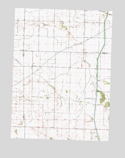
Yorktown, IL USGS Topographic Map
Click on map above to begin viewing in our Map Viewer.

This topographic map contains these locations and features:
Feature Name Type Latitude Longitude GNIS ID View Map
Anderson Family CemeteryCemeteryN41.5010°W89.8022°1822627View Map
Burden School (historical)SchoolN41.5689°W89.7790°405209View Map
Center School (historical)SchoolN41.5411°W89.8118°405835View Map
Cloverdale School (historical)SchoolN41.5992°W89.8626°406270View Map
County Ditch Number 2CanalN41.6223°W89.8618°424781View Map
Fairfield Amish Mennonite CemeteryCemeteryN41.5764°W89.7849°1822626View Map
Fairfield Church (historical)ChurchN41.5120°W89.7529°408166View Map
Fairfield Ditch Number 1CanalN41.5489°W89.8365°424882View Map
Fairfield Union Special DitchCanalN41.5356°W89.7876°408170View Map
Harms AirstripAirportN41.5765°W89.7954°427866View Map
Hennepin Feeder CanalCanalN41.5981°W89.7587°410759View Map
Johnson School (historical)SchoolN41.5117°W89.7812°411178View Map
Lisa Landing Strip (historical)AirportN41.5406°W89.7762°1718896View Map
LovePopulated PlaceN41.5692°W89.8059°422923View Map
Pleasant Hill School (historical)SchoolN41.5331°W89.8498°415862View Map
Pleasant Hill School (historical)SchoolN41.6031°W89.8046°415863View Map
Sunnyside School (historical)SchoolN41.6000°W89.8429°419399View Map
Tampico Rural Fire Protection District Station 2BuildingN41.5692°W89.8489°2640840View Map
ThomasPopulated PlaceN41.5117°W89.8195°419654View Map
Township of FairfieldCivilN41.5407°W89.8017°428985View Map
Whittington School (historical)SchoolN41.5273°W89.7568°421123View Map
YorktownPopulated PlaceN41.5698°W89.8501°421587View Map
Yorktown CemeteryCemeteryN41.5725°W89.8498°1820605View Map

Note: Coordinates in the location and feature list above are referenced to NAD83 datum.


Copyright (C) 2008-2025 Ryan Niemi / Sunset Dynamics ... All Rights Reserved