TopoQuest Logo
Do you find TopoQuest useful?
Help keep TopoQuest running and adding new maps/features by donating!
Bitcoin:  19c7KJd3qBynnjoSw5npx9KScwjBe4ifkT
Litecoin:  LXs6TkuXGGXo1vDsWCkWVdjQX94eUKd6ui
Home View Maps Find Maps Find Places Resources & Links


Zaneta, Iowa Topographic Map

USGS Map Title: Zaneta, IA
USGS Map MRC: 42092D5
DRG (GeoTIFF) Download: o42092d5.tif


Neighboring USGS Topographic Map Quads:


  Stout, IA  
42092E6
 

  New Hartford, IA  
42092E5
 

  Cedar Falls, IA  
42092E4
 

  Dike, IA  
42092D6
 

  Zaneta, IA  
42092D5
 

  Hudson, IA  
42092D4
 

  Lincoln, IA  
42092C6
 

  Reinbeck, IA  
42092C5
 

  Buckingham, IA  
42092C4


Map MRC Location:

N43°
W93°
N43°
W92°
H8 H7 H6 H5 H4 H3 H2 H1
G8 G7 G6 G5 G4 G3 G2 G1
F8 F7 F6 F5 F4 F3 F2 F1
E8 E7 E6 E5 E4 E3 E2 E1
D8 D7 D6 D5 D4 D3 D2 D1
C8 C7 C6 C5 C4 C3 C2 C1
B8 B7 B6 B5 B4 B3 B2 B1
A8 A7 A6 A5 A4 A3 A2 A1
N42°
W93°
N42°
W92°

Zaneta, IA USGS 1:24K Topographic Map Preview:
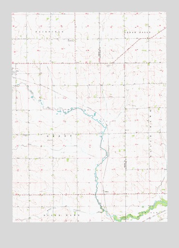
Zaneta, IA USGS Topographic Map
Click on map above to begin viewing in our Map Viewer.

This topographic map contains these locations and features:
Feature Name Type Latitude Longitude GNIS ID View Map
Bois d'ArcLocaleN42.4155°W92.5377°466245View Map
Bois D'Arc Post Office (historical)Post OfficeN42.4055°W92.5391°1983346View Map
Cedar Valley CemeteryCemeteryN42.4166°W92.5057°2046209View Map
Corn Beef FeedlotLocaleN42.4075°W92.5794°2611859View Map
Fox Ridge Golf CourseLocaleN42.4655°W92.6197°1983359View Map
FredsvillePopulated PlaceN42.4842°W92.5741°456755View Map
Fredsville Evangelical Lutheran Church CemeteryCemeteryN42.4846°W92.5789°1983461View Map
Fredsville Post Office (historical)Post OfficeN42.4842°W92.5741°1983350View Map
Kingsbury Post Office (historical)Post OfficeN42.4264°W92.5919°1983347View Map
North Fork Black Hawk CreekStreamN42.3764°W92.5377°461476View Map
Saint Mary's CemeteryCemeteryN42.4271°W92.6126°461173View Map
Saint Marys ChurchChurchN42.4239°W92.5927°461205View Map
Seyffer Public Use AreaParkN42.3772°W92.5335°461517View Map
Township of GrantCivilN42.4269°W92.5928°467939View Map
Willow CreekStreamN42.3814°W92.5521°463088View Map
Witcombe FieldAirportN42.4763°W92.5000°466728View Map
ZanetaPopulated PlaceN42.3936°W92.5521°464812View Map
Zaneta (historical)LocaleN42.3936°W92.5521°1983349View Map
Zaneta Post Office (historical)Post OfficeN42.3936°W92.5521°1983348View Map
Zion ChurchChurchN42.4297°W92.5338°463273View Map
Zion Lutheran CemeteryCemeteryN42.4275°W92.5291°1958309View Map

Note: Coordinates in the location and feature list above are referenced to NAD83 datum.


Copyright (C) 2008-2024 Ryan Niemi / Sunset Dynamics ... All Rights Reserved