TopoQuest Logo
Do you find TopoQuest useful?
Help keep TopoQuest running and adding new maps/features by donating!
Bitcoin:  19c7KJd3qBynnjoSw5npx9KScwjBe4ifkT
Litecoin:  LXs6TkuXGGXo1vDsWCkWVdjQX94eUKd6ui
Home View Maps Find Maps Find Places Resources & Links


Bowdle, South Dakota Topographic Map

USGS Map Title: Bowdle, SD
USGS Map MRC: 45099D6
DRG (GeoTIFF) Download: o45099d6.tif


Neighboring USGS Topographic Map Quads:


  Java SE, SD  
45099E7
 

  Bowdle-Hosmer Lake, SD  
45099E6
 

  Hillsview SE, SD  
45099E5
 

  Spring Lake, SD  
45099D7
 

  Bowdle, SD  
45099D6
 

  Gretna, SD  
45099D5
 

  Hoven Municipal Airport, SD  
45099C7
 

  Bowdle SW, SD  
45099C6
 

  Bowdle SE, SD  
45099C5


Map MRC Location:

N46°
W100°
N46°
W99°
H8 H7 H6 H5 H4 H3 H2 H1
G8 G7 G6 G5 G4 G3 G2 G1
F8 F7 F6 F5 F4 F3 F2 F1
E8 E7 E6 E5 E4 E3 E2 E1
D8 D7 D6 D5 D4 D3 D2 D1
C8 C7 C6 C5 C4 C3 C2 C1
B8 B7 B6 B5 B4 B3 B2 B1
A8 A7 A6 A5 A4 A3 A2 A1
N45°
W100°
N45°
W99°

Bowdle, SD USGS 1:24K Topographic Map Preview:
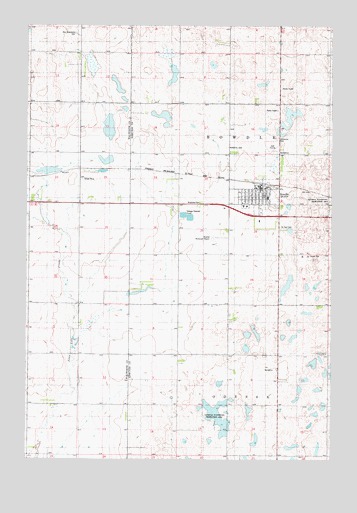
Bowdle, SD USGS Topographic Map
Click on map above to begin viewing in our Map Viewer.

This topographic map contains these locations and features:
Feature Name Type Latitude Longitude GNIS ID View Map
BowdlePopulated PlaceN45.4530°W99.6540°1254024View Map
Bowdle City CemeteryCemeteryN45.4481°W99.6476°2773663View Map
Bowdle City HallBuildingN45.4481°W99.6609°2724687View Map
Bowdle Elementary SchoolSchoolN45.4506°W99.6509°2728428View Map
Bowdle Healthcare CenterHospitalN45.4480°W99.6616°2610913View Map
Bowdle High SchoolSchoolN45.4506°W99.6509°2728429View Map
Bowdle Junior High SchoolSchoolN45.4506°W99.6509°2728430View Map
Bowdle Municipal AirportAirportN45.4397°W99.6736°1260213View Map
Bowdle Post OfficePost OfficeN45.4532°W99.6535°2709684View Map
Bowdle Volunteer Fire DepartmentBuildingN45.4532°W99.6531°2580837View Map
City of BowdleCivilN45.4513°W99.6565°1267289View Map
Ketterling CemeteryCemeteryN45.4650°W99.6679°1255929View Map
Nell Glueckstal CemeteryCemeteryN45.4978°W99.7307°1266176View Map
Redeemer CemeteryCemeteryN45.4672°W99.6479°1257325View Map
Reverend Martin Bieber Public LibraryBuildingN45.4536°W99.6534°2723352View Map
Saint Augustine CemeteryCemeteryN45.4482°W99.6484°2773665View Map
Saint John Evangelical LutheranCemeteryN45.4483°W99.6500°2773666View Map
Saint Paul Evangelical Lutheran Church CemeteryCemeteryN45.4416°W99.6464°1257716View Map
Township of BowdleCivilN45.4633°W99.6466°1268396View Map
Township of OdessaCivilN45.3761°W99.6469°1268387View Map

Note: Coordinates in the location and feature list above are referenced to NAD83 datum.


Copyright (C) 2008-2025 Ryan Niemi / Sunset Dynamics ... All Rights Reserved