TopoQuest Logo
Do you find TopoQuest useful?
Help keep TopoQuest running and adding new maps/features by donating!
Bitcoin:  19c7KJd3qBynnjoSw5npx9KScwjBe4ifkT
Litecoin:  LXs6TkuXGGXo1vDsWCkWVdjQX94eUKd6ui
Home View Maps Find Maps Find Places Resources & Links


Boyes, Montana Topographic Map

USGS Map Title: Boyes, MT
USGS Map MRC: 45105C1
DRG (GeoTIFF) Download: o45105c1.tif


Neighboring USGS Topographic Map Quads:


  Little Pilgrim Butte, MT  
45105D2
 

  Lightning Butte, MT  
45105D1
 

  Pentecost Reservoir, MT  
45104D8
 

  Dry Creek Butte, MT  
45105C2
 

  Boyes, MT  
45105C1
 

  Knudson Draw, MT  
45104C8
 

  Sanburn Reservoir, MT  
45105B2
 

  Belle Creek North, MT  
45105B1
 

  Hammond, MT  
45104B8


Map MRC Location:

N46°
W106°
N46°
W105°
H8 H7 H6 H5 H4 H3 H2 H1
G8 G7 G6 G5 G4 G3 G2 G1
F8 F7 F6 F5 F4 F3 F2 F1
E8 E7 E6 E5 E4 E3 E2 E1
D8 D7 D6 D5 D4 D3 D2 D1
C8 C7 C6 C5 C4 C3 C2 C1
B8 B7 B6 B5 B4 B3 B2 B1
A8 A7 A6 A5 A4 A3 A2 A1
N45°
W106°
N45°
W105°

Boyes, MT USGS 1:24K Topographic Map Preview:
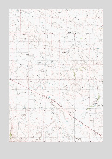
Boyes, MT USGS Topographic Map
Click on map above to begin viewing in our Map Viewer.

This topographic map contains these locations and features:
Feature Name Type Latitude Longitude GNIS ID View Map
05S53E25BDD_01 WellWellN45.3711°W105.1166°809148View Map
05S54E28DBB_01 WellWellN45.3683°W105.0522°809130View Map
05S54E34DDAD01 WellWellN45.3542°W105.0386°809062View Map
05S54E36CBB_01 WellWellN45.3555°W105.0008°809067View Map
06S54E01CCCB01 WellWellN45.3383°W105.0583°808998View Map
06S54E09ADAC01 WellWellN45.3322°W105.1014°808967View Map
06S54E12ACAC01 WellWellN45.3322°W105.0447°808966View Map
06S54E22CA__01 WellWellN45.2953°W105.0919°808778View Map
06S54E22CDC_01 WellWellN45.2928°W105.0916°808764View Map
06S54E28BDBB01 WellWellN45.2903°W105.1141°808747View Map
06S54E28DAA_01 WellWellN45.2861°W105.1011°808728View Map
06S55E05ADCA01 WellWellN45.3453°W105.0014°809026View Map
06S55E06CDA_01 WellWellN45.3383°W105.0269°808997View Map
06S55E07ABC_01 WellWellN45.3325°W105.0183°808969View Map
06S55E18BC__01 WellWellN45.3142°W105.0330°808883View Map
06S55E20CAAD01 WellWellN45.2969°W105.0080°808791View Map
06S55E31ACDC01 WellWellN45.2730°W105.0258°808674View Map
06S55E31BC__01 WellWellN45.2739°W105.0361°808677View Map
06S55E31CCAC01 WellWellN45.2669°W105.0358°808646View Map
06S55E31CCC_01 WellWellN45.2655°W105.0375°808643View Map
06S55E31CCDB01 WellWellN45.2667°W105.0361°808645View Map
07S54E03AADB01 WellWellN45.2625°W105.0800°808634View Map
07S55E05BB__01 WellWellN45.2605°W105.0139°808620View Map
BoyesPopulated PlaceN45.2680°W105.0311°802052View Map
Boyes CemeteryCemeteryN45.3069°W105.0032°1688704View Map
Boyes Post OfficePost OfficeN45.2692°W105.0308°1688733View Map
Boyes School (historical)SchoolN45.2680°W105.0311°1688779View Map
Coyote CreekStreamN45.2833°W105.0119°799680View Map
Deranleau ButteSummitN45.3508°W105.1055°799677View Map
Dick CreekStreamN45.3536°W105.1097°799676View Map
Hay Creek School (historical)SchoolN45.3517°W105.0480°772267View Map
Morellas ButteSummitN45.3342°W105.0530°799678View Map
Scott CreekStreamN45.2953°W105.0975°776304View Map
Spring CreekStreamN45.2550°W105.0428°777035View Map
Tom CreekStreamN45.3736°W105.1141°799654View Map

Note: Coordinates in the location and feature list above are referenced to NAD83 datum.


Copyright (C) 2008-2025 Ryan Niemi / Sunset Dynamics ... All Rights Reserved