TopoQuest Logo
Do you find TopoQuest useful?
Help keep TopoQuest running and adding new maps/features by donating!
Bitcoin:  19c7KJd3qBynnjoSw5npx9KScwjBe4ifkT
Litecoin:  LXs6TkuXGGXo1vDsWCkWVdjQX94eUKd6ui
Home View Maps Find Maps Find Places Resources & Links


Boysen, Wyoming Topographic Map

USGS Map Title: Boysen, WY
USGS Map MRC: 43108D2
DRG (GeoTIFF) Download: o43108d2.tif


Neighboring USGS Topographic Map Quads:


  Nostrum Mountain, WY  
43108E3
 

  Wedding of the Waters, WY  
43108E2
 

  Devil Slide, WY  
43108E1
 

  Morrison Canyon, WY  
43108D3
 

  Boysen, WY  
43108D2
 

  Birdseye Pass, WY  
43108D1
 

  Mexican Pass SE, WY  
43108C3
 

  Bonneville SW, WY  
43108C2
 

  Bonneville, WY  
43108C1


Map MRC Location:

N44°
W109°
N44°
W108°
H8 H7 H6 H5 H4 H3 H2 H1
G8 G7 G6 G5 G4 G3 G2 G1
F8 F7 F6 F5 F4 F3 F2 F1
E8 E7 E6 E5 E4 E3 E2 E1
D8 D7 D6 D5 D4 D3 D2 D1
C8 C7 C6 C5 C4 C3 C2 C1
B8 B7 B6 B5 B4 B3 B2 B1
A8 A7 A6 A5 A4 A3 A2 A1
N43°
W109°
N43°
W108°

Boysen, WY USGS 1:24K Topographic Map Preview:
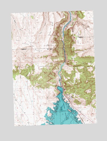
Boysen, WY USGS Topographic Map
Click on map above to begin viewing in our Map Viewer.

This topographic map contains these locations and features:
Feature Name Type Latitude Longitude GNIS ID View Map
BoysenPopulated PlaceN43.4416°W108.1732°1597228View Map
Boysen CampLocaleN43.4038°W108.1618°1585863View Map
Boysen CreekStreamN43.4422°W108.1715°1585864View Map
Boysen DamDamN43.4166°W108.1773°1608036View Map
Boysen DamDamN43.4172°W108.1776°1585865View Map
Boysen PeakSummitN43.4586°W108.1932°1585866View Map
Boysen RidgeRidgeN43.4819°W108.1879°1585868View Map
Cottonwood CreekStreamN43.4411°W108.1704°1587046View Map
DornickLocaleN43.4850°W108.1662°1597291View Map
Gold CreekStreamN43.4447°W108.1687°1588953View Map
Jewell CanyonValleyN43.3983°W108.2248°1590099View Map
Johnson TrailTrailN43.4427°W108.1440°1590205View Map
KFNE-TV (Riverton)TowerN43.4572°W108.2012°1609218View Map
Stagner MountainSummitN43.4563°W108.2087°1596940View Map
Stone MountainSummitN43.4636°W108.1459°1595076View Map
Wind River Canyon Number One MineMineN43.4113°W108.1701°1746006View Map
Wind River Canyon Number Two MineMineN43.4113°W108.1701°1746007View Map
Woods BasinBasinN43.4736°W108.1376°1597026View Map

Note: Coordinates in the location and feature list above are referenced to NAD83 datum.


Copyright (C) 2008-2025 Ryan Niemi / Sunset Dynamics ... All Rights Reserved