TopoQuest Logo
Do you find TopoQuest useful?
Help keep TopoQuest running and adding new maps/features by donating!
Bitcoin:  19c7KJd3qBynnjoSw5npx9KScwjBe4ifkT
Litecoin:  LXs6TkuXGGXo1vDsWCkWVdjQX94eUKd6ui
Home View Maps Find Maps Find Places Resources & Links


Bradford, New York Topographic Map

USGS Map Title: Bradford, NY
USGS Map MRC: 42077C1
DRG (GeoTIFF) Download: o42077c1.tif


Neighboring USGS Topographic Map Quads:


  Hammondsport, NY  
42077D2
 

  Wayne, NY  
42077D1
 

  Reading Center, NY  
42076D8
 

  Savona, NY  
42077C2
 

  Bradford, NY  
42077C1
 

  Beaver Dams, NY  
42076C8
 

  Campbell, NY  
42077B2
 

  Corning, NY  
42077B1
 

  Big Flats, NY  
42076B8


Map MRC Location:

N43°
W78°
N43°
W77°
H8 H7 H6 H5 H4 H3 H2 H1
G8 G7 G6 G5 G4 G3 G2 G1
F8 F7 F6 F5 F4 F3 F2 F1
E8 E7 E6 E5 E4 E3 E2 E1
D8 D7 D6 D5 D4 D3 D2 D1
C8 C7 C6 C5 C4 C3 C2 C1
B8 B7 B6 B5 B4 B3 B2 B1
A8 A7 A6 A5 A4 A3 A2 A1
N42°
W78°
N42°
W77°

Bradford, NY USGS 1:24K Topographic Map Preview:
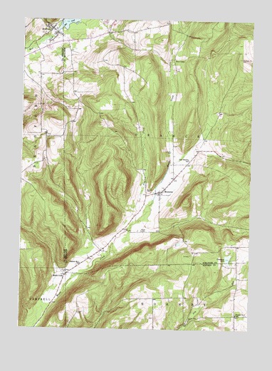
Bradford, NY USGS Topographic Map
Click on map above to begin viewing in our Map Viewer.

This topographic map contains these locations and features:
Feature Name Type Latitude Longitude GNIS ID View Map
Belmont CemeteryCemeteryN42.3059°W77.0539°943636View Map
BradfordPopulated PlaceN42.3712°W77.1089°944568View Map
Bradford Baptist ChurchChurchN42.3690°W77.1081°2597645View Map
Bradford CemeteryCemeteryN42.3695°W77.1127°2547931View Map
Bradford Post OfficePost OfficeN42.3711°W77.1100°2599086View Map
Bradford Volunteer Fire CompanyBuildingN42.3728°W77.1127°2735289View Map
Central Valley CemeteryCemeteryN42.2540°W77.0327°946325View Map
Christ Johns CemeteryCemeteryN42.2725°W77.0995°946621View Map
Cinnamon LakeLakeN42.2790°W77.0117°946704View Map
District Number 1 School (historical)SchoolN42.2562°W77.0066°948477View Map
District Number 1 School (historical)SchoolN42.2762°W77.0922°948478View Map
Duvall CemeteryCemeteryN42.2564°W77.0930°948883View Map
Maltby CemeteryCemeteryN42.2896°W77.0591°956326View Map
Meads CreekPopulated PlaceN42.2720°W77.1002°956893View Map
MontereyPopulated PlaceN42.3056°W77.0491°957550View Map
Monterey CemeteryCemeteryN42.3073°W77.0467°2514463View Map
Monterey Volunteer Fire CompanyBuildingN42.3043°W77.0502°2701297View Map
Old Sugar Hill CemeteryCemeteryN42.3594°W77.0062°959327View Map
Pine CreekPopulated PlaceN42.3595°W77.0422°972943View Map
Pine CreekStreamN42.2937°W77.0614°960428View Map
Rose Hill FarmLocaleN42.2969°W77.0514°2518670View Map
Schuyler CemeteryCemeteryN42.3220°W77.0438°964629View Map
Star District School (historical)SchoolN42.3187°W77.0330°966241View Map
Town of OrangeCivilN42.3329°W77.0351°979315View Map
Ultralight Flight FarmAirportN42.2917°W77.0575°978155View Map

Note: Coordinates in the location and feature list above are referenced to NAD83 datum.


Copyright (C) 2008-2024 Ryan Niemi / Sunset Dynamics ... All Rights Reserved