TopoQuest Logo
Do you find TopoQuest useful?
Help keep TopoQuest running and adding new maps/features by donating!
Bitcoin:  19c7KJd3qBynnjoSw5npx9KScwjBe4ifkT
Litecoin:  LXs6TkuXGGXo1vDsWCkWVdjQX94eUKd6ui
Home View Maps Find Maps Find Places Resources & Links


Bradley Peak, Wyoming Topographic Map

USGS Map Title: Bradley Peak, WY
USGS Map MRC: 42107B1
DRG (GeoTIFF) Download: o42107b1.tif


Neighboring USGS Topographic Map Quads:


  Spanish Mine, WY  
42107C2
 

  Buzzard Ranch, WY  
42107C1
 

  Pathfinder Reservoir SW, WY  
42106C8
 

  Ferris, WY  
42107B2
 

  Bradley Peak, WY  
42107B1
 

  Seminoe Dam, WY  
42106B8
 

  Riddle Cut, WY  
42107A2
 

  Wild Horse Mountain, WY  
42107A1
 

  Seminoe Dam SW, WY  
42106A8


Map MRC Location:

N43°
W108°
N43°
W107°
H8 H7 H6 H5 H4 H3 H2 H1
G8 G7 G6 G5 G4 G3 G2 G1
F8 F7 F6 F5 F4 F3 F2 F1
E8 E7 E6 E5 E4 E3 E2 E1
D8 D7 D6 D5 D4 D3 D2 D1
C8 C7 C6 C5 C4 C3 C2 C1
B8 B7 B6 B5 B4 B3 B2 B1
A8 A7 A6 A5 A4 A3 A2 A1
N42°
W108°
N42°
W107°

Bradley Peak, WY USGS 1:24K Topographic Map Preview:
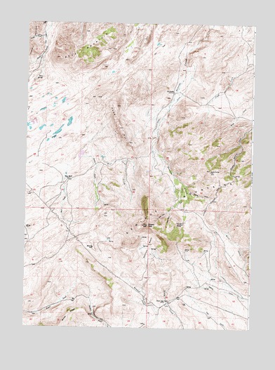
Bradley Peak, WY USGS Topographic Map
Click on map above to begin viewing in our Map Viewer.

This topographic map contains these locations and features:
Feature Name Type Latitude Longitude GNIS ID View Map
Bear MountainSummitN42.2386°W107.0942°1585270View Map
Boot CreekStreamN42.1827°W107.1026°1585782View Map
Boot RanchLocaleN42.1855°W107.1014°1585784View Map
Bradley PeakSummitN42.1672°W107.0570°1585877View Map
Bradley Peak MineMineN42.1644°W107.0589°1746512View Map
Cannon CreekStreamN42.1819°W107.0353°1586334View Map
Denn Wyoming MineMineN42.1277°W107.0328°1746521View Map
East Twin CreekStreamN42.1733°W107.0448°1588149View Map
Elkhorn Stage Station (historical)LocaleN42.1358°W107.0456°1588264View Map
Field House MineMineN42.1280°W107.0803°1746519View Map
Fieldhouse CutGapN42.1294°W107.0851°1588446View Map
Junk Creek MinesMineN42.2100°W107.0287°1746513View Map
Junk HillSummitN42.2066°W107.0731°1590262View Map
Kronkneit MineMineN42.2202°W107.0328°1746520View Map
Long Creek Area Three MineMineN42.1936°W107.0278°1746515View Map
Long Creek Area Two MineMineN42.1811°W107.0278°1746514View Map
Mahoney LakeLakeN42.1577°W107.0870°1591177View Map
Pattison BasinBasinN42.1580°W107.0556°1592623View Map
Penn MineMineN42.1677°W107.0389°1592660View Map
R S RanchLocaleN42.2219°W107.0434°1593111View Map
Sand SpringsSpringN42.2283°W107.1166°1593914View Map
School CreekStreamN42.1947°W107.0939°1594000View Map
Seminoe Mountains Area MineMineN42.2088°W107.0089°1746516View Map
Seminoe Mountains Area MineMineN42.1525°W107.0664°1746517View Map
Seminoe Mountains Area MineMineN42.1527°W107.0464°1746518View Map
Sunday Morning MineMineN42.1888°W107.0228°1595198View Map
Turkey CreekStreamN42.2447°W107.1156°1595738View Map
Twin CreekStreamN42.1833°W107.0381°1595784View Map
West Junk CreekStreamN42.1972°W107.0884°1596221View Map
West Twin CreekStreamN42.1733°W107.0448°1596258View Map

Note: Coordinates in the location and feature list above are referenced to NAD83 datum.


Copyright (C) 2008-2024 Ryan Niemi / Sunset Dynamics ... All Rights Reserved