TopoQuest Logo
Do you find TopoQuest useful?
Help keep TopoQuest running and adding new maps/features by donating!
Bitcoin:  19c7KJd3qBynnjoSw5npx9KScwjBe4ifkT
Litecoin:  LXs6TkuXGGXo1vDsWCkWVdjQX94eUKd6ui
Home View Maps Find Maps Find Places Resources & Links


Branchborough, Florida Topographic Map

USGS Map Title: Branchborough, FL
USGS Map MRC: 28082C1
DRG (GeoTIFF) Download: o28082c1.tif


Neighboring USGS Topographic Map Quads:


  Lacoochee, FL  
28082D2
 

  Clay Sink, FL  
28082D1
 

  Bay Lake, FL  
28081D8
 

  Dade City, FL  
28082C2
 

  Branchborough, FL  
28082C1
 

  Rock Ridge, FL  
28081C8
 

  Zephyrhills, FL  
28082B2
 

  Socrum, FL  
28082B1
 

  Providence, FL  
28081B8


Map MRC Location:

N29°
W83°
N29°
W82°
H8 H7 H6 H5 H4 H3 H2 H1
G8 G7 G6 G5 G4 G3 G2 G1
F8 F7 F6 F5 F4 F3 F2 F1
E8 E7 E6 E5 E4 E3 E2 E1
D8 D7 D6 D5 D4 D3 D2 D1
C8 C7 C6 C5 C4 C3 C2 C1
B8 B7 B6 B5 B4 B3 B2 B1
A8 A7 A6 A5 A4 A3 A2 A1
N28°
W83°
N28°
W82°

Branchborough, FL USGS 1:24K Topographic Map Preview:
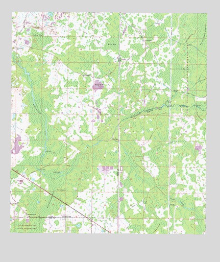
Branchborough, FL USGS Topographic Map
Click on map above to begin viewing in our Map Viewer.

This topographic map contains these locations and features:
Feature Name Type Latitude Longitude GNIS ID View Map
Ashley BaySwampN28.3602°W82.1084°277969View Map
Blue LakePopulated PlaceN28.3031°W82.0573°295140View Map
Bonnet LakeLakeN28.2846°W82.0926°279216View Map
BranchboroughPopulated PlaceN28.2592°W82.0892°294693View Map
Branchborough ChurchChurchN28.2608°W82.1137°279326View Map
Brown BridgeBridgeN28.2861°W82.1065°279469View Map
Colt CreekSwampN28.3006°W82.0267°280669View Map
Cow Ford BridgeBridgeN28.3258°W82.0237°280928View Map
Cross CreekStreamN28.3236°W82.0273°281094View Map
Cross Creek BridgeBridgeN28.3306°W82.0195°281096View Map
Cross Creek SwampSwampN28.3452°W82.0175°281097View Map
CumpresscoPopulated PlaceN28.3589°W82.0392°294734View Map
Devils Creek SwampSwampN28.3707°W82.0156°281526View Map
Gator CreekStreamN28.3045°W82.0595°282973View Map
Hillsborough RiverSwampN28.2722°W82.0979°284043View Map
Mills BaySwampN28.3576°W82.0602°286932View Map
Mud LakeLakeN28.2967°W82.1029°287404View Map
Orange HammockIslandN28.2672°W82.0212°288199View Map
Port LonesomePopulated PlaceN28.2742°W82.0915°295558View Map
Sixteen Section PondLakeN28.3339°W82.0694°291196View Map
Stanley Fish HoleLakeN28.3232°W82.0145°291615View Map
Thrasher RidgesRidgeN28.3194°W82.0719°292241View Map
Trial Ford BridgeBridgeN28.3211°W82.0312°292423View Map
Wildwood Shopping CenterLocaleN28.3561°W82.0423°296016View Map
Williams HammockIslandN28.2531°W82.0301°293328View Map
Withlacoochee CemeteryCemeteryN28.2608°W82.1145°300906View Map
Withlacoochee CemeteryCemeteryN28.3544°W82.1220°293444View Map

Note: Coordinates in the location and feature list above are referenced to NAD83 datum.


Copyright (C) 2008-2025 Ryan Niemi / Sunset Dynamics ... All Rights Reserved