TopoQuest Logo
Do you find TopoQuest useful?
Help keep TopoQuest running and adding new maps/features by donating!
Bitcoin:  19c7KJd3qBynnjoSw5npx9KScwjBe4ifkT
Litecoin:  LXs6TkuXGGXo1vDsWCkWVdjQX94eUKd6ui
Home View Maps Find Maps Find Places Resources & Links


Bridgeton, Michigan Topographic Map

USGS Map Title: Bridgeton, MI
USGS Map MRC: 43085C8
DRG (GeoTIFF) Download: o43085c8.tif


Neighboring USGS Topographic Map Quads:


  Holton, MI  
43086D1
 

  Fremont, MI  
43085D8
 

  Newaygo, MI  
43085D7
 

  Wolf Lake, MI  
43086C1
 

  Bridgeton, MI  
43085C8
 

  Grant, MI  
43085C7
 

  Sullivan, MI  
43086B1
 

  Ravenna, MI  
43085B8
 

  Casnovia, MI  
43085B7


Map MRC Location:

N44°
W86°
N44°
W85°
H8 H7 H6 H5 H4 H3 H2 H1
G8 G7 G6 G5 G4 G3 G2 G1
F8 F7 F6 F5 F4 F3 F2 F1
E8 E7 E6 E5 E4 E3 E2 E1
D8 D7 D6 D5 D4 D3 D2 D1
C8 C7 C6 C5 C4 C3 C2 C1
B8 B7 B6 B5 B4 B3 B2 B1
A8 A7 A6 A5 A4 A3 A2 A1
N43°
W86°
N43°
W85°

Bridgeton, MI USGS 1:24K Topographic Map Preview:
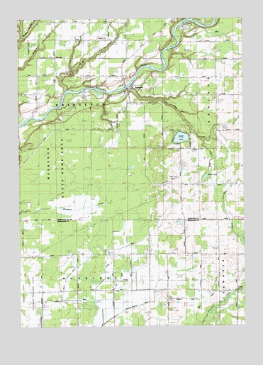
Bridgeton, MI USGS Topographic Map
Click on map above to begin viewing in our Map Viewer.

This topographic map contains these locations and features:
Feature Name Type Latitude Longitude GNIS ID View Map
Bixby Post Office (historical)Post OfficeN43.2792°W85.9375°2571711View Map
Blood LakeLakeN43.3104°W85.8965°621608View Map
Bowen SchoolSchoolN43.2536°W85.9192°621795View Map
BridgetonPopulated PlaceN43.3467°W85.9373°621972View Map
Bridgeton CemeteryCemeteryN43.3417°W85.9353°2541883View Map
Bridgeton ChurchChurchN43.3667°W85.9500°2106647View Map
Bridgeton Post Office (historical)Post OfficeN43.3467°W85.9372°2541853View Map
Brigadoon Golf ClubLocaleN43.3292°W85.8992°2542082View Map
Chinook CampgroundLocaleN43.3478°W85.9361°2542081View Map
Community Fellowship ChurchChurchN43.3694°W85.9208°2542090View Map
Dailey DrainCanalN43.2717°W85.9714°2106589View Map
Dickenson SchoolSchoolN43.3072°W85.9106°624659View Map
Dickinson Post Office (historical)Post OfficeN43.3075°W85.9092°2541845View Map
Dickinson Station (historical)LocaleN43.3075°W85.9092°2541801View Map
Ferguson SchoolSchoolN43.2786°W85.8900°625907View Map
Indian RunStreamN43.2864°W85.8767°629017View Map
Johnston SchoolSchoolN43.2647°W85.9884°629356View Map
Lewis DrainCanalN43.2614°W85.8944°2106590View Map
McLeanPopulated PlaceN43.3597°W85.9792°2106646View Map
McLean SchoolSchoolN43.3589°W85.9801°631980View Map
McLeans Post Office (historical)Post OfficeN43.3594°W85.9792°2541827View Map
Minnie CreekStreamN43.3459°W85.9739°632464View Map
Sand CreekStreamN43.3470°W85.9392°637169View Map
Sand LakeLakeN43.3265°W85.9097°637186View Map
Slater DrainCanalN43.2847°W85.9339°2106588View Map
Streams Airpark (historical)AirportN43.2667°W85.9501°1624116View Map
Township of BridgetonCivilN43.3369°W85.9794°1625978View Map
Trent Post Office (historical)Post OfficeN43.2644°W85.8792°2571710View Map
Trent SchoolSchoolN43.2639°W85.8764°1615061View Map
WZZM-TV (Grand Rapids)TowerN43.3095°W85.9123°1625784View Map

Note: Coordinates in the location and feature list above are referenced to NAD83 datum.


Copyright (C) 2008-2025 Ryan Niemi / Sunset Dynamics ... All Rights Reserved