TopoQuest Logo
Do you find TopoQuest useful?
Help keep TopoQuest running and adding new maps/features by donating!
Bitcoin:  19c7KJd3qBynnjoSw5npx9KScwjBe4ifkT
Litecoin:  LXs6TkuXGGXo1vDsWCkWVdjQX94eUKd6ui
Home View Maps Find Maps Find Places Resources & Links


Briggsdale, Colorado Topographic Map

USGS Map Title: Briggsdale, CO
USGS Map MRC: 40104F3
DRG (GeoTIFF) Download: o40104f3.tif


Neighboring USGS Topographic Map Quads:


  Reno Reservoir, CO  
40104G4
 

  Hereford SE, CO  
40104G3
 

  Grover South, CO  
40104G2
 

  Baker Draw, CO  
40104F4
 

  Briggsdale, CO  
40104F3
 

  Keota NW, CO  
40104F2
 

  Cornish, CO  
40104E4
 

  Fosston, CO  
40104E3
 

  Dutch Girl Lake, CO  
40104E2


Map MRC Location:

N41°
W105°
N41°
W104°
H8 H7 H6 H5 H4 H3 H2 H1
G8 G7 G6 G5 G4 G3 G2 G1
F8 F7 F6 F5 F4 F3 F2 F1
E8 E7 E6 E5 E4 E3 E2 E1
D8 D7 D6 D5 D4 D3 D2 D1
C8 C7 C6 C5 C4 C3 C2 C1
B8 B7 B6 B5 B4 B3 B2 B1
A8 A7 A6 A5 A4 A3 A2 A1
N40°
W105°
N40°
W104°

Briggsdale, CO USGS 1:24K Topographic Map Preview:
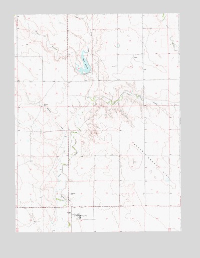
Briggsdale, CO USGS Topographic Map
Click on map above to begin viewing in our Map Viewer.

This topographic map contains these locations and features:
Feature Name Type Latitude Longitude GNIS ID View Map
Arrowhead WindmillLocaleN40.7139°W104.3391°197954View Map
BriggsdalePopulated PlaceN40.6347°W104.3269°180494View Map
Briggsdale CemeteryCemeteryN40.6471°W104.3339°180495View Map
Briggsdale Fire DistrictBuildingN40.6357°W104.3305°2666890View Map
Briggsdale Post OfficePost OfficeN40.6342°W104.3277°2759225View Map
Crow Valley ParkFlatN40.6458°W104.3400°180496View Map
Crow Valley Recreation AreaLocaleN40.6439°W104.3358°197948View Map
Geary CreekStreamN40.7439°W104.3197°180491View Map
Headquarters WaterwellWellN40.6500°W104.3350°197947View Map
Heart DamDamN40.7183°W104.3188°200832View Map
Heart ReservoirReservoirN40.7208°W104.3221°180492View Map
Hoffman WindmillLocaleN40.6658°W104.3630°197951View Map
Howard CreekStreamN40.6644°W104.3402°180488View Map
Lee WindmillLocaleN40.6311°W104.3594°197949View Map
Little Crow CreekStreamN40.7000°W104.3141°171161View Map
Murphy ReservoirReservoirN40.6981°W104.3535°180493View Map
Pawnee Work CenterLocaleN40.6511°W104.3358°197952View Map
Seven Cross Ditch-Mapelli Filling DitchCanalN40.6783°W104.3322°2724201View Map
Seven Cross HillSummitN40.6692°W104.2766°202708View Map
Seven Cross WindmillLocaleN40.6853°W104.3622°197950View Map
Test WindmillLocaleN40.7033°W104.3516°197955View Map
Willow CreekStreamN40.7178°W104.3213°171160View Map

Note: Coordinates in the location and feature list above are referenced to NAD83 datum.


Copyright (C) 2008-2025 Ryan Niemi / Sunset Dynamics ... All Rights Reserved