TopoQuest Logo
Do you find TopoQuest useful?
Help keep TopoQuest running and adding new maps/features by donating!
Bitcoin:  19c7KJd3qBynnjoSw5npx9KScwjBe4ifkT
Litecoin:  LXs6TkuXGGXo1vDsWCkWVdjQX94eUKd6ui
Home View Maps Find Maps Find Places Resources & Links


Brighton, Utah Topographic Map

USGS Map Title: Brighton, UT
USGS Map MRC: 40111E5
DRG (GeoTIFF) Download: o40111e5.tif


Neighboring USGS Topographic Map Quads:


  Mount Aire, UT  
40111F6
 

  Park City West, UT  
40111F5
 

  Park City East, UT  
40111F4
 

  Dromedary Peak, UT  
40111E6
 

  Brighton, UT  
40111E5
 

  Heber City, UT  
40111E4
 

  Timpanogos Cave, UT  
40111D6
 

  Aspen Grove, UT  
40111D5
 

  Charleston, UT  
40111D4


Map MRC Location:

N41°
W112°
N41°
W111°
H8 H7 H6 H5 H4 H3 H2 H1
G8 G7 G6 G5 G4 G3 G2 G1
F8 F7 F6 F5 F4 F3 F2 F1
E8 E7 E6 E5 E4 E3 E2 E1
D8 D7 D6 D5 D4 D3 D2 D1
C8 C7 C6 C5 C4 C3 C2 C1
B8 B7 B6 B5 B4 B3 B2 B1
A8 A7 A6 A5 A4 A3 A2 A1
N40°
W112°
N40°
W111°

Brighton, UT USGS 1:24K Topographic Map Preview:
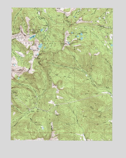
Brighton, UT USGS Topographic Map
Click on map above to begin viewing in our Map Viewer.

This topographic map contains these locations and features:
Feature Name Type Latitude Longitude GNIS ID View Map
Albion AlpsPopulated PlaceN40.5805°W111.6185°1452988View Map
Albion BasinPopulated PlaceN40.5805°W111.6185°1452989View Map
Albion BasinBasinN40.5772°W111.6185°1438144View Map
Albion Basin CampgroundLocaleN40.5766°W111.6124°1454642View Map
Alpine Forest CampLocaleN40.6083°W111.5805°1438176View Map
Alta TunnelMineN40.6122°W111.6216°1438180View Map
American TunnelMineN40.6247°W111.5727°1438200View Map
Anchor MineMineN40.6130°W111.5205°1438206View Map
Anchor TunnelMineN40.6186°W111.5130°1438207View Map
Ant KnollsSummitN40.5513°W111.5710°1438234View Map
Apex MineMineN40.6225°W111.5405°1438259View Map
Baker ForkStreamN40.5305°W111.5955°1438332View Map
Bay State TunnelMineN40.5280°W111.5941°1438430View Map
Big Cottonwood MineMineN40.5838°W111.5855°1438648View Map
Big FlatFlatN40.5588°W111.5574°1438666View Map
Big Flat SpringSpringN40.5616°W111.5714°1438671View Map
Big SpringSpringN40.5158°W111.5574°1438735View Map
Black Bess ShaftMineN40.5994°W111.6069°1438824View Map
Bloods LakeReservoirN40.6015°W111.5512°1438919View Map
Bog MineMineN40.5538°W111.6185°1438987View Map
Bonanza FlatFlatN40.5950°W111.5163°1438994View Map
Bonner HollowValleyN40.5458°W111.5049°1438997View Map
Boulder BasinBasinN40.5869°W111.5185°1439017View Map
BrightonPopulated PlaceN40.6038°W111.5821°1439115View Map
Brighton Guard StationLocaleN40.5986°W111.5827°1454683View Map
Brighton Post Office (historical)Post OfficeN40.6038°W111.5821°2027174View Map
Brighton Recreation AreaLocaleN40.5966°W111.5874°1454684View Map
Brighton Ski AreaLocaleN40.6000°W111.5835°1454685View Map
Brighton Ski Area HeliportAirportN40.6013°W111.5833°1448188View Map
Brighton Ski ResortLocaleN40.5991°W111.5813°1450182View Map
California MineMineN40.6219°W111.5410°1439434View Map
Centennial TunnelTunnelN40.5530°W111.6021°1439604View Map
Clayton PeakSummitN40.5905°W111.5596°1439786View Map
Cloud Rim Girl Scout CampLocaleN40.6019°W111.5396°1439816View Map
Comstock MineMineN40.6230°W111.5424°1439910View Map
Daly West MineMineN40.6155°W111.5116°1440241View Map
Davenport HillSummitN40.5994°W111.6221°1440276View Map
Deer Creek CampgroundLocaleN40.5019°W111.5332°1451223View Map
Devils CastlePillarN40.5658°W111.6146°1440423View Map
Dog LakeLakeN40.5872°W111.5846°1440503View Map
Dry ForkValleyN40.5391°W111.5919°1440627View Map
Dutchman Guard StationLocaleN40.5280°W111.6010°1440748View Map
Dutchman MineMineN40.5286°W111.6027°1440749View Map
Epperson SpringSpringN40.5500°W111.5090°1440950View Map
Faucett CanyonValleyN40.5197°W111.5027°1441017View Map
Flagstaff MineMineN40.6069°W111.5035°1441108View Map
Forest GlenPopulated PlaceN40.6152°W111.5813°1449868View Map
Forest LakeReservoirN40.5111°W111.5860°1441168View Map
Giles FlatFlatN40.6150°W111.5902°1441320View Map
Graveyard FlatFlatN40.5188°W111.6202°1441452View Map
Guardsman PassGapN40.6063°W111.5549°1454758View Map
Honeycomb CliffsCliffN40.6005°W111.6116°1441829View Map
Honeycomb ForkValleyN40.6202°W111.6149°1441830View Map
Iowa Copper TunnelMineN40.6175°W111.5683°1442044View Map
Jones ShaftMineN40.6044°W111.5246°1442218View Map
Jupiter HillSummitN40.6133°W111.5399°1442256View Map
Jupiter MineMineN40.6136°W111.5460°1442257View Map
Lackawaxen LakeLakeN40.5918°W111.5552°1442387View Map
Lady of the LakePopulated PlaceN40.6058°W111.5880°1452219View Map
Lake BrimhallLakeN40.6002°W111.5395°1439119View Map
Lake CatherineLakeN40.5809°W111.5932°1439539View Map
Lake MarthaLakeN40.5854°W111.5920°1443207View Map
Lake MaryReservoirN40.5888°W111.5899°1443216View Map
Lake Mary DamDamN40.5900°W111.5874°1447872View Map
Lake SolitudeReservoirN40.6039°W111.6002°1445777View Map
Lavina CreekStreamN40.5602°W111.5274°1442457View Map
Lime CanyonValleyN40.5300°W111.5016°1442604View Map
Little Bell ShaftMineN40.6108°W111.5091°1442668View Map
Little Dollie TunnelMineN40.6211°W111.5913°1442705View Map
Lone HillSummitN40.5980°W111.5085°1442870View Map
Lucky BillMineN40.6066°W111.5055°1443039View Map
Lundeen CreekStreamN40.5055°W111.5360°1454810View Map
Mary Ellen GulchValleyN40.5241°W111.6091°1443214View Map
Michigan-Utah MineMineN40.5955°W111.6144°1443318View Map
Middle MountainSummitN40.5222°W111.5357°1443366View Map
Midway ReservoirReservoirN40.5900°W111.5019°1443382View Map
Midwest TunnelMineN40.5416°W111.6202°1443384View Map
Mill F East ForkValleyN40.6236°W111.5927°1443439View Map
Mill F South ForkValleyN40.6172°W111.5938°1443441View Map
Mill FlatFlatN40.5569°W111.5277°1443442View Map
Miller HillSummitN40.5458°W111.6208°1443486View Map
Miller Hill TunnelMineN40.5344°W111.5952°1443487View Map
Mount EvergreenSummitN40.6011°W111.5971°1440973View Map
Mount MillicentSummitN40.5902°W111.5974°1443494View Map
Mount TuscaroraSummitN40.5841°W111.5988°1446767View Map
Mount WolverineSummitN40.5852°W111.6035°1447502View Map
Mountain Dell MineMineN40.5425°W111.6024°1443636View Map
New York TunnelMineN40.6058°W111.5921°1443811View Map
Pacific MineMineN40.5411°W111.5949°1444151View Map
Pioneer PeakSummitN40.5808°W111.5894°1444449View Map
Pioneer RidgeRidgeN40.6186°W111.5374°1444451View Map
Pittsburg LakeLakeN40.5583°W111.6167°1444465View Map
Pole Line PassGapN40.5327°W111.5708°1444558View Map
Pot HollowValleyN40.5177°W111.5444°1454867View Map
Prince of Wales ShaftMineN40.6052°W111.6144°1444647View Map
Quincy MineMineN40.6130°W111.5091°1444700View Map
Redman Forest CampLocaleN40.6141°W111.5869°1444842View Map
Sandy Baker PassGapN40.5236°W111.5710°1445319View Map
Scott HillSummitN40.6244°W111.5671°1445383View Map
Scottish Chief MineMineN40.6227°W111.5691°1445385View Map
Scotts PassGapN40.6166°W111.5580°1445387View Map
Secret LakeReservoirN40.5708°W111.6220°1445416View Map
Shadow LakeLakeN40.6165°W111.5480°1445456View Map
Shaffer ForkStreamN40.5230°W111.6077°1445460View Map
Sids CanyonValleyN40.5191°W111.5013°1445575View Map
Silver LakeReservoirN40.5981°W111.5438°1445598View Map
Silver LakeReservoirN40.6039°W111.5885°1445599View Map
Silver Lake DamDamN40.5983°W111.5424°1447878View Map
Silver Lake EstatesPopulated PlaceN40.6027°W111.5841°1452224View Map
Silver Lake IsletReservoirN40.5962°W111.5391°1447875View Map
Silver Lake Islet DamDamN40.5966°W111.5374°1447876View Map
Silver Lake Summer ResortPopulated PlaceN40.6041°W111.5813°1449869View Map
Smuggler TunnelTunnelN40.5575°W111.6085°1445723View Map
Snake Creek TunnelTunnelN40.5736°W111.5441°1445726View Map
SolitudePopulated PlaceN40.6211°W111.5933°1454903View Map
Solitude Ski Area HeliportAirportN40.6200°W111.5858°1449024View Map
Solitude TunnelMineN40.6033°W111.6019°1445776View Map
Steamboat TunnelMineN40.5727°W111.5810°1446113View Map
Sugarloaf MountainSummitN40.5661°W111.6221°1454917View Map
Sunday TunnelMineN40.5491°W111.6241°1446251View Map
Sunset PeakSummitN40.5769°W111.5935°1446260View Map
Texan TunnelMineN40.5372°W111.6083°1446403View Map
The Church of Jesus Christ of Latter Day SaintsChurchN40.6033°W111.5827°1449389View Map
Town of AltaCivilN40.5817°W111.6224°2412354View Map
Twin Lakes DamDamN40.5983°W111.5958°1447879View Map
Twin Lakes ReservoirReservoirN40.5972°W111.5999°1446791View Map
Unified Fire Authority Station 108BuildingN40.6098°W111.5806°2627345View Map
USLM 4 MineMineN40.6230°W111.5321°1446827View Map
Walker and Webster MineMineN40.6241°W111.5199°1446959View Map
Woodlawn MineMineN40.6072°W111.6099°1447514View Map
Wyoming TunnelMineN40.5458°W111.6241°1447541View Map

Note: Coordinates in the location and feature list above are referenced to NAD83 datum.


Copyright (C) 2008-2024 Ryan Niemi / Sunset Dynamics ... All Rights Reserved