TopoQuest Logo
Do you find TopoQuest useful?
Help keep TopoQuest running and adding new maps/features by donating!
Bitcoin:  19c7KJd3qBynnjoSw5npx9KScwjBe4ifkT
Litecoin:  LXs6TkuXGGXo1vDsWCkWVdjQX94eUKd6ui
Home View Maps Find Maps Find Places Resources & Links


Briscoe Ranch, New Mexico Topographic Map

USGS Map Title: Briscoe Ranch, NM
USGS Map MRC: 35103A7
DRG (GeoTIFF) Download: o35103a7.tif


Neighboring USGS Topographic Map Quads:


  Cow Canyon, NM  
35103B8
 

  Liberty Mesa, NM  
35103B7
 

  Tucumcari, NM  
35103B6
 

  Quemado Hills, NM  
35103A8
 

  Briscoe Ranch, NM  
35103A7
 

  Bulldog Mesa, NM  
35103A6
 

  Circle S Mesa, NM  
34103H8
 

  Quay, NM  
34103H7
 

  Mesa Redonda, NM  
34103H6


Map MRC Location:

N36°
W104°
N36°
W103°
H8 H7 H6 H5 H4 H3 H2 H1
G8 G7 G6 G5 G4 G3 G2 G1
F8 F7 F6 F5 F4 F3 F2 F1
E8 E7 E6 E5 E4 E3 E2 E1
D8 D7 D6 D5 D4 D3 D2 D1
C8 C7 C6 C5 C4 C3 C2 C1
B8 B7 B6 B5 B4 B3 B2 B1
A8 A7 A6 A5 A4 A3 A2 A1
N35°
W104°
N35°
W103°

Briscoe Ranch, NM USGS 1:24K Topographic Map Preview:
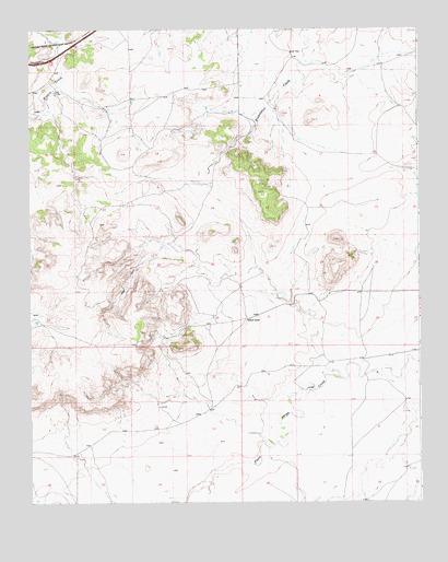
Briscoe Ranch, NM USGS Topographic Map
Click on map above to begin viewing in our Map Viewer.

This topographic map contains these locations and features:
Feature Name Type Latitude Longitude GNIS ID View Map
05090 Water WellWellN35.1076°W103.8661°927444View Map
05091 Water WellWellN35.1012°W103.8705°927453View Map
05092 Water WellWellN35.1020°W103.8725°928064View Map
05093 Water WellWellN35.1056°W103.8494°928065View Map
05099 Water WellWellN35.0653°W103.8333°927455View Map
05103 Water WellWellN35.1131°W103.7633°928070View Map
05104 Water WellWellN35.1131°W103.8639°928072View Map
05105 Water WellWellN35.1178°W103.7869°928073View Map
05110 Water WellWellN35.1056°W103.7583°928067View Map
05118 Water WellWellN35.0970°W103.8011°927451View Map
05120 Water WellWellN35.0789°W103.7733°927459View Map
05124 Water WellWellN35.0670°W103.7883°927457View Map
05126 Water WellWellN35.0645°W103.7841°928056View Map
05127 Water WellWellN35.0609°W103.8000°928054View Map
05128 Water WellWellN35.0562°W103.8058°928051View Map
05130 Water WellWellN35.0573°W103.8016°928053View Map
05132 Water WellWellN35.0478°W103.8022°927464View Map
10096 Water WellWellN35.1131°W103.8639°928071View Map
10100 Water WellWellN35.1112°W103.8086°927445View Map
10103 Water WellWellN35.1076°W103.8064°927443View Map
10104 Water WellWellN35.1020°W103.7908°928063View Map
Briscoe RanchLocaleN35.0481°W103.8055°886735View Map
JoseLocaleN35.0978°W103.8025°925162View Map
KilgoreLocaleN35.1020°W103.8714°929159View Map
Mesa QuemadoSummitN35.0317°W103.8714°898679View Map
Paris CreekStreamN35.0173°W103.7547°893074View Map
Tucumcari DivisionCivilN35.0488°W103.7544°1937609View Map

Note: Coordinates in the location and feature list above are referenced to NAD83 datum.


Copyright (C) 2008-2024 Ryan Niemi / Sunset Dynamics ... All Rights Reserved