TopoQuest Logo
Do you find TopoQuest useful?
Help keep TopoQuest running and adding new maps/features by donating!
Bitcoin:  19c7KJd3qBynnjoSw5npx9KScwjBe4ifkT
Litecoin:  LXs6TkuXGGXo1vDsWCkWVdjQX94eUKd6ui
Home View Maps Find Maps Find Places Resources & Links


Bristol, Maryland Topographic Map

USGS Map Title: Bristol, MD
USGS Map MRC: 38076G6
DRG (GeoTIFF) Download: o38076g6.tif


Neighboring USGS Topographic Map Quads:


  Lanham, MD  
38076H7
 

  Bowie, MD  
38076H6
 

  South River, MD  
38076H5
 

  Upper Marlboro, MD  
38076G7
 

  Bristol, MD  
38076G6
 

  Deale, MD  
38076G5
 

  Brandywine, MD  
38076F7
 

  Lower Marlboro, MD  
38076F6
 

  North Beach, MD  
38076F5


Map MRC Location:

N39°
W77°
N39°
W76°
H8 H7 H6 H5 H4 H3 H2 H1
G8 G7 G6 G5 G4 G3 G2 G1
F8 F7 F6 F5 F4 F3 F2 F1
E8 E7 E6 E5 E4 E3 E2 E1
D8 D7 D6 D5 D4 D3 D2 D1
C8 C7 C6 C5 C4 C3 C2 C1
B8 B7 B6 B5 B4 B3 B2 B1
A8 A7 A6 A5 A4 A3 A2 A1
N38°
W77°
N38°
W76°

Bristol, MD USGS 1:24K Topographic Map Preview:
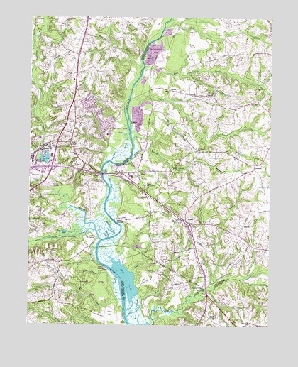
Bristol, MD USGS Topographic Map
Click on map above to begin viewing in our Map Viewer.

This topographic map contains these locations and features:
Feature Name Type Latitude Longitude GNIS ID View Map
Adams ChurchChurchN38.8451°W76.6775°582863View Map
Am - Van Ambulance and TransportBuildingN38.8114°W76.6978°2639975View Map
Back ChannelChannelN38.8198°W76.7016°597034View Map
Barksdale FarmsLocaleN38.8306°W76.6464°2585802View Map
BayardPopulated PlaceN38.8457°W76.6772°589707View Map
Bethel United Methodist ChurchChurchN38.8515°W76.7255°1714708View Map
Billingsley PointCapeN38.7922°W76.7194°1709994View Map
Black Walnut CreekStreamN38.7726°W76.7083°597085View Map
Blue Ridge FarmsLocaleN38.8629°W76.6291°1709996View Map
Boone's Mobile EstatesPopulated PlaceN38.8079°W76.6755°2503118View Map
Boones Mobile EstatesPopulated PlaceN38.8071°W76.6769°1709997View Map
BristolPopulated PlaceN38.7923°W76.6680°589817View Map
Bristol Landing (historical)Populated PlaceN38.7923°W76.7044°589818View Map
Bristol SchoolSchoolN38.8065°W76.6891°583395View Map
Brookridge School (historical)SchoolN38.7618°W76.7366°1714711View Map
Cabin BranchStreamN38.7646°W76.6533°583525View Map
Calvert EstatesPopulated PlaceN38.7534°W76.6611°1676085View Map
Century ManorPopulated PlaceN38.7546°W76.6341°1676089View Map
ChaneyPopulated PlaceN38.7515°W76.6347°589934View Map
Chaney StationPopulated PlaceN38.7543°W76.6397°1676091View Map
Charles BranchStreamN38.7884°W76.7152°597219View Map
Chews LakeLakeN38.7876°W76.7315°597237View Map
Collington BranchStreamN38.8198°W76.7469°597267View Map
Conte ManorPopulated PlaceN38.7968°W76.6372°1710019View Map
Courtney ManorPopulated PlaceN38.7932°W76.6805°1710020View Map
Croom AcresPopulated PlaceN38.7607°W76.7455°1714720View Map
Croom High SchoolSchoolN38.7718°W76.7339°2132673View Map
Croom High SchoolSchoolN38.7746°W76.7350°1992789View Map
Croom Vocational SchoolSchoolN38.7740°W76.7469°1714721View Map
DarnallPopulated PlaceN38.7907°W76.6383°590067View Map
Deep CreekStreamN38.7558°W76.6986°584051View Map
Deep Run BranchStreamN38.8521°W76.6680°584076View Map
Depot PondReservoirN38.8176°W76.7410°597325View Map
District 3, MarlboroCivilN38.8318°W76.7358°1929584View Map
District BranchStreamN38.8548°W76.6908°597329View Map
DruryPopulated PlaceN38.8123°W76.6927°590113View Map
DunleighPopulated PlaceN38.7507°W76.6594°1676101View Map
East Branch Collington BranchStreamN38.8373°W76.7469°597366View Map
Federal Spring BranchStreamN38.8204°W76.7469°597394View Map
Ferry BranchStreamN38.8382°W76.6989°584362View Map
Fox ChapelPopulated PlaceN38.8123°W76.6769°1710039View Map
Galloway CreekStreamN38.8058°W76.7075°584545View Map
Greater Upper Marlboro Census Designated PlaceCensusN38.8314°W76.7483°2389872View Map
Green LandingPopulated PlaceN38.8059°W76.7086°597488View Map
GreenockPopulated PlaceN38.8154°W76.6330°590380View Map
Hardwick BranchStreamN38.7618°W76.6941°2573477View Map
Hawthorne WoodsPopulated PlaceN38.8723°W76.6650°1710059View Map
Heritage HillsPopulated PlaceN38.8737°W76.7030°1714740View Map
Hills BridgeBridgeN38.8112°W76.7116°597559View Map
Horse Tavern BranchStreamN38.7848°W76.7339°597583View Map
House CreekBayN38.7551°W76.6947°585091View Map
Hunt ChapelPopulated PlaceN38.8476°W76.6275°1710067View Map
Hunt Valley EstatesPopulated PlaceN38.8534°W76.6261°1710068View Map
Iron Pot Landing (historical)LocaleN38.7932°W76.7205°597606View Map
Jackson LandingPopulated PlaceN38.7729°W76.7100°597612View Map
Jug BayBayN38.7684°W76.6986°585276View Map
Jug Bay Wetlands SanctuaryParkN38.7798°W76.7083°1710070View Map
LahainaPopulated PlaceN38.7668°W76.7427°1714744View Map
LeelandPopulated PlaceN38.8740°W76.7486°597676View Map
Lothian EstatesPopulated PlaceN38.8237°W76.6505°1710079View Map
Lothian WoodsPopulated PlaceN38.8234°W76.6466°1710081View Map
Lyons Creek FischersLocaleN38.7651°W76.6594°585645View Map
Lyons Creek HundredPopulated PlaceN38.7609°W76.6364°1676112View Map
Lyons Creek Mobile EstatesPopulated PlaceN38.7623°W76.6672°1710082View Map
Marlboro Fire Station Company 20BuildingN38.8168°W76.7479°2457333View Map
Marlboro HeliportAirportN38.8034°W76.7375°598360View Map
Marlboro Horse FarmLocaleN38.7697°W76.6756°2585800View Map
Marlboro Hunt ClubLocaleN38.8079°W76.7114°597716View Map
Marlboro MeadowsPopulated PlaceN38.8362°W76.7150°1714749View Map
Marlboro Meadows Census Designated PlaceCensusN38.8374°W76.7143°2583653View Map
Marlboro SpeedwayLocaleN38.8068°W76.7383°597717View Map
Marlboro Square Shopping CenterLocaleN38.8121°W76.7416°1714750View Map
Marlboro StationLocaleN38.8207°W76.7441°597718View Map
Mary E White EstatePopulated PlaceN38.7565°W76.6566°1676114View Map
Maryland Mobile EstatesPopulated PlaceN38.8582°W76.6824°1710171View Map
Mill CreekStreamN38.8094°W76.7089°585853View Map
Mondays CreekBayN38.7865°W76.7089°597760View Map
Moreland PondReservoirN38.8201°W76.6406°1710090View Map
Mount Calvary Methodist ChurchChurchN38.8209°W76.6630°585980View Map
Mount CalvertPopulated PlaceN38.7854°W76.7147°597774View Map
Mount Calvert PointCapeN38.7843°W76.7130°1714759View Map
Old Galloway CreekStreamN38.8003°W76.7094°2573476View Map
Old South Country ClubLocaleN38.8182°W76.6552°1710096View Map
Patuxent Elementary SchoolSchoolN38.8275°W76.7097°1714770View Map
Patuxent Mobile EstatesPopulated PlaceN38.8157°W76.6948°1710103View Map
Pennsylvania JunctionLocaleN38.8015°W76.7439°1714773View Map
Peters ChapelChurchN38.7534°W76.6552°586487View Map
Pig PointPopulated PlaceN38.7929°W76.7014°590654View Map
Pigg Point (historical)CapeN38.7690°W76.7036°1714775View Map
PindellPopulated PlaceN38.7757°W76.6830°591007View Map
Pindell BranchStreamN38.7718°W76.6961°586514View Map
Pond View AcresPopulated PlaceN38.8221°W76.6689°1710108View Map
Portland ManorPopulated PlaceN38.7982°W76.6358°1710109View Map
Prince George's County Equestrian CenterLocaleN38.8109°W76.7489°1714776View Map
Prince Georges County Volunteer Fire Department Marlboro Volunteer Fire Department Station 1BuildingN38.8173°W76.7477°2085735View Map
Railroad CreekBayN38.7893°W76.7072°597942View Map
Reed MarshSwampN38.7559°W76.6922°586799View Map
Reo Vista PlazaPopulated PlaceN38.8187°W76.6941°1710115View Map
Rio Vista Plaza Mobile Home ParkPopulated PlaceN38.8185°W76.6933°2503604View Map
Rock BranchStreamN38.8543°W76.6902°586859View Map
Route 260 Recreation AreaParkN38.7557°W76.6475°1676122View Map
Rustic KnollsPopulated PlaceN38.8262°W76.6669°1710120View Map
Saint Lukes ChapelChurchN38.8434°W76.6583°587066View Map
Saint Mary of the Assumption Catholic ChurchChurchN38.8190°W76.7483°1714787View Map
Saint Marys of the Assumption SchoolSchoolN38.8254°W76.7494°1714788View Map
Selbys LandingPopulated PlaceN38.7512°W76.6991°598074View Map
Sollers United Methodist ChurchChurchN38.7951°W76.6866°587428View Map
SpringfieldPopulated PlaceN38.7587°W76.6580°1676130View Map
Spyglass IslandIslandN38.8317°W76.6986°587519View Map
Swan Point CreekStreamN38.7590°W76.7005°598140View Map
Thanksgiving FarmLocaleN38.8706°W76.6325°2704691View Map
The SandsPopulated PlaceN38.8701°W76.6730°1710146View Map
Twin Shields EstatesPopulated PlaceN38.7598°W76.6455°1676131View Map
Twin Shields Golf CourseLocaleN38.7626°W76.6486°1676132View Map
Two Run BranchStreamN38.7768°W76.7022°587937View Map
Upper MarlboroPopulated PlaceN38.8159°W76.7497°598208View Map
Upper Marlboro CourthouseBuildingN38.8155°W76.7498°2503732View Map
Upper Marlboro Town HallBuildingN38.8162°W76.7497°2457851View Map
Vale of Pleasure Horse FarmLocaleN38.7886°W76.6844°2585801View Map
Waysons CornerPopulated PlaceN38.8112°W76.7025°588941View Map
Waysons Mobile CourtPopulated PlaceN38.8139°W76.7032°1710160View Map
Wells CornerPopulated PlaceN38.8243°W76.7283°598230View Map
Wesley ChapelChurchN38.7918°W76.6711°588117View Map
Western Branch Patuxent RiverStreamN38.7846°W76.7122°598240View Map
Wilson Owens BranchStreamN38.8259°W76.6966°588271View Map
Winding BrookePopulated PlaceN38.8246°W76.6714°1710166View Map
Windsor FarmLocaleN38.8640°W76.6386°1710167View Map

Note: Coordinates in the location and feature list above are referenced to NAD83 datum.


Copyright (C) 2008-2025 Ryan Niemi / Sunset Dynamics ... All Rights Reserved