TopoQuest Logo
Do you find TopoQuest useful?
Help keep TopoQuest running and adding new maps/features by donating!
Bitcoin:  19c7KJd3qBynnjoSw5npx9KScwjBe4ifkT
Litecoin:  LXs6TkuXGGXo1vDsWCkWVdjQX94eUKd6ui
Home View Maps Find Maps Find Places Resources & Links


Bristol Ridge, Wyoming Topographic Map

USGS Map Title: Bristol Ridge, WY
USGS Map MRC: 41104E8
DRG (GeoTIFF) Download: o41104e8.tif


Neighboring USGS Topographic Map Quads:


  McDonald Ranch, WY  
41105F1
 

  Whitcomb Hill, WY  
41104F8
 

  Bristol Ridge NE, WY  
41104F7
 

  Hirsig Ranch, WY  
41105E1
 

  Bristol Ridge, WY  
41104E8
 

  Moffett Ranch, WY  
41104E7
 

  Dereemer Ranch, WY  
41105D1
 

  Nimmo Ranch, WY  
41104D8
 

  Lewis Ranch, WY  
41104D7


Map MRC Location:

N42°
W105°
N42°
W104°
H8 H7 H6 H5 H4 H3 H2 H1
G8 G7 G6 G5 G4 G3 G2 G1
F8 F7 F6 F5 F4 F3 F2 F1
E8 E7 E6 E5 E4 E3 E2 E1
D8 D7 D6 D5 D4 D3 D2 D1
C8 C7 C6 C5 C4 C3 C2 C1
B8 B7 B6 B5 B4 B3 B2 B1
A8 A7 A6 A5 A4 A3 A2 A1
N41°
W105°
N41°
W104°

Bristol Ridge, WY USGS 1:24K Topographic Map Preview:
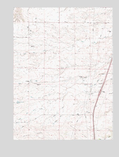
Bristol Ridge, WY USGS Topographic Map
Click on map above to begin viewing in our Map Viewer.

This topographic map contains these locations and features:
Feature Name Type Latitude Longitude GNIS ID View Map
Bert Gillaspie RanchLocaleN41.6028°W104.8769°1585401View Map
Bliss Pumping StationLocaleN41.6103°W104.8991°1585660View Map
Bristol RidgeRidgeN41.5044°W104.9958°1585931View Map
Caster RanchLocaleN41.6047°W104.9811°1586434View Map
Chalk HillSummitN41.6114°W104.9339°1586559View Map
Collins RanchLocaleN41.5239°W104.9205°1586902View Map
Dick Duvall RanchLocaleN41.5589°W104.9133°1587601View Map
Elvy Gillaspie RanchLocaleN41.5886°W104.9789°1588277View Map
F L Duvall RanchLocaleN41.5583°W104.9125°1588361View Map
Harry Dayton RanchLocaleN41.5550°W104.9800°1589344View Map
Hoyt Duvall RanchLocaleN41.5447°W104.8847°1589785View Map
Little Bear CemeteryCemeteryN41.5679°W104.9410°1590738View Map
Mable RanchLocaleN41.5439°W104.8811°1609201View Map
McCann DrawValleyN41.5291°W104.9377°1591287View Map
Nimmo Reservoir Number 9ReservoirN41.5356°W104.9946°1605393View Map
North Fork South Fork Bear CreekStreamN41.5444°W104.9339°1592212View Map
Richards HallLocaleN41.5533°W104.8877°1593428View Map
Russell Dayton RanchLocaleN41.5525°W104.9705°1593712View Map
Sweet DrawValleyN41.5366°W104.9380°1595242View Map

Note: Coordinates in the location and feature list above are referenced to NAD83 datum.


Copyright (C) 2008-2025 Ryan Niemi / Sunset Dynamics ... All Rights Reserved